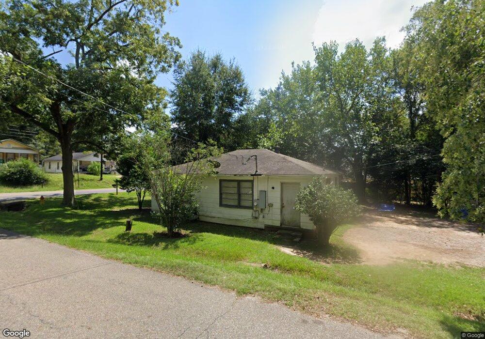
347 Martin Luther King Dr Prattville, AL 36067
Estimated Value: $71,000 - $213,000
--
Bed
--
Bath
720
Sq Ft
$167/Sq Ft
Est. Value
About This Home
This home is located at 347 Martin Luther King Dr, Prattville, AL 36067 and is currently estimated at $120,179, approximately $166 per square foot. 347 Martin Luther King Dr is a home located in Autauga County with nearby schools including Prattville Primary School, Prattville Elementary School, and Prattville Jr High School.
Ownership History
Date
Name
Owned For
Owner Type
Purchase Details
Closed on
Jun 19, 2015
Bought by
Napoleon
Current Estimated Value
Home Financials for this Owner
Home Financials are based on the most recent Mortgage that was taken out on this home.
Original Mortgage
$35,200
Interest Rate
3.89%
Mortgage Type
Purchase Money Mortgage
Purchase Details
Closed on
May 24, 2015
Bought by
Ann H
Home Financials for this Owner
Home Financials are based on the most recent Mortgage that was taken out on this home.
Original Mortgage
$35,200
Interest Rate
3.89%
Mortgage Type
Purchase Money Mortgage
Create a Home Valuation Report for This Property
The Home Valuation Report is an in-depth analysis detailing your home's value as well as a comparison with similar homes in the area
Home Values in the Area
Average Home Value in this Area
Purchase History
| Date | Buyer | Sale Price | Title Company |
|---|---|---|---|
| Napoleon | $40,000 | -- | |
| Ann H | $28,416 | -- |
Source: Public Records
Mortgage History
| Date | Status | Borrower | Loan Amount |
|---|---|---|---|
| Closed | Napoleon | $35,200 |
Source: Public Records
Tax History Compared to Growth
Tax History
| Year | Tax Paid | Tax Assessment Tax Assessment Total Assessment is a certain percentage of the fair market value that is determined by local assessors to be the total taxable value of land and additions on the property. | Land | Improvement |
|---|---|---|---|---|
| 2025 | $335 | $10,820 | $0 | $0 |
| 2024 | $330 | $10,660 | $0 | $0 |
| 2023 | $304 | $9,800 | $0 | $0 |
| 2022 | $304 | $9,800 | $0 | $0 |
| 2021 | $210 | $6,780 | $0 | $0 |
| 2020 | $210 | $6,780 | $0 | $0 |
| 2019 | $210 | $6,780 | $0 | $0 |
| 2018 | $210 | $6,780 | $0 | $0 |
| 2015 | $177 | $0 | $0 | $0 |
| 2014 | $177 | $5,700 | $1,680 | $4,020 |
| 2013 | -- | $5,460 | $1,800 | $3,660 |
Source: Public Records
Map
Nearby Homes
- 110 White Oak Ct
- 320 E 6th St
- Lot 2 Oak Creek Cir
- 315 S Northington St
- 255 Magnolia Dr
- 253 Magnolia Dr
- 251 Magnolia Dr
- 307 Pratt St
- 782 Park Ln
- 1405 Indian Hills Rd
- Cr 21
- 131 Bridge St
- Magnolia Plan at Park Lane - Park Place
- Savannah Plan at Park Lane - Park Place
- Sawgrass Plan at Park Lane - Park Place
- Willow Plan at Park Lane - Park Place
- Aspen Plan at Park Lane - Park Place
- Sweetbay Plan at Park Lane - Park Place
- Windsor Plan at Park Lane - Park Place
- Birch Plan at Park Lane - Park Place
- 107 7th St
- 101 7th St
- 106 7th St
- 116 7th St
- 348 S Chestnut St
- 319 Martin Luther King jr Dr
- 344 S Chestnut St
- 323 Martin Luther King Dr
- 409 Martin Luther King Dr
- 406 Martin Luther King jr Dr
- 321 Martin Luther King Dr
- 348 Martin Luther King Dr
- 125 7th St
- 410 Martin Luther King Dr
- 108 Railroad St
- 327 Martin Luther King Dr
- 444 Martin Luther King Dr
- 414 Martin Luther King Dr
- 110 7th St
- 110 Railroad St