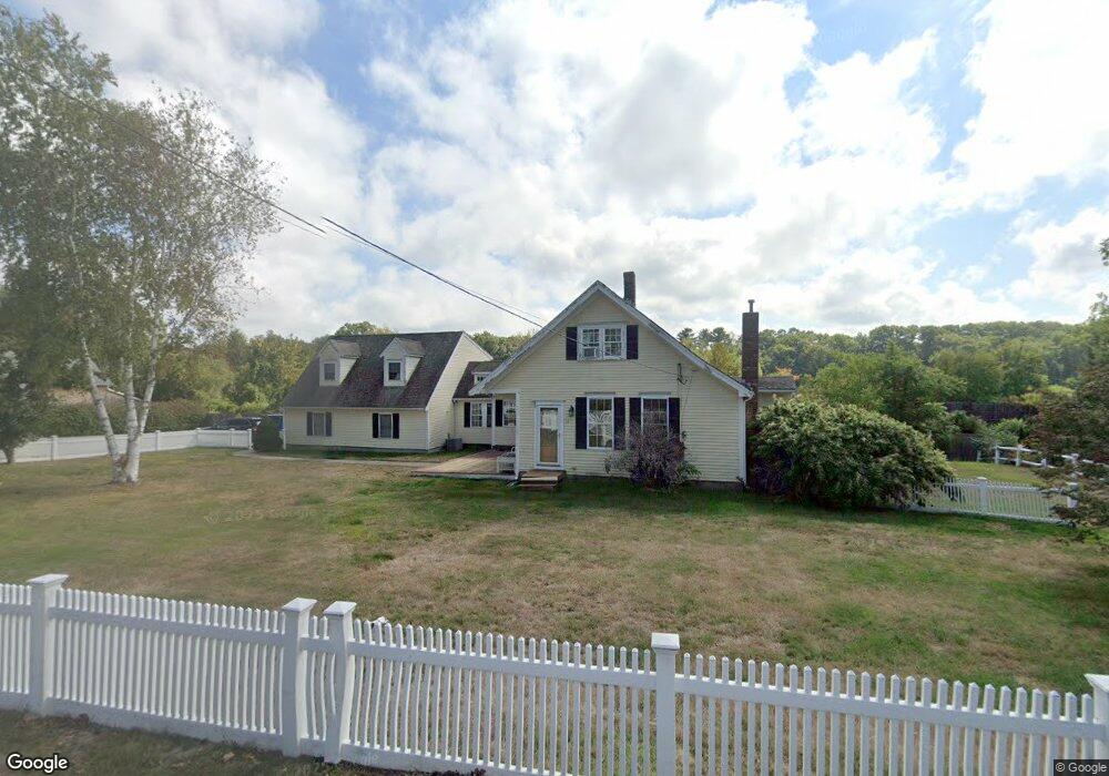
347 N Main St Cohasset, MA 02025
Estimated Value: $881,000 - $1,089,000
4
Beds
2
Baths
2,300
Sq Ft
$429/Sq Ft
Est. Value
About This Home
This home is located at 347 N Main St, Cohasset, MA 02025 and is currently estimated at $985,796, approximately $428 per square foot. 347 N Main St is a home located in Norfolk County with nearby schools including Joseph Osgood School, Deer Hill School, and Cohasset Middle School.
Ownership History
Date
Name
Owned For
Owner Type
Purchase Details
Closed on
Apr 25, 2002
Sold by
Mortland Lance and Mortland Shirley A
Bought by
Simone Brian J and Simone Vanessa A
Current Estimated Value
Home Financials for this Owner
Home Financials are based on the most recent Mortgage that was taken out on this home.
Original Mortgage
$378,000
Outstanding Balance
$157,789
Interest Rate
7.05%
Mortgage Type
Purchase Money Mortgage
Estimated Equity
$828,007
Purchase Details
Closed on
Nov 16, 1993
Sold by
Davis Brian R
Bought by
Mortland Lance and Mortland Shirley A
Home Financials for this Owner
Home Financials are based on the most recent Mortgage that was taken out on this home.
Original Mortgage
$112,000
Interest Rate
6.79%
Mortgage Type
Purchase Money Mortgage
Create a Home Valuation Report for This Property
The Home Valuation Report is an in-depth analysis detailing your home's value as well as a comparison with similar homes in the area
Home Values in the Area
Average Home Value in this Area
Purchase History
| Date | Buyer | Sale Price | Title Company |
|---|---|---|---|
| Simone Brian J | $420,000 | -- | |
| Simone Brian J | $420,000 | -- | |
| Mortland Lance | $140,000 | -- | |
| Mortland Lance | $140,000 | -- |
Source: Public Records
Mortgage History
| Date | Status | Borrower | Loan Amount |
|---|---|---|---|
| Open | Simone Brian J | $378,000 | |
| Closed | Mortland Lance | $378,000 | |
| Previous Owner | Mortland Lance | $112,000 |
Source: Public Records
Tax History Compared to Growth
Tax History
| Year | Tax Paid | Tax Assessment Tax Assessment Total Assessment is a certain percentage of the fair market value that is determined by local assessors to be the total taxable value of land and additions on the property. | Land | Improvement |
|---|---|---|---|---|
| 2025 | $8,085 | $698,200 | $323,400 | $374,800 |
| 2024 | $7,840 | $644,200 | $269,400 | $374,800 |
| 2023 | $7,176 | $608,100 | $234,000 | $374,100 |
| 2022 | $7,186 | $572,100 | $234,000 | $338,100 |
| 2021 | $6,417 | $492,100 | $187,500 | $304,600 |
| 2020 | $6,383 | $492,100 | $187,500 | $304,600 |
| 2019 | $6,348 | $492,100 | $187,500 | $304,600 |
| 2018 | $6,294 | $492,100 | $187,500 | $304,600 |
| 2017 | $5,792 | $443,500 | $178,600 | $264,900 |
| 2016 | $5,712 | $443,500 | $178,600 | $264,900 |
| 2015 | $5,637 | $443,500 | $178,600 | $264,900 |
| 2014 | $5,561 | $443,500 | $178,600 | $264,900 |
Source: Public Records
Map
Nearby Homes
- 321 N Main St
- 349 N Main St
- 317 N Main St
- 336 N Main St
- 330 N Main St
- 324 N Main St
- 351 N Main St
- 315 N Main St
- 344 N Main St
- 340 N Main St
- 365 N Main St
- 313 N Main St
- 313 N Main St Unit 1
- 320 N Main St
- 350 N Main St Unit 1
- 21 Rocky Ln
- 348 N Main St
- 348 N Main St
- 348B N Main St Unit 1
- 348B N Main St