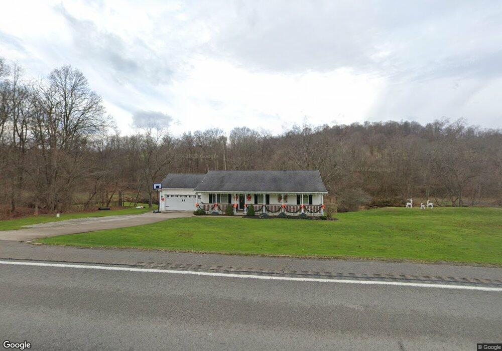
347 Route 519 Eighty Four, PA 15330
North Bethlehem NeighborhoodEstimated Value: $263,000 - $345,000
3
Beds
3
Baths
1,260
Sq Ft
$257/Sq Ft
Est. Value
About This Home
This home is located at 347 Route 519, Eighty Four, PA 15330 and is currently estimated at $323,295, approximately $256 per square foot. 347 Route 519 is a home with nearby schools including Bentworth Middle School and Bentworth Senior High School.
Ownership History
Date
Name
Owned For
Owner Type
Purchase Details
Closed on
Jul 26, 2013
Sold by
Sallee Ryan M
Bought by
Fava Kerry A
Current Estimated Value
Home Financials for this Owner
Home Financials are based on the most recent Mortgage that was taken out on this home.
Original Mortgage
$168,000
Outstanding Balance
$122,811
Interest Rate
3.97%
Mortgage Type
New Conventional
Estimated Equity
$200,484
Create a Home Valuation Report for This Property
The Home Valuation Report is an in-depth analysis detailing your home's value as well as a comparison with similar homes in the area
Home Values in the Area
Average Home Value in this Area
Purchase History
We collect this data history from publicly available records. To have your information removed, we recommend requesting removal directly through your county’s website.
| Date | Buyer | Sale Price | Title Company |
|---|---|---|---|
| Fava Kerry A | $212,500 | -- |
Source: Public Records
Mortgage History
We collect this data history from publicly available records. To have your information removed, we recommend requesting removal directly through your county’s website.
| Date | Status | Borrower | Loan Amount |
|---|---|---|---|
| Open | Fava Kerry A | $168,000 |
Source: Public Records
Tax History
| Year | Tax Paid | Tax Assessment Tax Assessment Total Assessment is a certain percentage of the fair market value that is determined by local assessors to be the total taxable value of land and additions on the property. | Land | Improvement |
|---|---|---|---|---|
| 2025 | $4,153 | $206,300 | $50,000 | $156,300 |
| 2024 | $3,428 | $197,000 | $50,000 | $147,000 |
| 2023 | $3,428 | $197,000 | $50,000 | $147,000 |
| 2022 | $3,308 | $197,000 | $50,000 | $147,000 |
| 2021 | $3,205 | $197,000 | $50,000 | $147,000 |
| 2020 | $3,120 | $197,000 | $50,000 | $147,000 |
| 2019 | $3,048 | $197,000 | $50,000 | $147,000 |
| 2018 | $2,973 | $197,000 | $50,000 | $147,000 |
| 2017 | $356 | $197,000 | $50,000 | $147,000 |
| 2016 | $356 | $14,288 | $1,742 | $12,546 |
| 2015 | -- | $14,288 | $1,742 | $12,546 |
| 2014 | $356 | $14,288 | $1,742 | $12,546 |
| 2013 | $356 | $14,288 | $1,742 | $12,546 |
Source: Public Records
Map
Nearby Homes
- 84 Beagle Club Rd
- 124 Dyersstone Dr
- 516 Chestnut Ridge Rd
- 216 Kopper Kettle Rd
- 19 Old Monongahela Pike
- 39 Valleyview Rd
- 571 Little Daniels Run Rd
- 190 Linnwood Rd
- Lot 355 & 356 Floral Hill Dr
- 4 Koa Rd
- 657 Lakeview Dr
- 338 Quarry Rd
- 189 Seal Rd
- 950 Davis School Rd
- 373 Lakeview Dr
- 91 Green Crescent Dr
- 1874 E National Pike
- 226 Regency Dr
- 75 Woodside Dr
- 70 Mancha St
Your Personal Tour Guide
Ask me questions while you tour the home.