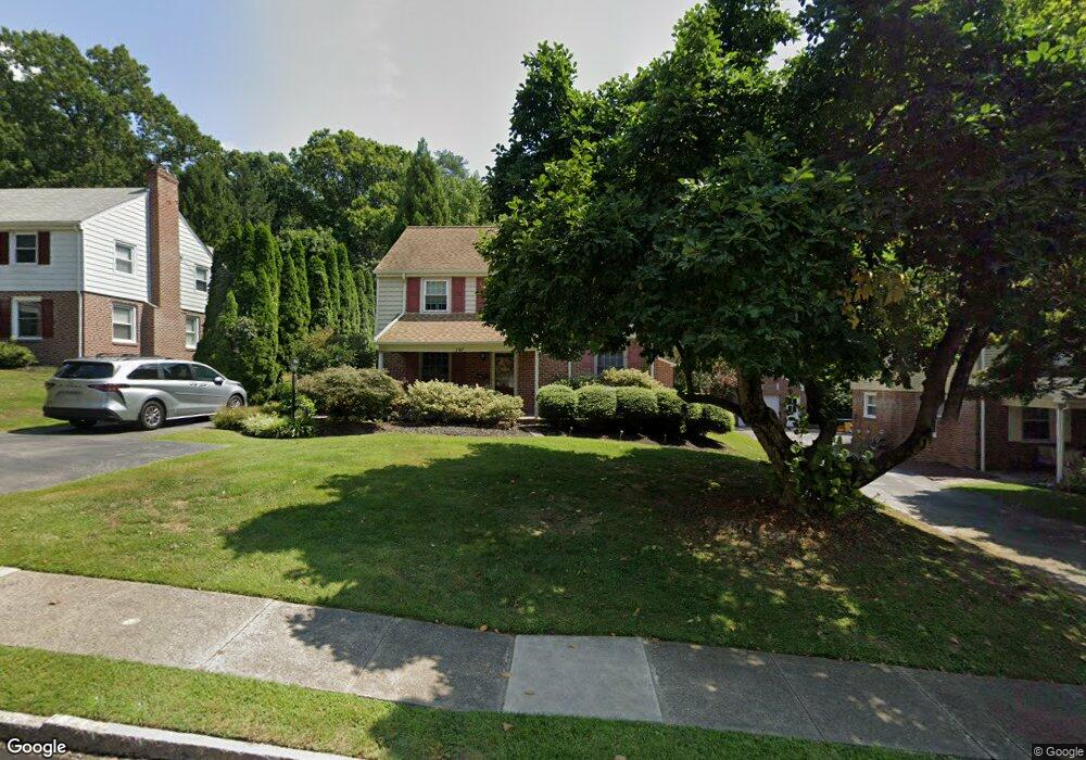
347 Spring Valley Rd Springfield, PA 19064
Estimated Value: $602,000 - $657,000
4
Beds
3
Baths
2,526
Sq Ft
$249/Sq Ft
Est. Value
About This Home
This home is located at 347 Spring Valley Rd, Springfield, PA 19064 and is currently estimated at $629,765, approximately $249 per square foot. 347 Spring Valley Rd is a home located in Delaware County with nearby schools including Springfield High School, St Francis Of Assisi School, and Holy Cross School.
Ownership History
Date
Name
Owned For
Owner Type
Purchase Details
Closed on
Jun 20, 2008
Sold by
Woods David and Woods Amy L
Bought by
Barlam Mark A and Barlam Kristine I
Current Estimated Value
Home Financials for this Owner
Home Financials are based on the most recent Mortgage that was taken out on this home.
Original Mortgage
$220,000
Outstanding Balance
$141,317
Interest Rate
6.07%
Mortgage Type
Purchase Money Mortgage
Estimated Equity
$488,448
Create a Home Valuation Report for This Property
The Home Valuation Report is an in-depth analysis detailing your home's value as well as a comparison with similar homes in the area
Home Values in the Area
Average Home Value in this Area
Purchase History
| Date | Buyer | Sale Price | Title Company |
|---|---|---|---|
| Barlam Mark A | $380,000 | None Available |
Source: Public Records
Mortgage History
| Date | Status | Borrower | Loan Amount |
|---|---|---|---|
| Open | Barlam Mark A | $220,000 |
Source: Public Records
Tax History Compared to Growth
Tax History
| Year | Tax Paid | Tax Assessment Tax Assessment Total Assessment is a certain percentage of the fair market value that is determined by local assessors to be the total taxable value of land and additions on the property. | Land | Improvement |
|---|---|---|---|---|
| 2025 | $9,463 | $336,680 | $105,960 | $230,720 |
| 2024 | $9,463 | $336,680 | $105,960 | $230,720 |
| 2023 | $9,112 | $336,680 | $105,960 | $230,720 |
| 2022 | $8,915 | $336,680 | $105,960 | $230,720 |
| 2021 | $13,806 | $336,680 | $105,960 | $230,720 |
| 2020 | $8,417 | $185,740 | $50,940 | $134,800 |
| 2019 | $8,219 | $185,740 | $50,940 | $134,800 |
| 2018 | $8,101 | $185,740 | $0 | $0 |
| 2017 | $7,914 | $185,740 | $0 | $0 |
| 2016 | $1,019 | $185,740 | $0 | $0 |
| 2015 | $1,019 | $185,740 | $0 | $0 |
| 2014 | $1,019 | $185,740 | $0 | $0 |
Source: Public Records
Map
Nearby Homes
- 111 Forest Rd
- 517 W Woodland Ave
- 31 Wayfield Rd
- 201 S Highland Rd
- 364 S Rolling Rd
- 326 Powell Rd
- 428 Wheatsheaf Rd
- 259 Powell Rd
- 220 Sedgewood Rd
- 225 Lynbrooke Rd
- 509 Lawrence Dr
- 332 Franklin Ave
- 15 Pearson Dr
- 509 Beatty Rd
- 1433 Country Club Dr Unit T214
- 19 Wayne Ave
- 506 Flora Cir
- 464 Conard Dr
- 34 Schuyler Rd
- 411 Lynbrooke Rd
- 353 Spring Valley Rd
- 341 Spring Valley Rd
- 337 Spring Valley Rd
- 365 W Woodland Ave
- 359 Spring Valley Rd
- 361 W Woodland Ave
- 331 Spring Valley Rd
- 350 Spring Valley Rd
- 344 Spring Valley Rd
- 421 W Woodland Ave
- 338 Spring Valley Rd
- 325 Spring Valley Rd
- 400 Kerr Ln
- 319 Spring Valley Rd
- 0 W Woodland Ave
- 431 W Woodland Ave
- 412 Kerr Ln
- 324 Spring Valley Rd
- 311 Spring Valley Rd
- 418 Kerr Ln