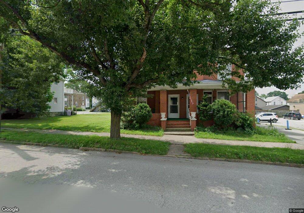
347 W Main St Somerset, PA 15501
Estimated Value: $131,000 - $267,000
6
Beds
3
Baths
3,740
Sq Ft
$55/Sq Ft
Est. Value
About This Home
This home is located at 347 W Main St, Somerset, PA 15501 and is currently estimated at $204,438, approximately $54 per square foot. 347 W Main St is a home located in Somerset County with nearby schools including Maple Ridge Elementary School, Eagle View Elementary School, and Somerset Area Junior/Senior High School.
Ownership History
Date
Name
Owned For
Owner Type
Purchase Details
Closed on
Feb 9, 2024
Sold by
Suss Jonathan D and Suss Kisook
Bought by
Double T Rentals Llc
Current Estimated Value
Home Financials for this Owner
Home Financials are based on the most recent Mortgage that was taken out on this home.
Original Mortgage
$130,000
Outstanding Balance
$127,703
Interest Rate
6.61%
Mortgage Type
Credit Line Revolving
Estimated Equity
$76,735
Purchase Details
Closed on
Sep 27, 2018
Sold by
Mcguire Janet
Bought by
Mcguire Jenet and Suss Jonathan D
Create a Home Valuation Report for This Property
The Home Valuation Report is an in-depth analysis detailing your home's value as well as a comparison with similar homes in the area
Home Values in the Area
Average Home Value in this Area
Purchase History
| Date | Buyer | Sale Price | Title Company |
|---|---|---|---|
| Double T Rentals Llc | $130,000 | None Listed On Document | |
| Mcguire Jenet | -- | None Available |
Source: Public Records
Mortgage History
| Date | Status | Borrower | Loan Amount |
|---|---|---|---|
| Open | Double T Rentals Llc | $130,000 |
Source: Public Records
Tax History Compared to Growth
Tax History
| Year | Tax Paid | Tax Assessment Tax Assessment Total Assessment is a certain percentage of the fair market value that is determined by local assessors to be the total taxable value of land and additions on the property. | Land | Improvement |
|---|---|---|---|---|
| 2025 | $4,158 | $52,250 | $0 | $0 |
| 2024 | $4,158 | $52,250 | $0 | $0 |
| 2023 | $4,066 | $52,250 | $0 | $0 |
| 2022 | $3,867 | $52,250 | $0 | $0 |
| 2021 | $3,786 | $52,250 | $0 | $0 |
| 2020 | $3,734 | $52,250 | $0 | $0 |
| 2019 | $3,734 | $52,250 | $0 | $0 |
| 2018 | $3,682 | $52,250 | $9,130 | $43,120 |
| 2017 | $3,655 | $52,250 | $9,130 | $43,120 |
| 2016 | -- | $52,250 | $9,130 | $43,120 |
| 2015 | -- | $52,250 | $9,130 | $43,120 |
| 2014 | -- | $52,250 | $9,130 | $43,120 |
Source: Public Records
Map
Nearby Homes
- 331 W Main St
- 336 W Sanner St
- 158 W Union St
- 127 W Main St
- 348 W Catherine St
- 344 W Garrett St
- 506 Tayman Ave
- 120 W Catherine St
- 527 N Edgewood Ave
- 549 W Race St
- 611 S Ankeny Ave
- 620 N Franklin Ave
- 678 W Main St
- 129 Missoura St
- 0 E Garrett St
- 152 E Garrett St
- 213 Stoystown Rd
- 218 Missoura St
- 742 S Edgewood Ave (Rear)
- 347-347.5-349 W Main St
- 335 W Main St
- 363 W Main St
- 438 W Patriot St
- 342 W Patriot St
- 348 W Patriot St
- 331 W Main St
- 336 W Patriot St
- 352 W Patriot St Unit WEST
- 352 W Patriot St
- 327 W Main St
- 352 W Patriot St
- 360 W Patriot St
- 356 W Patriot St
- 323 W Main St
- 344 W Main St
- 332 W Patriot St
- 371 W Main St
- 375 W Main St
- 324 W Patriot St