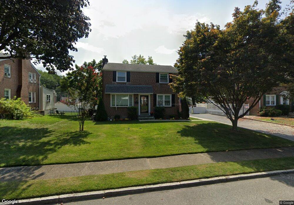
347 Yarnall Dr Springfield, PA 19064
Estimated Value: $466,000 - $514,000
3
Beds
2
Baths
1,590
Sq Ft
$309/Sq Ft
Est. Value
About This Home
This home is located at 347 Yarnall Dr, Springfield, PA 19064 and is currently estimated at $491,113, approximately $308 per square foot. 347 Yarnall Dr is a home located in Delaware County with nearby schools including Springfield High School, St Francis Of Assisi School, and Holy Cross School.
Ownership History
Date
Name
Owned For
Owner Type
Purchase Details
Closed on
Jun 8, 2006
Sold by
Murphy Peter and Murphy Kimberly Ann
Bought by
Murphy Peter
Current Estimated Value
Purchase Details
Closed on
Sep 3, 1997
Sold by
Tralie Peter J and Tralie Mildred E
Bought by
Murphy Peter and Murphy Kimberly Ann
Home Financials for this Owner
Home Financials are based on the most recent Mortgage that was taken out on this home.
Original Mortgage
$140,800
Outstanding Balance
$21,513
Interest Rate
7.31%
Mortgage Type
FHA
Estimated Equity
$469,600
Create a Home Valuation Report for This Property
The Home Valuation Report is an in-depth analysis detailing your home's value as well as a comparison with similar homes in the area
Home Values in the Area
Average Home Value in this Area
Purchase History
| Date | Buyer | Sale Price | Title Company |
|---|---|---|---|
| Murphy Peter | -- | None Available | |
| Murphy Peter | $145,000 | Commonwealth Land Title Ins |
Source: Public Records
Mortgage History
| Date | Status | Borrower | Loan Amount |
|---|---|---|---|
| Open | Murphy Peter | $140,800 |
Source: Public Records
Tax History
| Year | Tax Paid | Tax Assessment Tax Assessment Total Assessment is a certain percentage of the fair market value that is determined by local assessors to be the total taxable value of land and additions on the property. | Land | Improvement |
|---|---|---|---|---|
| 2025 | $7,772 | $276,530 | $94,800 | $181,730 |
| 2024 | $7,772 | $276,530 | $94,800 | $181,730 |
| 2023 | $7,484 | $276,530 | $94,800 | $181,730 |
| 2022 | $7,322 | $276,530 | $94,800 | $181,730 |
| 2021 | $11,101 | $270,710 | $94,800 | $175,910 |
| 2020 | $6,668 | $147,160 | $45,570 | $101,590 |
| 2019 | $6,512 | $147,160 | $45,570 | $101,590 |
| 2018 | $6,419 | $147,160 | $0 | $0 |
| 2017 | $6,270 | $147,160 | $0 | $0 |
| 2016 | $808 | $147,160 | $0 | $0 |
| 2015 | $808 | $147,160 | $0 | $0 |
| 2014 | $762 | $138,900 | $0 | $0 |
Source: Public Records
Map
Nearby Homes
- 173 Rambling Way
- 211 S Norwinden Dr
- 332 Franklin Ave
- 226 Lynbrooke Rd
- 978 Westfield Rd
- 34 Schuyler Rd
- 29 School Ln
- 120 W Springfield Rd
- 31 Wayfield Rd
- 364 S Rolling Rd
- 19 Wayne Ave
- 0 N Bishop Ave
- 507 School St
- 5358 Delmar Dr
- 111 Broad St
- 246 Pennington Ave
- 173 Hillview Dr
- 493 Wheatsheaf Rd
- 202-203 Sycamore Ave
- 472 Larchwood Rd
Your Personal Tour Guide
Ask me questions while you tour the home.