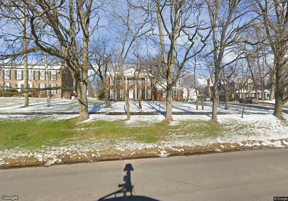
3470 Lone Pine Rd West Bloomfield, MI 48323
Estimated Value: $448,553 - $752,000
4
Beds
3
Baths
2,434
Sq Ft
$232/Sq Ft
Est. Value
About This Home
This home is located at 3470 Lone Pine Rd, West Bloomfield, MI 48323 and is currently estimated at $565,138, approximately $232 per square foot. 3470 Lone Pine Rd is a home located in Oakland County with nearby schools including West Hills Middle School, Bloomfield Hills High School, and The Susan And Rabbi Harold Loss Ecc.
Ownership History
Date
Name
Owned For
Owner Type
Purchase Details
Closed on
Jan 9, 2015
Sold by
Wilcox David D and Wilcox Gerald F
Bought by
Wilcox David D and Wilcox Gerard F
Current Estimated Value
Purchase Details
Closed on
Dec 22, 2009
Sold by
Wilcox Virginia E and Wilcox David D
Bought by
Wilcox Virginia Elizabeth and Virginia Elizabeth Wilcox Trus
Purchase Details
Closed on
Sep 16, 2008
Sold by
Wilcox Virginia E B and Wilcox Frank B
Bought by
Wilcox Virginia E and Wilcox David D
Purchase Details
Closed on
Nov 15, 1997
Sold by
Wilcox Frank B
Bought by
Frank B Wilcox Jr Tr
Create a Home Valuation Report for This Property
The Home Valuation Report is an in-depth analysis detailing your home's value as well as a comparison with similar homes in the area
Home Values in the Area
Average Home Value in this Area
Purchase History
| Date | Buyer | Sale Price | Title Company |
|---|---|---|---|
| Wilcox David D | -- | None Available | |
| Wilcox Virginia Elizabeth | -- | None Available | |
| Wilcox Virginia E | -- | None Available | |
| Frank B Wilcox Jr Tr | -- | -- |
Source: Public Records
Tax History Compared to Growth
Tax History
| Year | Tax Paid | Tax Assessment Tax Assessment Total Assessment is a certain percentage of the fair market value that is determined by local assessors to be the total taxable value of land and additions on the property. | Land | Improvement |
|---|---|---|---|---|
| 2024 | $2,554 | $197,900 | $0 | $0 |
| 2022 | $2,472 | $183,410 | $58,720 | $124,690 |
| 2021 | $4,558 | $181,270 | $0 | $0 |
| 2020 | $2,261 | $179,970 | $58,720 | $121,250 |
| 2018 | $4,284 | $154,960 | $50,870 | $104,090 |
| 2015 | -- | $126,890 | $0 | $0 |
| 2014 | -- | $116,970 | $0 | $0 |
| 2011 | -- | $103,050 | $0 | $0 |
Source: Public Records
Map
Nearby Homes
- 3440 Lone Pine Rd
- 3367 Lone Pine Rd
- 4568 Rolling Ridge Rd
- 4427 Westover Dr
- 4435 Westover Dr
- 3142 Bloomfield Shore Dr
- 3845 Lone Pine Rd Unit 101
- 3835 Lone Pine Rd
- 3925 Lone Pine Rd Unit 300
- 4941 Fairway Ridge Cir
- 3075 Bloomfield Park Dr
- 4053 Harbor Vista Dr
- 2943 Moon Lake Dr Unit 52
- 3930 Maple Hill W
- 0 Wendell Rd Unit 20250033815
- 4274 Wendell Rd
- 4641 Cove Rd
- 4408 Knightsbridge Ln
- 4670 Cove Rd
- 2460 Turner St
- 3478 Lone Pine Rd
- 3462 Lone Pine Rd
- 3457 Buckingham Trail
- 3447 Buckingham Trail
- 3467 Buckingham Trail
- 4495 Apple Valley Ln
- 3450 Lone Pine Rd
- 4483 Apple Valley Ln
- 3437 Buckingham Trail
- 4507 Rolling Ridge Rd
- 4467 Apple Valley Ln
- 4518 Rolling Ridge Rd
- 3464 Buckingham Trail
- 3452 Buckingham Trail
- 3427 Buckingham Trail
- 3449 Lone Pine Rd
- 3442 Buckingham Trail
- 3472 Buckingham Trail
- 4515 Rolling Ridge Rd
- 3437 Lone Pine Rd