Estimated Value: $844,000 - $982,000
5
Beds
4
Baths
4,965
Sq Ft
$183/Sq Ft
Est. Value
About This Home
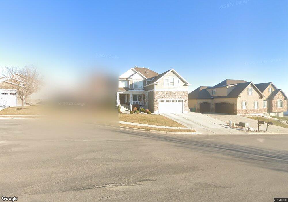
This home is located at 3474 N 700 W, Lehi, UT 84043 and is currently estimated at $907,837, approximately $182 per square foot. 3474 N 700 W is a home located in Utah County with nearby schools including Fox Hollow Elementary School, Skyridge High School, and Ignite Entrepreneurship Academy.
Ownership History
Date
Name
Owned For
Owner Type
Purchase Details
Closed on
Dec 8, 2023
Sold by
Wangsgard Spencer and Wangsgard Zandra
Bought by
Wangsgard Family Revocable Trust and Wangsgard
Current Estimated Value
Purchase Details
Closed on
Jun 12, 2013
Sold by
Edge Land 14 Llc
Bought by
Wangsgard Spencer and Wangsgard Zandra
Home Financials for this Owner
Home Financials are based on the most recent Mortgage that was taken out on this home.
Original Mortgage
$260,000
Interest Rate
3.32%
Mortgage Type
New Conventional
Purchase Details
Closed on
Jan 15, 2013
Sold by
Miyagi Properties Inc
Bought by
Edge Land 14 Llc
Create a Home Valuation Report for This Property
The Home Valuation Report is an in-depth analysis detailing your home's value as well as a comparison with similar homes in the area
Home Values in the Area
Average Home Value in this Area
Purchase History
| Date | Buyer | Sale Price | Title Company |
|---|---|---|---|
| Wangsgard Family Revocable Trust | -- | None Listed On Document | |
| Wangsgard Spencer | -- | Affiliated First Title Co | |
| Edge Land 14 Llc | -- | None Available |
Source: Public Records
Mortgage History
| Date | Status | Borrower | Loan Amount |
|---|---|---|---|
| Previous Owner | Wangsgard Spencer | $260,000 |
Source: Public Records
Tax History Compared to Growth
Tax History
| Year | Tax Paid | Tax Assessment Tax Assessment Total Assessment is a certain percentage of the fair market value that is determined by local assessors to be the total taxable value of land and additions on the property. | Land | Improvement |
|---|---|---|---|---|
| 2025 | $3,642 | $475,365 | $346,100 | $518,200 |
| 2024 | $3,240 | $426,195 | $0 | $0 |
| 2023 | $3,240 | $411,730 | $0 | $0 |
| 2022 | $3,432 | $422,785 | $0 | $0 |
| 2021 | $3,037 | $565,600 | $200,300 | $365,300 |
| 2020 | $2,862 | $526,900 | $185,500 | $341,400 |
| 2019 | $2,696 | $516,000 | $185,500 | $330,500 |
| 2018 | $2,762 | $499,700 | $181,400 | $318,300 |
| 2017 | $2,555 | $245,740 | $0 | $0 |
| 2016 | $2,631 | $234,740 | $0 | $0 |
| 2015 | $2,511 | $212,685 | $0 | $0 |
| 2014 | $2,730 | $229,900 | $0 | $0 |
Source: Public Records
Map
Nearby Homes
- 389 W 3200 N
- 337 W 3200 N
- 3773 N 750 W
- 3117 N 325 W
- Cleveland Plan at Fox Canyon
- Balsam Plan at Fox Canyon
- Basswood Plan at Fox Canyon
- Harrison Plan at Fox Canyon
- Sycamore Plan at Fox Canyon
- Monroe Plan at Fox Canyon
- Yukon Plan at Fox Canyon
- Ash Plan at Fox Canyon
- Charles Plan at Fox Canyon
- Spruce Pantry Plan at Fox Canyon
- Madison Plan at Fox Canyon
- Chapman Plan at Fox Canyon
- Hancock Plan at Fox Canyon
- Harmony Plan at Fox Canyon
- Juniper Plan at Fox Canyon
- Columbia Plan at Fox Canyon
- 3474 N 700 W Unit 14
- 3469 N Hillside Dr Unit 11
- 3454 N 700 W
- 3502 N 700 W Unit 25
- 3502 N 700 W
- 3489 N Hillside Drive Dr W Unit 12
- 3489 N Hillside Dr W Unit 12
- 3489 Hillside Dr
- 3451 N Hillside Dr Unit 10
- 3451 N Hillside Dr Unit 10
- 3451 N Hillside Dr
- 3475 N 700 W
- 3475 N 700 W Unit 21
- 3501 N 700 W Unit 22
- 3453 N 700 W Unit 18
- 3486 Hillside Dr
- 3486 N Hillside Dr
- 685 W 3430 N
- 685 W 3430 N Unit 16
- 3476 N 775 W Unit 20