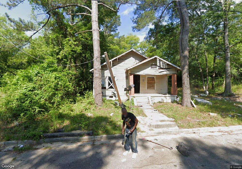
3478 Bond St W Macon, GA 31204
Estimated Value: $58,000 - $95,000
3
Beds
1
Bath
1,000
Sq Ft
$75/Sq Ft
Est. Value
About This Home
This home is located at 3478 Bond St W, Macon, GA 31204 and is currently estimated at $74,663, approximately $74 per square foot. 3478 Bond St W is a home located in Bibb County with nearby schools including Union Elementary School, Weaver Middle School, and Westside High School.
Ownership History
Date
Name
Owned For
Owner Type
Purchase Details
Closed on
Jun 18, 2025
Sold by
Tax Commissioner Of Macon-Bibb County
Bought by
Macon-Bibb County Land Bank Authority
Current Estimated Value
Purchase Details
Closed on
Feb 9, 2017
Sold by
Glover Tommie L
Bought by
Wilson William P
Purchase Details
Closed on
Feb 16, 2016
Sold by
Lowe William E
Bought by
Glover Tommie L
Purchase Details
Closed on
Mar 23, 1989
Sold by
Cheatham Valerie
Bought by
Lowe William E
Create a Home Valuation Report for This Property
The Home Valuation Report is an in-depth analysis detailing your home's value as well as a comparison with similar homes in the area
Home Values in the Area
Average Home Value in this Area
Purchase History
| Date | Buyer | Sale Price | Title Company |
|---|---|---|---|
| Macon-Bibb County Land Bank Authority | $4,978 | None Listed On Document | |
| Macon-Bibb County Land Bank Authority | $4,978 | None Listed On Document | |
| Wilson William P | -- | -- | |
| Glover Tommie L | $2,500 | -- | |
| Lowe William E | $8,000 | -- |
Source: Public Records
Tax History Compared to Growth
Tax History
| Year | Tax Paid | Tax Assessment Tax Assessment Total Assessment is a certain percentage of the fair market value that is determined by local assessors to be the total taxable value of land and additions on the property. | Land | Improvement |
|---|---|---|---|---|
| 2025 | $196 | $7,994 | $1,584 | $6,410 |
| 2024 | $192 | $7,571 | $1,440 | $6,131 |
| 2023 | $178 | $7,014 | $1,440 | $5,574 |
| 2022 | $82 | $2,366 | $448 | $1,918 |
| 2021 | $87 | $2,287 | $448 | $1,839 |
| 2020 | $89 | $2,287 | $448 | $1,839 |
| 2019 | $90 | $2,287 | $448 | $1,839 |
| 2018 | $317 | $2,287 | $448 | $1,839 |
| 2017 | $37 | $2,287 | $448 | $1,839 |
| 2016 | $137 | $3,971 | $897 | $3,074 |
| 2015 | $221 | $4,522 | $1,009 | $3,513 |
| 2014 | $244 | $4,522 | $1,009 | $3,513 |
Source: Public Records
Map
Nearby Homes
- 3484 Bond St W
- 3474 Bond St W
- 3490 Bond St W
- 3487 Bond St W
- 3494 Bond St W
- 3473 Bond St W
- 3465 Barnes St
- 3468 Bond St W
- 3493 Barnes St
- 3495 Bond St W
- 3457 Barnes St
- 3467 Bond St W
- 3424 Barnes St
- 3485 Barnes St
- 3755 Robinson Rd
- 3494 Barnes St
- 0 Barnes St Unit 8542874
- 0 Barnes St Unit 8329898
- 3793 Robinson Rd
- 3669 Robinson Rd