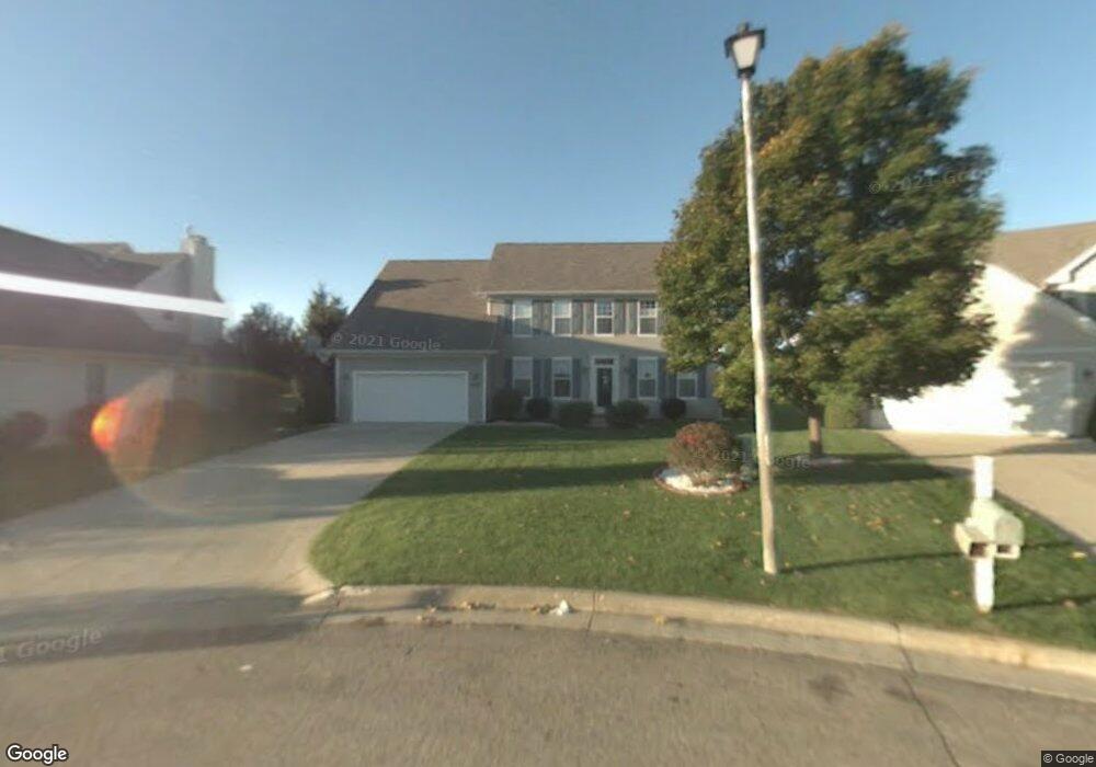
3479 Hampstead Ct Unit 19 Portage, MI 49024
Estimated Value: $473,000 - $599,000
4
Beds
4
Baths
3,818
Sq Ft
$139/Sq Ft
Est. Value
About This Home
This home is located at 3479 Hampstead Ct Unit 19, Portage, MI 49024 and is currently estimated at $531,561, approximately $139 per square foot. 3479 Hampstead Ct Unit 19 is a home located in Kalamazoo County with nearby schools including Moorsbridge Elementary School, Portage West Middle School, and Portage Central High School.
Ownership History
Date
Name
Owned For
Owner Type
Purchase Details
Closed on
Apr 12, 2023
Sold by
Singh Tejinder Bir and Singh Rekha
Bought by
Singh Tejinder Bir and Singh Tejinder Bir
Current Estimated Value
Purchase Details
Closed on
Jan 12, 2006
Sold by
Solomon Andrew M and Solomon Helen D
Bought by
Singh Tejinder Bir and Singh Rekha
Home Financials for this Owner
Home Financials are based on the most recent Mortgage that was taken out on this home.
Original Mortgage
$301,150
Interest Rate
6.34%
Mortgage Type
Fannie Mae Freddie Mac
Create a Home Valuation Report for This Property
The Home Valuation Report is an in-depth analysis detailing your home's value as well as a comparison with similar homes in the area
Home Values in the Area
Average Home Value in this Area
Purchase History
| Date | Buyer | Sale Price | Title Company |
|---|---|---|---|
| Singh Tejinder Bir | -- | None Listed On Document | |
| Singh Tejinder Bir | $317,000 | Chicago Title |
Source: Public Records
Mortgage History
| Date | Status | Borrower | Loan Amount |
|---|---|---|---|
| Previous Owner | Singh Tejinder Bir | $301,150 |
Source: Public Records
Tax History Compared to Growth
Tax History
| Year | Tax Paid | Tax Assessment Tax Assessment Total Assessment is a certain percentage of the fair market value that is determined by local assessors to be the total taxable value of land and additions on the property. | Land | Improvement |
|---|---|---|---|---|
| 2025 | $8,809 | $258,700 | $0 | $0 |
| 2024 | $7,755 | $236,000 | $0 | $0 |
| 2023 | $7,393 | $214,700 | $0 | $0 |
| 2022 | $7,988 | $200,000 | $0 | $0 |
| 2021 | $7,720 | $199,300 | $0 | $0 |
| 2020 | $7,552 | $187,200 | $0 | $0 |
| 2019 | $656 | $179,000 | $0 | $0 |
| 2018 | $0 | $165,300 | $0 | $0 |
| 2017 | $0 | $161,500 | $0 | $0 |
| 2016 | -- | $166,700 | $0 | $0 |
| 2015 | -- | $157,200 | $0 | $0 |
| 2014 | -- | $154,700 | $0 | $0 |
Source: Public Records
Map
Nearby Homes
- 7236 Hampstead Ln Unit 18
- 3320 Scots Pine Way Unit 2
- 3522 Bellflower Dr
- 3653 Tartan Cir
- 7481 Turnberry Ct
- 3737 Bellflower Dr
- 3638 Bellflower Dr
- 6876 Towhee St
- 7464 Saint George Cir
- 3318 Davcliff Ave
- 6645 Oleander Ln
- 7639 Dunross Dr
- 6740 Amberly St
- 4280 Romence Rd
- 2801 Daventry Ave
- 2604 Radcliffe Ave
- 6605 Rothbury St
- 7160 Crown Pointe Cir
- 6576 Isabelle St
- 7922 Kilmory Cir
- 3495 Hampstead Ct
- 7246 Hampstead Ln Unit 17
- 3488 Hampstead Ct Unit 21
- 7269 Mackenzie Ln Unit 55
- 7251 Mackenzie Ln Unit 54
- 3470 Hampstead Ct
- 7252 Hampstead Ln Unit 16
- 7233 Hampstead Ln Unit 32
- 7241 Hampstead Ln Unit 33
- 7291 Mackenzie Ln Unit 56
- 3448 Hampstead Ct Unit 23
- 7221 Mackenzie Ln
- 3424 Hampstead Ct Unit 24
- 7309 Mackenzie Ln
- 7265 Hampstead Ln Unit 34
- 7270 Hampstead Ln Unit 14
- 3397 Hampstead Ct
- 3404 Hampstead Ct Unit 25
- 7331 Mackenzie Ln Unit 58
- 7275 Hampstead Ln Unit 35