Estimated Value: $217,000 - $299,000
3
Beds
2
Baths
1,550
Sq Ft
$169/Sq Ft
Est. Value
About This Home
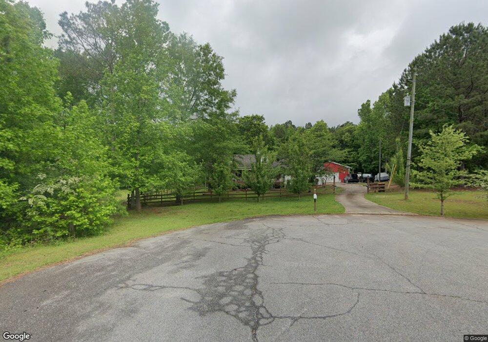
This home is located at 348 Ann Dr, Gay, GA 30218 and is currently estimated at $261,876, approximately $168 per square foot. 348 Ann Dr is a home located in Meriwether County with nearby schools including Unity Elementary School.
Ownership History
Date
Name
Owned For
Owner Type
Purchase Details
Closed on
Sep 20, 2019
Sold by
Cotton Robert G
Bought by
Sitton Michael Stanley and Sitton Karia Whitehead
Current Estimated Value
Home Financials for this Owner
Home Financials are based on the most recent Mortgage that was taken out on this home.
Original Mortgage
$147,184
Outstanding Balance
$129,627
Interest Rate
3.87%
Mortgage Type
FHA
Estimated Equity
$132,249
Purchase Details
Closed on
Apr 21, 2006
Sold by
Not Provided
Bought by
Federal Home Loan Mortgage Corporation
Purchase Details
Closed on
Mar 28, 2002
Sold by
Dunn Dunn and Dunn Enterpri
Bought by
Caldwell James P
Purchase Details
Closed on
Oct 25, 2001
Sold by
Neely John O and Neely Steve
Bought by
Dunn Dunn and Dunn Enterpri
Purchase Details
Closed on
May 18, 2000
Sold by
Hall Nettie T Estate
Bought by
Neely John O and Neely Steve
Create a Home Valuation Report for This Property
The Home Valuation Report is an in-depth analysis detailing your home's value as well as a comparison with similar homes in the area
Home Values in the Area
Average Home Value in this Area
Purchase History
| Date | Buyer | Sale Price | Title Company |
|---|---|---|---|
| Sitton Michael Stanley | $149,900 | -- | |
| Federal Home Loan Mortgage Corporation | -- | -- | |
| Caldwell James P | $94,900 | -- | |
| Dunn Dunn | $15,000 | -- | |
| Neely John O | -- | -- |
Source: Public Records
Mortgage History
| Date | Status | Borrower | Loan Amount |
|---|---|---|---|
| Open | Sitton Michael Stanley | $147,184 |
Source: Public Records
Tax History Compared to Growth
Tax History
| Year | Tax Paid | Tax Assessment Tax Assessment Total Assessment is a certain percentage of the fair market value that is determined by local assessors to be the total taxable value of land and additions on the property. | Land | Improvement |
|---|---|---|---|---|
| 2024 | $2,551 | $76,792 | $3,600 | $73,192 |
| 2023 | $2,318 | $67,152 | $3,600 | $63,552 |
| 2022 | $1,891 | $54,792 | $3,600 | $51,192 |
| 2021 | $1,921 | $54,792 | $3,600 | $51,192 |
| 2020 | $1,936 | $54,792 | $3,600 | $51,192 |
| 2019 | $1,450 | $40,920 | $3,600 | $37,320 |
| 2018 | $1,464 | $40,920 | $3,600 | $37,320 |
| 2017 | $1,222 | $33,760 | $3,600 | $30,160 |
| 2016 | $1,112 | $33,760 | $3,600 | $30,160 |
| 2015 | $1,113 | $33,760 | $3,600 | $30,160 |
| 2014 | $1,113 | $33,760 | $3,600 | $30,160 |
| 2013 | -- | $33,760 | $3,600 | $30,160 |
Source: Public Records
Map
Nearby Homes
- 21101 Georgia 85
- 20911 Georgia 85
- 21743 Highway 85
- 210 Hidden Meadows Dr
- 181 Hidden Meadows Dr
- 123 Hidden Meadows Dr
- 156 Hidden Meadows Dr
- 294 Ike Williams Rd
- 333 Ike Williams Rd
- 10580 Callaway Rd
- 151 Rocker Rd
- 210.73 Acres
- The Bradford Plan at Garner Woods
- The Northern Hills Plan at Garner Woods
- The Forsythe Plan at Garner Woods
- 277 Griffin Hwy
- 64 Timberland Ct
- 882 Caldwell Rd
- 795 Alexander Rd
- 19 ACRES 6536 Luthersville Rd Unit 19 ACRES
- 332 Ann Dr
- 292 Ann Dr
- 435 Lillie Patrick Rd Unit 1
- 435 Lillie Patrick Rd
- 367 Lillie Patrick Rd
- 236 Ann Dr
- 319 Lillie Patrick Rd
- 172 Ann Dr
- 288 Lillie Patrick Rd
- 249 Lillie Patrick Rd
- 0 Ann Dr Unit 8634189
- 112 Ann Dr
- 187 Lillie Patrick Rd
- 200 Lillie Patrick Rd
- 681 Lillie Patrick Rd
- 79 Ann Dr
- 72 Ann Dr
- 145 Lillie Patrick Rd
- 10937 Luthersville Rd
- 10863 Luthersville Rd