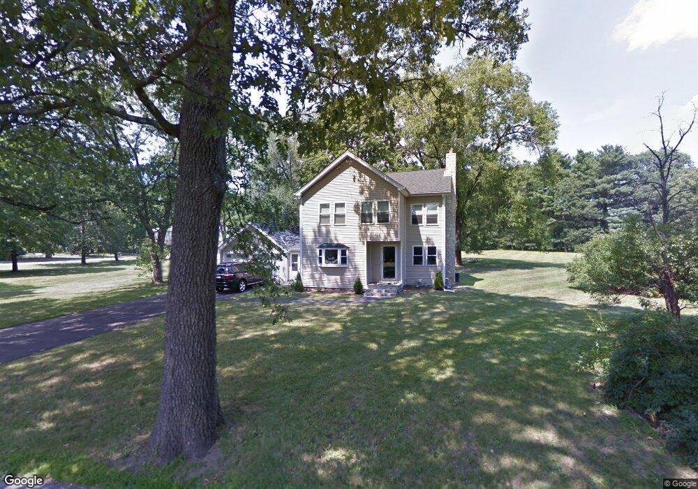
348 Brigham St Unit 1 Northborough, MA 01532
Estimated Value: $680,000 - $774,467
4
Beds
3
Baths
2,082
Sq Ft
$350/Sq Ft
Est. Value
About This Home
This home is located at 348 Brigham St Unit 1, Northborough, MA 01532 and is currently estimated at $729,117, approximately $350 per square foot. 348 Brigham St Unit 1 is a home located in Worcester County with nearby schools including Marguerite E. Peaslee Elementary School, Robert E. Melican Middle School, and Algonquin Regional High School.
Ownership History
Date
Name
Owned For
Owner Type
Purchase Details
Closed on
Oct 4, 2022
Sold by
Shapiro Keith and Shapiro Shari
Bought by
Norbrigham Llc
Current Estimated Value
Purchase Details
Closed on
Mar 18, 2005
Sold by
Fouracre David A and Fouracre John H
Bought by
Shapiro Keith
Home Financials for this Owner
Home Financials are based on the most recent Mortgage that was taken out on this home.
Original Mortgage
$261,000
Interest Rate
5.64%
Mortgage Type
Purchase Money Mortgage
Purchase Details
Closed on
Mar 7, 2005
Sold by
Fouracre Richard S and Fouracre Robert E
Bought by
Fouracre Richard S and Fouracre Robert E
Home Financials for this Owner
Home Financials are based on the most recent Mortgage that was taken out on this home.
Original Mortgage
$261,000
Interest Rate
5.64%
Mortgage Type
Purchase Money Mortgage
Create a Home Valuation Report for This Property
The Home Valuation Report is an in-depth analysis detailing your home's value as well as a comparison with similar homes in the area
Home Values in the Area
Average Home Value in this Area
Purchase History
| Date | Buyer | Sale Price | Title Company |
|---|---|---|---|
| Norbrigham Llc | $620,000 | None Available | |
| Shapiro Keith | $290,062 | -- | |
| Fouracre Richard S | -- | -- | |
| Shapiro Keith | $290,062 | -- | |
| Fouracre Richard S | -- | -- |
Source: Public Records
Mortgage History
| Date | Status | Borrower | Loan Amount |
|---|---|---|---|
| Previous Owner | Fouracre Richard S | $341,250 | |
| Previous Owner | Shapiro Keith | $261,000 |
Source: Public Records
Tax History Compared to Growth
Tax History
| Year | Tax Paid | Tax Assessment Tax Assessment Total Assessment is a certain percentage of the fair market value that is determined by local assessors to be the total taxable value of land and additions on the property. | Land | Improvement |
|---|---|---|---|---|
| 2025 | $8,506 | $596,900 | $275,200 | $321,700 |
| 2024 | $7,514 | $526,200 | $219,500 | $306,700 |
| 2023 | $7,101 | $480,100 | $207,900 | $272,200 |
| 2022 | $6,904 | $418,700 | $198,700 | $220,000 |
| 2021 | $6,655 | $388,700 | $181,900 | $206,800 |
| 2020 | $6,633 | $384,500 | $181,900 | $202,600 |
| 2019 | $6,505 | $379,300 | $181,900 | $197,400 |
| 2018 | $6,163 | $354,400 | $170,500 | $183,900 |
| 2017 | $5,956 | $342,500 | $170,500 | $172,000 |
| 2016 | $5,822 | $339,100 | $167,100 | $172,000 |
| 2015 | $6,103 | $364,800 | $175,400 | $189,400 |
| 2014 | $5,884 | $354,700 | $175,400 | $179,300 |
Source: Public Records
Map
Nearby Homes
- 349 Brigham St
- 223 South St
- 198 South St
- 185-187 South St
- 1 Hamilton Rd
- 59 School St Unit A-14
- 71 Summer St
- 19 Crestwood Dr Unit 19
- 139 Davis St
- 59 Indian Meadow Dr
- 5 Swan View Common Dr
- 132 W Main St
- 89 W Main St
- 90 W Main St
- 26 Maple St
- 39 Pleasant St Unit B19
- 39 Pleasant St Unit C5
- 85 Hudson St Unit 85
- 2 Codman Way Unit 409
- 2 Codman Way Unit 411
- 348 Brigham St
- 2 Milk Porridge Cir
- 345 Brigham St
- 340 Brigham St
- 2 Rustic Dr
- 353 Brigham St
- 6 Milk Porridge Cir
- 360 Brigham St
- 6 Rustic Dr
- 357 Brigham St
- 10 Milk Porridge Cir
- 1 Milk Porridge Cir
- 1 Rustic Dr
- 1 Rustic Dr
- 10 Rustic Dr
- 33 Sunset Dr
- 37 Sunset Dr
- 363 Brigham St
- 7 Rustic Dr
- 14 Milk Porridge Cir