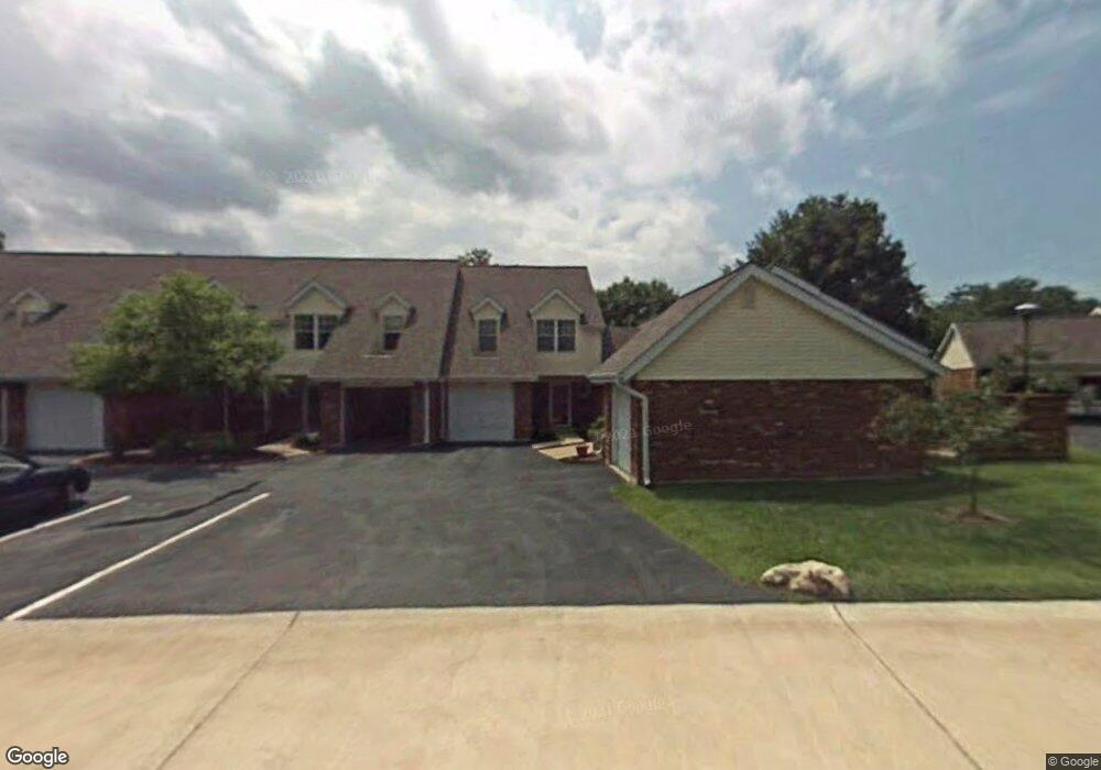
348 Devonshire Ct Saint Peters, MO 63376
Estimated Value: $205,226 - $241,000
2
Beds
2
Baths
1,238
Sq Ft
$178/Sq Ft
Est. Value
About This Home
This home is located at 348 Devonshire Ct, Saint Peters, MO 63376 and is currently estimated at $220,057, approximately $177 per square foot. 348 Devonshire Ct is a home located in St. Charles County with nearby schools including Lewis & Clark Elementary School, Dr. Bernard J. Dubray Middle School, and Fort Zumwalt East High School.
Ownership History
Date
Name
Owned For
Owner Type
Purchase Details
Closed on
Oct 15, 2024
Sold by
Marilyn L Burger-Myles Living Trust
Bought by
Hebisen Scott and Hebisen Annjanette E
Current Estimated Value
Home Financials for this Owner
Home Financials are based on the most recent Mortgage that was taken out on this home.
Original Mortgage
$150,000
Outstanding Balance
$148,423
Interest Rate
6.35%
Mortgage Type
New Conventional
Estimated Equity
$71,634
Purchase Details
Closed on
Feb 7, 2023
Sold by
Burger-Myles Marilyn L
Bought by
Marilyn L Burger-Myles Living Trust
Purchase Details
Closed on
Sep 19, 2013
Sold by
Bryant Amanda C and Bryant Kelly
Bought by
Burger Myles Marilyn L
Create a Home Valuation Report for This Property
The Home Valuation Report is an in-depth analysis detailing your home's value as well as a comparison with similar homes in the area
Home Values in the Area
Average Home Value in this Area
Purchase History
| Date | Buyer | Sale Price | Title Company |
|---|---|---|---|
| Hebisen Scott | -- | Freedom Title | |
| Marilyn L Burger-Myles Living Trust | -- | -- | |
| Burger Myles Marilyn L | $88,000 | Ort |
Source: Public Records
Mortgage History
| Date | Status | Borrower | Loan Amount |
|---|---|---|---|
| Open | Hebisen Scott | $150,000 |
Source: Public Records
Tax History
| Year | Tax Paid | Tax Assessment Tax Assessment Total Assessment is a certain percentage of the fair market value that is determined by local assessors to be the total taxable value of land and additions on the property. | Land | Improvement |
|---|---|---|---|---|
| 2025 | $2,652 | $41,527 | -- | -- |
| 2023 | $2,650 | $37,195 | $0 | $0 |
| 2022 | $2,314 | $30,402 | $0 | $0 |
| 2021 | $2,310 | $30,402 | $0 | $0 |
| 2020 | $2,003 | $25,509 | $0 | $0 |
| 2019 | $1,998 | $25,509 | $0 | $0 |
| 2018 | $1,771 | $21,694 | $0 | $0 |
| 2017 | $1,763 | $21,694 | $0 | $0 |
| 2016 | $1,554 | $19,059 | $0 | $0 |
| 2015 | $1,456 | $19,059 | $0 | $0 |
| 2014 | $1,679 | $21,616 | $0 | $0 |
Source: Public Records
Map
Nearby Homes
- 312 Crown Colony Ct Unit F
- 1002 Chapel Hill Dr Unit 2
- 352 Windsor Place Unit B
- 2032 Belltower Dr
- 420 Cambridge Place Unit 2
- 406 S Church St Unit 128
- 12 Saint Catherine Dr
- 16 Maple St
- 138 Rhythm Point Dr
- 1023 Briley St
- 1232 Cashmere Ln
- 525 Ryehill Dr
- 1 Brookmont @ Ryehill Manor
- 563 Ryehill Dr
- 105 W Sunny Hill Blvd
- 14 Augusta Downs Dr
- 27 Glenna Dr
- 30 N Joyce Ellen Way
- 21 Sun Beam Ct
- 82 N Hillview Dr
- 346 Devonshire Ct Unit G
- 346 Devonshire Ct
- 344 Devonshire Ct
- 342 Devonshire Ct
- 342 Devonshire Ct Unit E
- 340 Devonshire Ct
- 338 Devonshire Ct Unit C
- 331 Devonshire Ct
- 357 Windsor Place
- 359 Windsor Place
- 355 Windsor Place Unit E
- 361 Windsor Place
- 361 Windsor Place Unit B
- 329 Devonshire Ct
- 329 Devonshire Ct Unit B
- 353 Windsor Place
- 325 Devonshire Ct
- 336 Devonshire Ct
- 351 Windsor Place
- 351 Windsor Place Unit G
Your Personal Tour Guide
Ask me questions while you tour the home.