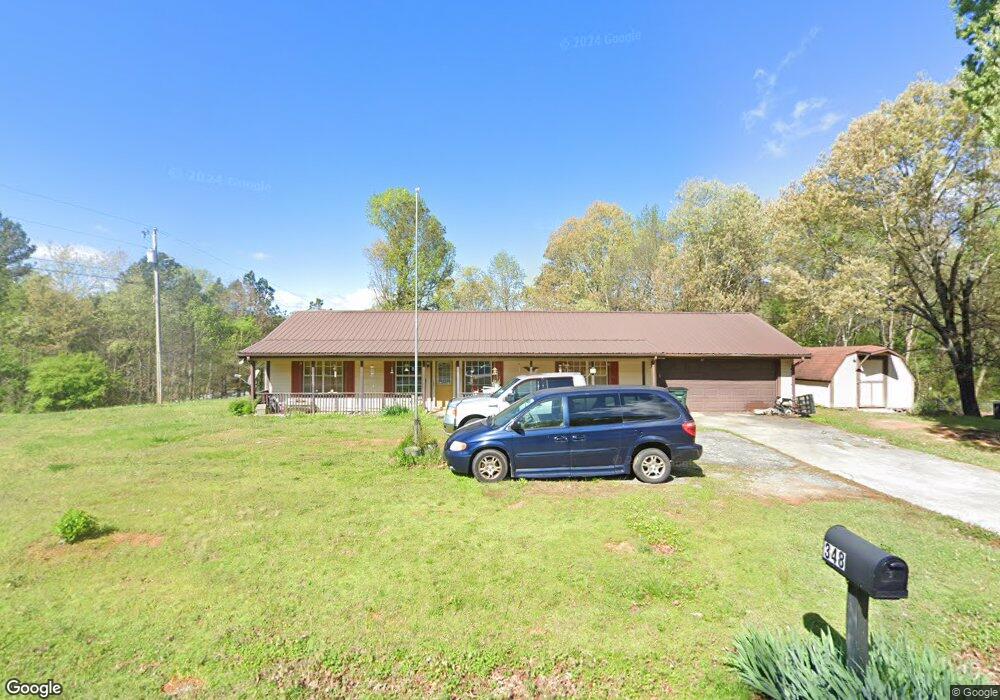
348 Liberty Ln SW Calhoun, GA 30701
Estimated Value: $231,000 - $280,000
3
Beds
1
Bath
1,348
Sq Ft
$187/Sq Ft
Est. Value
About This Home
This home is located at 348 Liberty Ln SW, Calhoun, GA 30701 and is currently estimated at $252,235, approximately $187 per square foot. 348 Liberty Ln SW is a home located in Gordon County with nearby schools including Swain Elementary School, Ashworth Middle School, and Gordon Central High School.
Ownership History
Date
Name
Owned For
Owner Type
Purchase Details
Closed on
Jan 29, 1992
Sold by
Stepp Jack D
Bought by
Black Carl J and Black Mary H
Current Estimated Value
Purchase Details
Closed on
Oct 3, 1989
Sold by
Roberts Construction & Development
Bought by
Decatur Federal Savings & Loan
Purchase Details
Closed on
Mar 9, 1988
Sold by
Stepp Jack D
Bought by
Roberts Construction & Development
Create a Home Valuation Report for This Property
The Home Valuation Report is an in-depth analysis detailing your home's value as well as a comparison with similar homes in the area
Home Values in the Area
Average Home Value in this Area
Purchase History
| Date | Buyer | Sale Price | Title Company |
|---|---|---|---|
| Black Carl J | $57,500 | -- | |
| Stepp Jack D | $45,000 | -- | |
| Decatur Federal Savings & Loan | $67,300 | -- | |
| Roberts Construction & Development | -- | -- |
Source: Public Records
Tax History Compared to Growth
Tax History
| Year | Tax Paid | Tax Assessment Tax Assessment Total Assessment is a certain percentage of the fair market value that is determined by local assessors to be the total taxable value of land and additions on the property. | Land | Improvement |
|---|---|---|---|---|
| 2024 | $884 | $61,280 | $5,600 | $55,680 |
| 2023 | $789 | $57,528 | $5,600 | $51,928 |
| 2022 | $748 | $54,292 | $5,600 | $48,692 |
| 2021 | $494 | $44,744 | $5,600 | $39,144 |
| 2020 | $516 | $45,272 | $5,600 | $39,672 |
| 2019 | $518 | $45,280 | $5,600 | $39,680 |
| 2018 | $433 | $42,320 | $5,600 | $36,720 |
| 2017 | $381 | $40,240 | $5,600 | $34,640 |
| 2016 | $382 | $40,240 | $5,600 | $34,640 |
| 2015 | $373 | $39,560 | $5,600 | $33,960 |
| 2014 | $255 | $28,138 | $4,480 | $23,658 |
Source: Public Records
Map
Nearby Homes
- 261 Liberty Ln SW
- 490 McDaniel Station Rd SW
- 506 McDaniel Station Rd SW
- 458 McDaniel Station Rd SW
- 474 McDaniel Station Rd SW
- 0 Highway 53 Spur SW Unit 7529096
- 00 Belmont Dr
- 1401 U S 41
- 271 Old Belwood Rd SE
- 0 Reeves Station Rd SW Unit 10548197
- 0 Reeves Station Rd SW Unit 7601645
- 1311 Us Highway 41
- 121 Foxhall Dr SW
- 0 W Belmont Dr Unit 10489910
- 0 Richardson Rd SE Unit 10474273
- 0 Richardson Rd SE Unit 7537183
- 110 Darby Rd SW
- 201 Porch Loop SE
- 220 Porch Loop SE
- 211 Darby Rd SW
- 350 Liberty Ln SW
- 305 Liberty Ln SW
- 325 Liberty Ln SW
- 315 Liberty Ln SW
- 335 Liberty Ln SW
- 297 Liberty Ln SW
- 351 Liberty Ln SW
- 360 Liberty Ln SW
- 279 Liberty Ln SW
- 191 Liberty Cir SW
- 361 Liberty Ln SW
- 290 Liberty Ln SW
- 141 Liberty Place SW
- 110 Liberty Place SW
- 278 Liberty Ln SW
- 147 Liberty Place SW
- 174 Azalea St SW
- 182 Liberty Cir SW
- 248 Liberty Ln SW
- 247 Liberty Ln SW