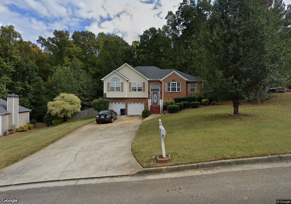
3480 Cowan Ridge Dr Unit 2 Winston, GA 30187
Bill Arp NeighborhoodEstimated Value: $306,409 - $351,000
3
Beds
2
Baths
1,771
Sq Ft
$186/Sq Ft
Est. Value
About This Home
This home is located at 3480 Cowan Ridge Dr Unit 2, Winston, GA 30187 and is currently estimated at $329,102, approximately $185 per square foot. 3480 Cowan Ridge Dr Unit 2 is a home located in Douglas County with nearby schools including Mason Creek Elementary School, Mason Creek Middle School, and Alexander High School.
Ownership History
Date
Name
Owned For
Owner Type
Purchase Details
Closed on
Aug 3, 2004
Sold by
Mgr Bldrs Llc
Bought by
Hinga Benson M
Current Estimated Value
Home Financials for this Owner
Home Financials are based on the most recent Mortgage that was taken out on this home.
Original Mortgage
$164,850
Outstanding Balance
$81,530
Interest Rate
5.96%
Mortgage Type
VA
Estimated Equity
$247,572
Create a Home Valuation Report for This Property
The Home Valuation Report is an in-depth analysis detailing your home's value as well as a comparison with similar homes in the area
Home Values in the Area
Average Home Value in this Area
Purchase History
| Date | Buyer | Sale Price | Title Company |
|---|---|---|---|
| Hinga Benson M | $167,600 | -- |
Source: Public Records
Mortgage History
| Date | Status | Borrower | Loan Amount |
|---|---|---|---|
| Open | Hinga Benson M | $164,850 |
Source: Public Records
Tax History Compared to Growth
Tax History
| Year | Tax Paid | Tax Assessment Tax Assessment Total Assessment is a certain percentage of the fair market value that is determined by local assessors to be the total taxable value of land and additions on the property. | Land | Improvement |
|---|---|---|---|---|
| 2024 | $3,774 | $119,960 | $18,000 | $101,960 |
| 2023 | $3,774 | $119,960 | $18,000 | $101,960 |
| 2022 | $3,512 | $107,840 | $18,000 | $89,840 |
| 2021 | $2,943 | $90,240 | $18,000 | $72,240 |
| 2020 | $2,575 | $77,640 | $11,200 | $66,440 |
| 2019 | $2,176 | $70,280 | $11,200 | $59,080 |
| 2018 | $2,134 | $68,600 | $11,200 | $57,400 |
| 2017 | $1,958 | $61,720 | $11,200 | $50,520 |
| 2016 | $1,551 | $48,080 | $9,000 | $39,080 |
| 2015 | $1,429 | $46,320 | $9,000 | $37,320 |
| 2014 | $1,429 | $42,520 | $9,000 | $33,520 |
| 2013 | -- | $45,840 | $9,760 | $36,080 |
Source: Public Records
Map
Nearby Homes
- 0 Cowan Ridge Dr Unit 10225526
- 6776 Birch Rd
- 6662 Birchwood Ct
- 3741 100 Rd
- 6556 Willow Ln
- 3677 Bright Star Rd
- 6512 Executive Dr
- 6480 Executive Dr
- 3301 Connie Way
- 6549 Biscayne Way
- 6653 Prinston Cir
- 6431 Courtney Dr
- 3721 Mason Creek Rd
- 3756 Bright Star Rd
- 3829 Bright Star Rd
- 2967 Ward Dr
- 3950 Sherwood Dr
- 3096 Campground Rd
- 3850 Bright Star Rd
- 3490 Cowan Ridge Dr Unit 2
- 3470 Cowan Ridge Dr
- 3500 Cowan Ridge Dr Unit 2
- 3465 Cowan Ridge Dr
- 3460 Cowan Ridge Dr
- 6852 Cowan Mill Rd
- 6882 Cowan Mill Rd
- 6850 Cowan Mill Rd
- 6822 Cowan Mill Rd
- 3455 Cowan Ridge Dr
- 3455 Cowan Ridge Dr Unit 22
- 3485 Cowan Ridge Dr
- 3510 Cowan Ridge Dr
- 3450 Cowan Ridge Dr
- 3495 Cowan Ridge Dr
- 0 Cowan Ridge Dr
- 0 Cowan Ridge Dr Unit 10468664
- 0 Cowan Ridge Dr Unit 7530964
- 0 Cowan Ridge Dr Unit 10438019
- 0 Cowan Ridge Dr Unit 7506273