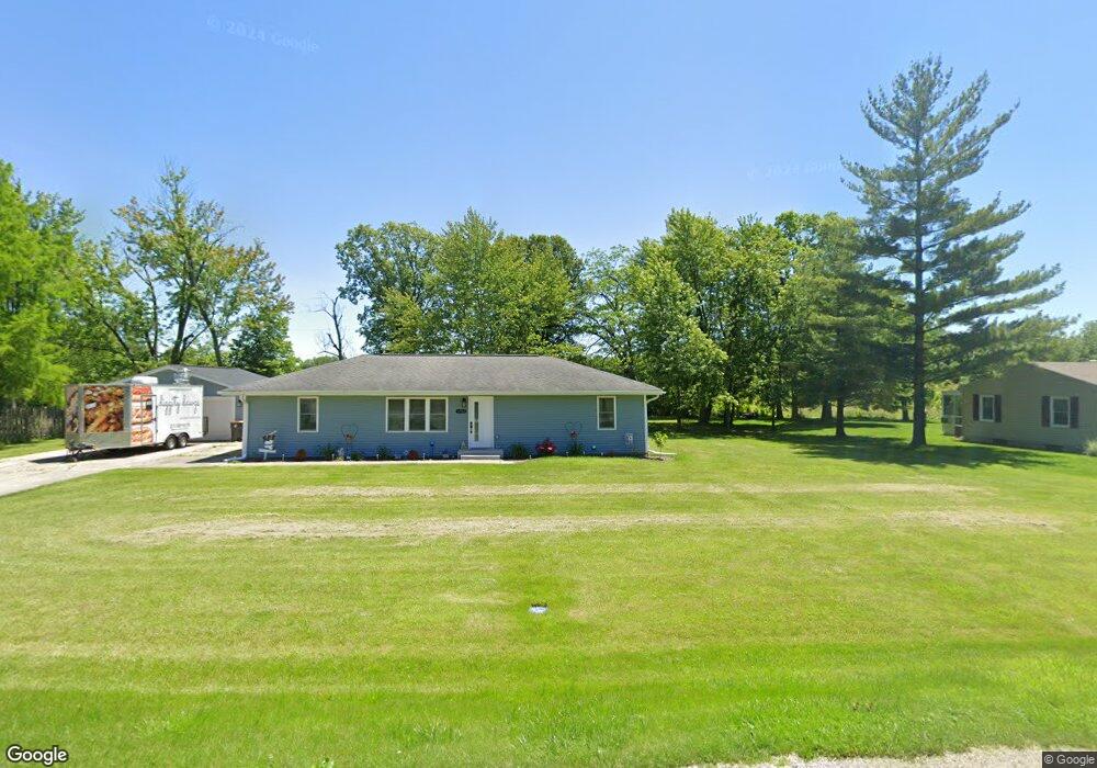
3482 Marilyn Dr Decatur, IL 62521
Estimated Value: $112,000 - $257,186
3
Beds
1
Bath
1,248
Sq Ft
$151/Sq Ft
Est. Value
About This Home
This home is located at 3482 Marilyn Dr, Decatur, IL 62521 and is currently estimated at $188,547, approximately $151 per square foot. 3482 Marilyn Dr is a home located in Macon County with nearby schools including McGaughey Elementary School, Mt. Zion Intermediate School, and Mt. Zion Elementary School.
Ownership History
Date
Name
Owned For
Owner Type
Purchase Details
Closed on
Dec 4, 2023
Sold by
Anderson Todd S and Anderson Sara D
Bought by
Bentley Janet M
Current Estimated Value
Purchase Details
Closed on
Oct 18, 2022
Sold by
Dennis Sherry L
Bought by
Dennis Michael and Anderson Sara D
Home Financials for this Owner
Home Financials are based on the most recent Mortgage that was taken out on this home.
Original Mortgage
$132,000
Interest Rate
6.7%
Mortgage Type
Construction
Create a Home Valuation Report for This Property
The Home Valuation Report is an in-depth analysis detailing your home's value as well as a comparison with similar homes in the area
Home Values in the Area
Average Home Value in this Area
Purchase History
| Date | Buyer | Sale Price | Title Company |
|---|---|---|---|
| Bentley Janet M | $219,000 | None Listed On Document | |
| Dennis Michael | $57,500 | -- |
Source: Public Records
Mortgage History
| Date | Status | Borrower | Loan Amount |
|---|---|---|---|
| Previous Owner | Dennis Michael | $132,000 |
Source: Public Records
Tax History Compared to Growth
Tax History
| Year | Tax Paid | Tax Assessment Tax Assessment Total Assessment is a certain percentage of the fair market value that is determined by local assessors to be the total taxable value of land and additions on the property. | Land | Improvement |
|---|---|---|---|---|
| 2024 | $1,603 | $36,502 | $5,432 | $31,070 |
| 2023 | $2,238 | $33,917 | $5,047 | $28,870 |
| 2022 | $2,112 | $31,890 | $4,745 | $27,145 |
| 2021 | $2,059 | $30,232 | $4,498 | $25,734 |
| 2020 | $1,986 | $28,893 | $4,298 | $24,595 |
| 2019 | $1,986 | $28,893 | $4,298 | $24,595 |
| 2018 | $1,941 | $28,260 | $4,204 | $24,056 |
| 2017 | $1,935 | $27,911 | $4,152 | $23,759 |
| 2016 | $1,785 | $25,737 | $4,150 | $21,587 |
| 2015 | $1,729 | $25,407 | $4,097 | $21,310 |
| 2014 | $1,678 | $25,407 | $4,097 | $21,310 |
| 2013 | $1,709 | $25,407 | $4,097 | $21,310 |
Source: Public Records
Map
Nearby Homes
- 9 Blakeridge Place
- 860 W Wildwood Dr
- 1700 Brentwood Dr
- 1625 Ridgewood Ct
- 3330 S Baltimore Ave
- 1610 Robin Ct
- 3930 S Mount Zion Rd
- 570 Fawn Ct
- 50 Sundance Dr
- 2130 Buckhead Ave
- 2125 Buckhead Ave
- 2110 Buckhead Ln
- 695 Country Ct
- 1820 Buckhead Ln
- 2020 Buckhead Ln
- 2030 Buckhead Ln
- 1030 Country Manor
- 1935 Buckhead Ct
- 1440 N Alexander Dr
- 5460 E Firehouse Rd
- 3474 Marilyn Dr
- 3494 Marilyn Dr
- 3485 Marilyn Dr
- 3495 Marilyn Dr
- 3465 Marilyn Dr
- 3450 Marilyn Dr
- 3480 Jeanette Dr
- 3445 Marilyn Dr
- 3490 Jeanette Dr
- 3460 Jeanette Dr
- 4685 Walton Dr
- 4675 Walton Dr
- 3438 Marilyn Dr
- 3440 Jeanette Dr
- 4635 Walton Dr
- 3435 Marilyn Dr
- 3485 Jeanette Dr
- 3471 Jeanette Dr
- 4597 Walton Dr
- 3495 Jeanette Dr