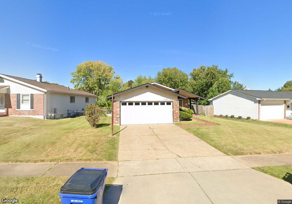
3483 Woodpath Dr Florissant, MO 63031
Estimated Value: $217,282 - $237,000
4
Beds
2
Baths
1,592
Sq Ft
$143/Sq Ft
Est. Value
About This Home
This home is located at 3483 Woodpath Dr, Florissant, MO 63031 and is currently estimated at $227,321, approximately $142 per square foot. 3483 Woodpath Dr is a home located in St. Louis County with nearby schools including North Middle School, Hazelwood Central High School, and St Norbert School.
Ownership History
Date
Name
Owned For
Owner Type
Purchase Details
Closed on
Jan 28, 1997
Sold by
Gordon James M and Gordon Shelley A
Bought by
Jones Noble and Jones Yolanda
Current Estimated Value
Home Financials for this Owner
Home Financials are based on the most recent Mortgage that was taken out on this home.
Original Mortgage
$90,149
Outstanding Balance
$9,770
Interest Rate
7.73%
Mortgage Type
FHA
Estimated Equity
$217,551
Create a Home Valuation Report for This Property
The Home Valuation Report is an in-depth analysis detailing your home's value as well as a comparison with similar homes in the area
Home Values in the Area
Average Home Value in this Area
Purchase History
| Date | Buyer | Sale Price | Title Company |
|---|---|---|---|
| Jones Noble | -- | -- |
Source: Public Records
Mortgage History
| Date | Status | Borrower | Loan Amount |
|---|---|---|---|
| Open | Jones Noble | $90,149 |
Source: Public Records
Tax History Compared to Growth
Tax History
| Year | Tax Paid | Tax Assessment Tax Assessment Total Assessment is a certain percentage of the fair market value that is determined by local assessors to be the total taxable value of land and additions on the property. | Land | Improvement |
|---|---|---|---|---|
| 2025 | $2,930 | $36,790 | $7,680 | $29,110 |
| 2024 | $2,930 | $33,560 | $3,060 | $30,500 |
| 2023 | $2,930 | $33,560 | $3,060 | $30,500 |
| 2022 | $2,537 | $25,900 | $5,000 | $20,900 |
| 2021 | $2,501 | $25,900 | $5,000 | $20,900 |
| 2020 | $2,719 | $26,240 | $7,660 | $18,580 |
| 2019 | $2,678 | $26,240 | $7,660 | $18,580 |
| 2018 | $2,271 | $20,430 | $2,360 | $18,070 |
| 2017 | $2,268 | $20,430 | $2,360 | $18,070 |
| 2016 | $2,275 | $20,220 | $2,740 | $17,480 |
| 2015 | $2,227 | $20,220 | $2,740 | $17,480 |
| 2014 | $2,195 | $20,540 | $4,900 | $15,640 |
Source: Public Records
Map
Nearby Homes
- 1323 Woodpath Dr
- 1455 Burnside Ct
- 1638 Matlock Dr
- 3660 Woodman Dr
- 3213 Yvette Ct
- 3645 Woodman Dr
- 1522 Sherwood Forest Dr
- 1114 Ransome Ct
- 1641 Sherwood Forest Dr
- 3870 Hope Haven Dr
- 3865 Kentucky Derby Dr
- 3849 Secretariat Dr
- 3035 Matlock Dr
- 2 Aspen II at Riverstone
- 4097 Fox Island Dr
- 1303 Topsider Ct
- 1069 Saratoga Springs Ct
- 1056 Saratoga Springs Ct
- 2906 Russet Ct
- 16787 River Stone Dr
- 3463 Woodpath Dr
- 3513 Woodpath Dr
- 3533 Woodpath Dr
- 3443 Woodpath Dr
- 3542 Heather Trails Dr
- 3562 Heather Trails Dr
- 3553 Woodpath Dr
- 3522 Heather Trails Dr
- 7 Covey Ct
- 3502 Heather Trails Dr
- 3582 Heather Trails Dr
- 3494 Woodpath Dr
- 3514 Woodpath Dr
- 8 Covey Ct
- 3484 Woodpath Dr
- 3534 Woodpath Dr
- 3464 Woodpath Dr
- 3612 Heather Trails Dr
- 3554 Woodpath Dr
- 3573 Woodpath Dr