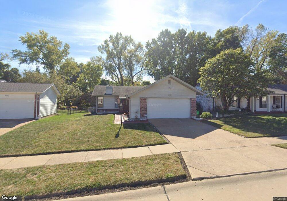
3484 Woodpath Dr Florissant, MO 63031
Estimated Value: $190,508 - $227,000
3
Beds
2
Baths
1,105
Sq Ft
$185/Sq Ft
Est. Value
About This Home
This home is located at 3484 Woodpath Dr, Florissant, MO 63031 and is currently estimated at $204,627, approximately $185 per square foot. 3484 Woodpath Dr is a home located in St. Louis County with nearby schools including North Middle School, Hazelwood Central High School, and St Norbert School.
Ownership History
Date
Name
Owned For
Owner Type
Purchase Details
Closed on
Sep 5, 2003
Sold by
Sigmund Ruth E
Bought by
Byrd Vanessa
Current Estimated Value
Home Financials for this Owner
Home Financials are based on the most recent Mortgage that was taken out on this home.
Original Mortgage
$94,000
Outstanding Balance
$43,126
Interest Rate
6.08%
Mortgage Type
Purchase Money Mortgage
Estimated Equity
$161,501
Create a Home Valuation Report for This Property
The Home Valuation Report is an in-depth analysis detailing your home's value as well as a comparison with similar homes in the area
Home Values in the Area
Average Home Value in this Area
Purchase History
| Date | Buyer | Sale Price | Title Company |
|---|---|---|---|
| Byrd Vanessa | $117,500 | -- |
Source: Public Records
Mortgage History
| Date | Status | Borrower | Loan Amount |
|---|---|---|---|
| Open | Byrd Vanessa | $94,000 | |
| Closed | Byrd Vanessa | $5,850 |
Source: Public Records
Tax History Compared to Growth
Tax History
| Year | Tax Paid | Tax Assessment Tax Assessment Total Assessment is a certain percentage of the fair market value that is determined by local assessors to be the total taxable value of land and additions on the property. | Land | Improvement |
|---|---|---|---|---|
| 2025 | $2,501 | $35,910 | $5,970 | $29,940 |
| 2024 | $2,501 | $28,600 | $2,380 | $26,220 |
| 2023 | $2,498 | $28,600 | $2,380 | $26,220 |
| 2022 | $2,259 | $23,030 | $3,900 | $19,130 |
| 2021 | $2,227 | $23,030 | $3,900 | $19,130 |
| 2020 | $2,193 | $21,110 | $5,970 | $15,140 |
| 2019 | $2,160 | $21,110 | $5,970 | $15,140 |
| 2018 | $2,116 | $19,020 | $2,010 | $17,010 |
| 2017 | $2,113 | $19,020 | $2,010 | $17,010 |
| 2016 | $1,966 | $17,440 | $2,390 | $15,050 |
| 2015 | $1,924 | $17,440 | $2,390 | $15,050 |
| 2014 | $1,641 | $15,290 | $3,780 | $11,510 |
Source: Public Records
Map
Nearby Homes
- 1323 Woodpath Dr
- 1455 Burnside Ct
- 1638 Matlock Dr
- 3213 Yvette Ct
- 1522 Sherwood Forest Dr
- 3660 Woodman Dr
- 3645 Woodman Dr
- 1114 Ransome Ct
- 1641 Sherwood Forest Dr
- 3870 Hope Haven Dr
- 3865 Kentucky Derby Dr
- 3849 Secretariat Dr
- 3035 Matlock Dr
- 4097 Fox Island Dr
- 2906 Russet Ct
- 2 Aspen II at Riverstone
- 2916 Corn Silk Ct
- 733 Mediterranean Dr
- 1069 Saratoga Springs Ct
- 1056 Saratoga Springs Ct
- 3464 Woodpath Dr
- 3494 Woodpath Dr
- 3514 Woodpath Dr
- 3443 Woodpath Dr
- 3424 Woodpath Dr
- 3502 Heather Trails Dr
- 3463 Woodpath Dr
- 3534 Woodpath Dr
- 3483 Woodpath Dr
- 3513 Woodpath Dr
- 3522 Heather Trails Dr
- 3471 Heather Trails Dr
- 3554 Woodpath Dr
- 1322 Langholm Dr
- 3533 Woodpath Dr
- 1312 Langholm Dr
- 1332 Langholm Dr
- 3542 Heather Trails Dr
- 1302 Langholm Dr
- 3564 Woodpath Dr