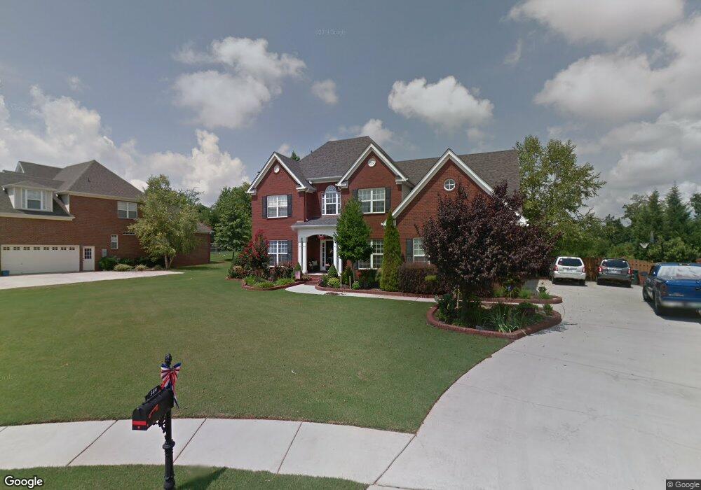
349 Cedar Trail Ln Harvest, AL 35749
Harvest-Cluttsville NeighborhoodEstimated Value: $504,062 - $545,000
--
Bed
1
Bath
2,998
Sq Ft
$175/Sq Ft
Est. Value
About This Home
This home is located at 349 Cedar Trail Ln, Harvest, AL 35749 and is currently estimated at $524,766, approximately $175 per square foot. 349 Cedar Trail Ln is a home with nearby schools including Harvest Elementary School, Sparkman Middle School, and Sparkman High School.
Ownership History
Date
Name
Owned For
Owner Type
Purchase Details
Closed on
Jul 31, 2007
Sold by
Ken Mcdaniel Homes Inc
Bought by
Stilwell Keith E and Tate Deborah S
Current Estimated Value
Home Financials for this Owner
Home Financials are based on the most recent Mortgage that was taken out on this home.
Original Mortgage
$339,000
Outstanding Balance
$214,528
Interest Rate
6.65%
Mortgage Type
New Conventional
Estimated Equity
$310,238
Create a Home Valuation Report for This Property
The Home Valuation Report is an in-depth analysis detailing your home's value as well as a comparison with similar homes in the area
Home Values in the Area
Average Home Value in this Area
Purchase History
| Date | Buyer | Sale Price | Title Company |
|---|---|---|---|
| Stilwell Keith E | -- | -- |
Source: Public Records
Mortgage History
| Date | Status | Borrower | Loan Amount |
|---|---|---|---|
| Open | Stilwell Keith E | $339,000 |
Source: Public Records
Tax History Compared to Growth
Tax History
| Year | Tax Paid | Tax Assessment Tax Assessment Total Assessment is a certain percentage of the fair market value that is determined by local assessors to be the total taxable value of land and additions on the property. | Land | Improvement |
|---|---|---|---|---|
| 2024 | $1,722 | $49,160 | $8,000 | $41,160 |
| 2023 | $1,639 | $46,880 | $8,000 | $38,880 |
| 2022 | $1,453 | $41,780 | $8,000 | $33,780 |
| 2021 | $1,331 | $38,320 | $6,500 | $31,820 |
| 2020 | $1,238 | $35,780 | $6,500 | $29,280 |
| 2019 | $1,198 | $34,650 | $6,500 | $28,150 |
| 2018 | $1,121 | $32,560 | $0 | $0 |
| 2017 | $1,121 | $32,560 | $0 | $0 |
| 2016 | $1,121 | $32,560 | $0 | $0 |
| 2015 | $1,121 | $32,560 | $0 | $0 |
| 2014 | $1,153 | $33,440 | $0 | $0 |
Source: Public Records
Map
Nearby Homes
- 108 Ashby Pond Dr
- Residence 1837 Plan at Highlands Trail - Townhomes
- Barton II Plan at Highlands Trail - Ranchers
- Residence 1850 Plan at Highlands Trail - Townhomes
- Trevi II Plan at Highlands Trail - Cottages
- Tivoli II Plan at Highlands Trail - Ranchers
- Medallion II Plan at Highlands Trail - Ranchers
- Brio II Plan at Highlands Trail - Ranchers
- Princeton II Plan at Highlands Trail - Ranchers
- Charle II Plan at Highlands Trail - Cottages
- Independence II Plan at Highlands Trail - Ranchers
- Halle II Plan at Highlands Trail - Cottages
- 107 Ashby Pond Dr
- 110 Ashby Pond Dr
- 125 Sager Cir
- 325 Cedar Trail Ln
- 145 Sager Cir
- 110 Kelly Valley Ln
- 113 Kelly Valley Ln
- 11.33 Acres Jeff View Ct
- 351 Cedar Trail Ln
- 347 Cedar Trail Ln
- 345 Cedar Trail Ln
- 353 Cedar Trail Ln
- 346 Cedar Trail Ln
- 343 Cedar Trail Ln
- 464 Ford Chapel Rd
- 129 Cherita Ln
- 352 Cedar Trail Ln
- 355 Cedar Trail Ln
- 341 Cedar Trail Ln
- 354 Cedar Trail Ln
- 127 Cherita Ln
- 216 Burwell Ridge Trail
- 472 Ford Chapel Rd
- 131 Cherita Ln
- 357 Cedar Trail Ln
- 214 Burwell Ridge Trail
- 339 Cedar Trail Ln
- 356 Cedar Trail Ln