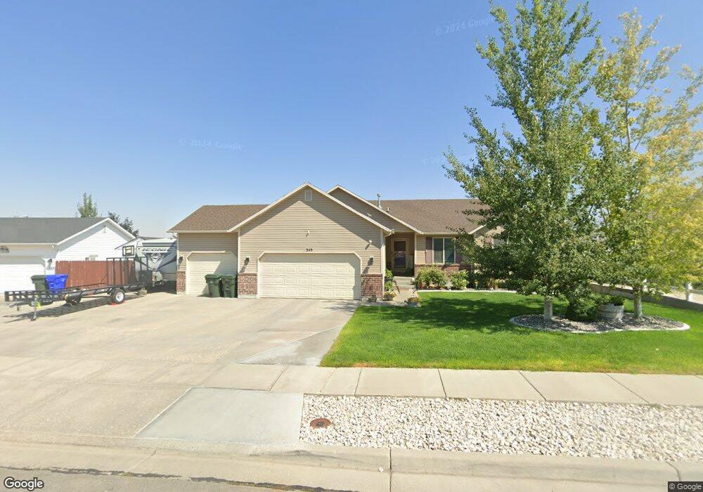
349 E 1520 N Tooele, UT 84074
Estimated Value: $434,000 - $491,000
3
Beds
2
Baths
2,950
Sq Ft
$153/Sq Ft
Est. Value
About This Home
This home is located at 349 E 1520 N, Tooele, UT 84074 and is currently estimated at $450,232, approximately $152 per square foot. 349 E 1520 N is a home located in Tooele County with nearby schools including Copper Canyon Elementary School, Clarke N. Johnsen Junior High School, and Stansbury High School.
Ownership History
Date
Name
Owned For
Owner Type
Purchase Details
Closed on
Jun 30, 2017
Sold by
Pearson Dustin B and Pearson Cindy
Bought by
Cloward Shane Litster and Cloward Ashley Ann
Current Estimated Value
Home Financials for this Owner
Home Financials are based on the most recent Mortgage that was taken out on this home.
Original Mortgage
$257,575
Outstanding Balance
$214,353
Interest Rate
3.95%
Mortgage Type
New Conventional
Estimated Equity
$235,879
Purchase Details
Closed on
Dec 4, 2007
Sold by
Pearson Dustin B
Bought by
Pearson Dustin B and Pearson Cindy
Home Financials for this Owner
Home Financials are based on the most recent Mortgage that was taken out on this home.
Original Mortgage
$226,000
Interest Rate
6.3%
Mortgage Type
New Conventional
Purchase Details
Closed on
May 11, 2005
Sold by
Pennco Inc
Bought by
Glisson Michael
Create a Home Valuation Report for This Property
The Home Valuation Report is an in-depth analysis detailing your home's value as well as a comparison with similar homes in the area
Purchase History
| Date | Buyer | Sale Price | Title Company |
|---|---|---|---|
| Cloward Shane Litster | -- | Stewart Title Insurance Agen | |
| Pearson Dustin B | -- | Inwest Title | |
| Pearson Dustin B | -- | Inwest Title | |
| Glisson Michael | -- | Merrill Title Company |
Source: Public Records
Mortgage History
| Date | Status | Borrower | Loan Amount |
|---|---|---|---|
| Open | Cloward Shane Litster | $257,575 | |
| Previous Owner | Pearson Dustin B | $226,000 |
Source: Public Records
Tax History
| Year | Tax Paid | Tax Assessment Tax Assessment Total Assessment is a certain percentage of the fair market value that is determined by local assessors to be the total taxable value of land and additions on the property. | Land | Improvement |
|---|---|---|---|---|
| 2025 | $2,624 | $397,869 | $102,500 | $295,369 |
| 2024 | $2,870 | $219,095 | $56,375 | $162,720 |
| 2023 | $2,870 | $230,476 | $53,689 | $176,787 |
| 2022 | $2,755 | $237,051 | $53,453 | $183,598 |
| 2021 | $2,260 | $162,610 | $21,381 | $141,229 |
| 2020 | $2,148 | $268,143 | $38,875 | $229,268 |
| 2019 | $2,095 | $257,225 | $38,875 | $218,350 |
| 2018 | $1,933 | $225,042 | $40,000 | $185,042 |
| 2017 | $1,696 | $234,346 | $30,000 | $204,346 |
| 2016 | $1,380 | $114,231 | $16,500 | $97,731 |
| 2015 | $1,380 | $100,333 | $0 | $0 |
| 2014 | -- | $100,333 | $0 | $0 |
Source: Public Records
Map
Nearby Homes
- 438 E 1480 N
- 1154 N Berra Blvd
- 472 E 1420 N
- 405 E 1310 N
- 1762 N Broadway Ave Unit 102
- 1598 N 210 E Unit 107
- 1618 N 210 E
- 475 E 1310 N
- 1741 Copper Canyon Dr Unit 1288
- 1735 Copper Canyon Dr Unit 1286
- 1822 N Blue Iris Ave Unit 1055
- 1833 N Blue Iris Ave Unit 1073
- 1770 N Patchwork Ave Unit 1255
- 1756 N Patchwork Ave Unit 1258
- 1727 N Patchwork Ave Unit 1268
- 1747 N Patchwork Ave Unit 1264
- 1774 N Patchwork Ave Unit 1254
- 1743 N Patchwork Ave Unit 1265
- 1753 N Patchwork Ave Unit 1263
- 1778 N Patchwork Ave Unit 1253
- 361 E 1520 N
- 337 E 1520 N
- 373 E 1520 N
- 356 E 1520 N
- 1512 N Broadway
- 1509 N 380 E
- 1495 N 380 E
- 1539 N Broadway Ave
- 1551 N Broadway Ave
- 1483 N 380 E
- 397 E 1480 N Unit 23
- 1563 N Broadway Ave
- 1475 N 380 E
- 411 E 1480 N
- 1575 N Broadway Ave
- 1587 N Broadway Ave
- 1476 N 380 E
- 1467 N 380 E
- 1599 N Broadway Ave
- 419 E 1480 N
Your Personal Tour Guide
Ask me questions while you tour the home.