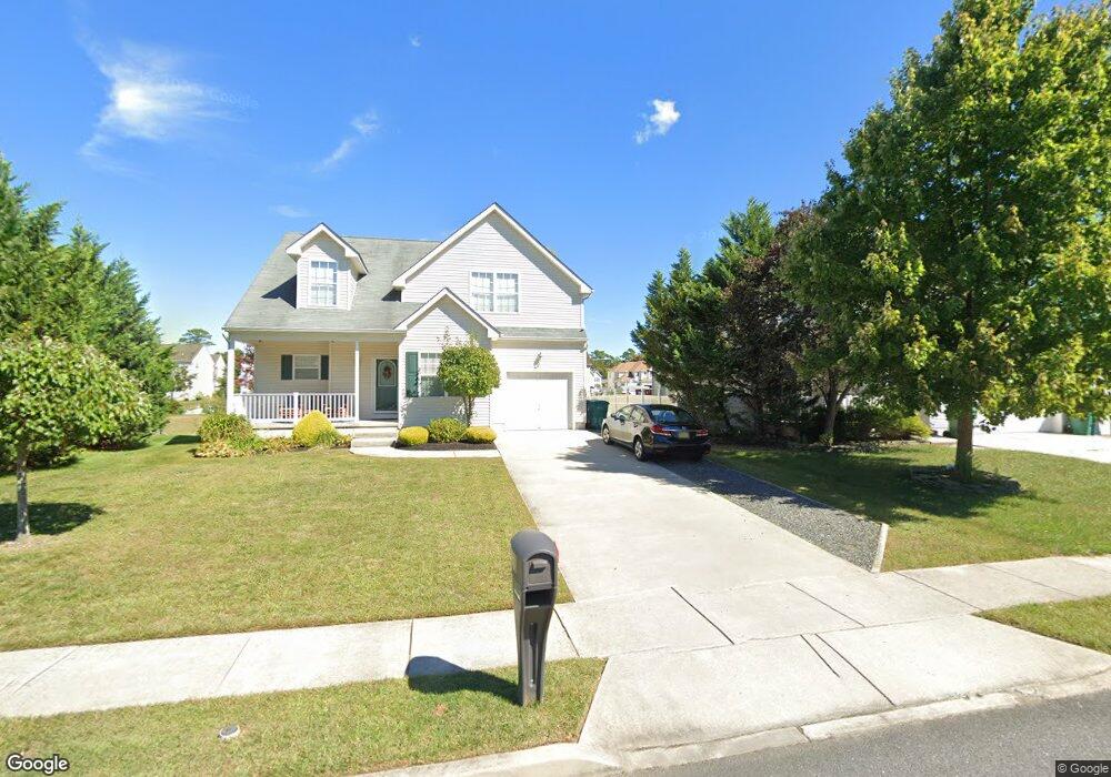
349 Elton Ln Galloway, NJ 08205
Estimated Value: $467,000 - $540,000
--
Bed
--
Bath
2,346
Sq Ft
$210/Sq Ft
Est. Value
About This Home
This home is located at 349 Elton Ln, Galloway, NJ 08205 and is currently estimated at $492,853, approximately $210 per square foot. 349 Elton Ln is a home located in Atlantic County with nearby schools including Absegami High School, Oakcrest High School, and Cedar Creek High School.
Ownership History
Date
Name
Owned For
Owner Type
Purchase Details
Closed on
Oct 31, 2007
Sold by
Foxmoor At Galloway Corp
Bought by
Hayek Timothy and Hayek Christine
Current Estimated Value
Home Financials for this Owner
Home Financials are based on the most recent Mortgage that was taken out on this home.
Original Mortgage
$265,871
Outstanding Balance
$168,235
Interest Rate
6.47%
Mortgage Type
Purchase Money Mortgage
Estimated Equity
$324,618
Create a Home Valuation Report for This Property
The Home Valuation Report is an in-depth analysis detailing your home's value as well as a comparison with similar homes in the area
Home Values in the Area
Average Home Value in this Area
Purchase History
| Date | Buyer | Sale Price | Title Company |
|---|---|---|---|
| Hayek Timothy | $312,790 | Coastline Title Agency Inc |
Source: Public Records
Mortgage History
| Date | Status | Borrower | Loan Amount |
|---|---|---|---|
| Open | Hayek Timothy | $265,871 |
Source: Public Records
Tax History Compared to Growth
Tax History
| Year | Tax Paid | Tax Assessment Tax Assessment Total Assessment is a certain percentage of the fair market value that is determined by local assessors to be the total taxable value of land and additions on the property. | Land | Improvement |
|---|---|---|---|---|
| 2025 | $9,303 | $278,700 | $33,600 | $245,100 |
| 2024 | $9,303 | $278,700 | $33,600 | $245,100 |
| 2023 | $8,949 | $278,700 | $33,600 | $245,100 |
| 2022 | $8,313 | $258,900 | $33,600 | $225,300 |
| 2021 | $8,148 | $258,900 | $33,600 | $225,300 |
| 2020 | $8,018 | $258,900 | $33,600 | $225,300 |
| 2019 | $7,871 | $258,900 | $33,600 | $225,300 |
| 2018 | $7,982 | $258,900 | $33,600 | $225,300 |
| 2017 | $7,982 | $258,900 | $33,600 | $225,300 |
| 2016 | $7,912 | $258,900 | $33,600 | $225,300 |
| 2015 | $7,876 | $258,900 | $33,600 | $225,300 |
| 2014 | $7,614 | $258,900 | $33,600 | $225,300 |
Source: Public Records
Map
Nearby Homes
- 231 W Father Keis Dr
- 252 Terry Ln
- 0 S Avenue A
- 403 S Zenia Ave
- 407 S Zenia Ave
- 402 S Zenia Ave
- 252 W White Horse Pike
- 327 S Yam Ave
- 426 S Zenia Ave
- 202 W White Horse Pike
- 725 W Duerer St
- 415 Vine Ave
- 104 W White Horse Pike
- 316 S Upas Ave
- 406 Tulip Ave
- 441 Vine Ave
- 294 W White Horse Pike
- 436 Upas Ave
- 270 W Todd Ave
- 108 Buchanan Ave