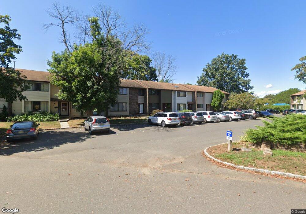
349 Evanston Dr East Windsor, NJ 08520
Estimated Value: $369,577 - $396,000
3
Beds
2
Baths
1,308
Sq Ft
$294/Sq Ft
Est. Value
About This Home
This home is located at 349 Evanston Dr, East Windsor, NJ 08520 and is currently estimated at $384,644, approximately $294 per square foot. 349 Evanston Dr is a home located in Mercer County with nearby schools including Oak Tree Elementary School, Monroe Township Middle School, and Monroe Township High School.
Ownership History
Date
Name
Owned For
Owner Type
Purchase Details
Closed on
Feb 26, 2009
Sold by
Kochie Derek and Kochie Jillian
Bought by
Trieber Orly F and Strout Anthony M
Current Estimated Value
Home Financials for this Owner
Home Financials are based on the most recent Mortgage that was taken out on this home.
Original Mortgage
$206,654
Outstanding Balance
$131,474
Interest Rate
5.14%
Mortgage Type
FHA
Estimated Equity
$253,170
Purchase Details
Closed on
Jun 28, 2004
Sold by
Morgan David
Bought by
Kochie Derek
Home Financials for this Owner
Home Financials are based on the most recent Mortgage that was taken out on this home.
Original Mortgage
$159,999
Interest Rate
6.08%
Purchase Details
Closed on
Jul 6, 2001
Sold by
Schrob David
Bought by
Morgan David and Morgan Megan
Home Financials for this Owner
Home Financials are based on the most recent Mortgage that was taken out on this home.
Original Mortgage
$110,500
Interest Rate
7.1%
Create a Home Valuation Report for This Property
The Home Valuation Report is an in-depth analysis detailing your home's value as well as a comparison with similar homes in the area
Home Values in the Area
Average Home Value in this Area
Purchase History
| Date | Buyer | Sale Price | Title Company |
|---|---|---|---|
| Trieber Orly F | $210,500 | Nrt Title Agency Llc | |
| Kochie Derek | $170,000 | -- | |
| Morgan David | $118,000 | -- |
Source: Public Records
Mortgage History
| Date | Status | Borrower | Loan Amount |
|---|---|---|---|
| Open | Trieber Orly F | $206,654 | |
| Previous Owner | Kochie Derek | $159,999 | |
| Previous Owner | Morgan David | $110,500 |
Source: Public Records
Tax History Compared to Growth
Tax History
| Year | Tax Paid | Tax Assessment Tax Assessment Total Assessment is a certain percentage of the fair market value that is determined by local assessors to be the total taxable value of land and additions on the property. | Land | Improvement |
|---|---|---|---|---|
| 2025 | $6,419 | $178,500 | $91,700 | $86,800 |
| 2024 | $6,065 | $178,500 | $91,700 | $86,800 |
| 2023 | $6,065 | $178,500 | $91,700 | $86,800 |
| 2022 | $5,903 | $178,500 | $91,700 | $86,800 |
| 2021 | $5,858 | $178,500 | $91,700 | $86,800 |
| 2020 | $5,866 | $178,500 | $91,700 | $86,800 |
| 2019 | $5,810 | $178,500 | $91,700 | $86,800 |
| 2018 | $5,953 | $178,500 | $91,700 | $86,800 |
| 2017 | $5,948 | $178,500 | $91,700 | $86,800 |
| 2016 | $5,642 | $178,500 | $91,700 | $86,800 |
| 2015 | $5,530 | $178,500 | $91,700 | $86,800 |
| 2014 | $5,462 | $178,500 | $91,700 | $86,800 |
Source: Public Records
Map
Nearby Homes
- 140 Bennington Dr
- 170 Bennington Dr
- 13 Pennington Rd
- 635 Edison Dr
- 63 Dennison Dr
- 9 G Dennison Dr
- 186 Valencia Dr
- 157 Valencia Dr
- 7A Dennison Dr Unit A
- 5C Twin Rivers Dr Unit C
- 221 Valencia Dr
- 2 Avon Dr E
- 171 Hollingston Place
- J4 Avon Dr
- 4 Avon Dr E
- 2 T-2 Avon
- 4 Avon Dr
- 4 Avon Dr Unit F
- 1 Lake Dr Unit L
- 10 Avon Dr
- 350 Evanston Dr
- 348 Evanston Dr
- 351 Evanston Dr
- 347 Evanston Dr
- 346 Evanston Dr
- 352 Evanston Dr
- 353 Evanston Dr
- 319 Evanston Dr
- 342 Evanston Dr
- 341 Evanston Dr
- 340 Evanston Dr
- 344 Evanston Dr
- 339 Evanston Dr
- 320 Evanston Dr
- 345 Evanston Dr
- 338 Evanston Dr
- 329 Evanston Dr
- 337 Evanston Dr
- 330 Evanston Dr
- 321 Evanston Dr