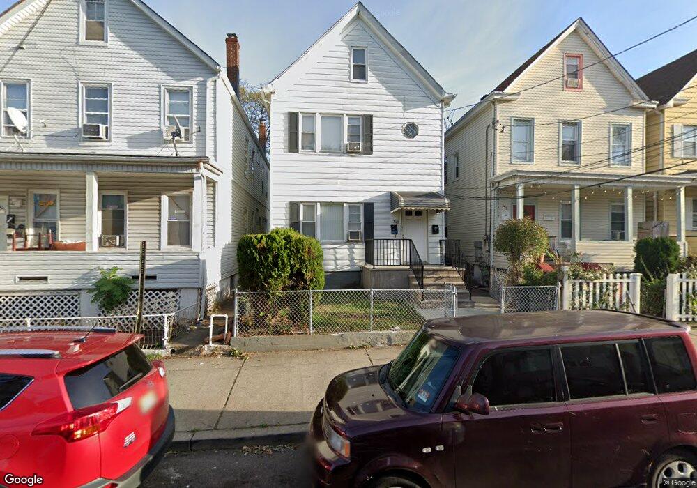
349 Howe Ave Unit 1 Passaic, NJ 07055
Estimated Value: $522,000 - $592,000
2
Beds
1
Bath
1,680
Sq Ft
$329/Sq Ft
Est. Value
About This Home
This home is located at 349 Howe Ave Unit 1, Passaic, NJ 07055 and is currently estimated at $553,109, approximately $329 per square foot. 349 Howe Ave Unit 1 is a home located in Passaic County with nearby schools including Passaic High School # 12, Ybh Of Passaic-Hillel, and Collegiate School.
Ownership History
Date
Name
Owned For
Owner Type
Purchase Details
Closed on
Jan 30, 2004
Sold by
Mcgrath Robert
Bought by
Cesani Alexis
Current Estimated Value
Home Financials for this Owner
Home Financials are based on the most recent Mortgage that was taken out on this home.
Original Mortgage
$248,106
Outstanding Balance
$116,118
Interest Rate
5.8%
Mortgage Type
FHA
Estimated Equity
$436,991
Purchase Details
Closed on
May 14, 2001
Sold by
Pickett Todd
Bought by
Mcgrath Robert
Home Financials for this Owner
Home Financials are based on the most recent Mortgage that was taken out on this home.
Original Mortgage
$125,900
Interest Rate
7.05%
Create a Home Valuation Report for This Property
The Home Valuation Report is an in-depth analysis detailing your home's value as well as a comparison with similar homes in the area
Home Values in the Area
Average Home Value in this Area
Purchase History
| Date | Buyer | Sale Price | Title Company |
|---|---|---|---|
| Cesani Alexis | $252,000 | -- | |
| Mcgrath Robert | $139,900 | -- | |
| Mcgrath Robert | $139,900 | -- |
Source: Public Records
Mortgage History
| Date | Status | Borrower | Loan Amount |
|---|---|---|---|
| Open | Cesani Alexis | $248,106 | |
| Previous Owner | Mcgrath Robert | $125,900 |
Source: Public Records
Tax History Compared to Growth
Tax History
| Year | Tax Paid | Tax Assessment Tax Assessment Total Assessment is a certain percentage of the fair market value that is determined by local assessors to be the total taxable value of land and additions on the property. | Land | Improvement |
|---|---|---|---|---|
| 2025 | $9,734 | $236,100 | $78,400 | $157,700 |
| 2024 | $9,453 | $236,100 | $78,400 | $157,700 |
| 2022 | $9,170 | $236,100 | $78,400 | $157,700 |
| 2021 | $8,877 | $236,100 | $78,400 | $157,700 |
| 2020 | $8,809 | $236,100 | $78,400 | $157,700 |
| 2019 | $8,681 | $236,100 | $78,400 | $157,700 |
| 2018 | $8,495 | $236,100 | $78,400 | $157,700 |
| 2017 | $8,233 | $236,100 | $78,400 | $157,700 |
| 2016 | $7,952 | $236,100 | $78,400 | $157,700 |
| 2015 | $7,937 | $104,800 | $48,500 | $56,300 |
| 2014 | $7,791 | $104,800 | $48,500 | $56,300 |
Source: Public Records
Map
Nearby Homes
- 445 Van Houten Ave Unit 101
- 435 Van Houten Ave Unit 307
- 435 Van Houten Ave
- 385 Broadway
- 412 Broadway Unit 25A
- 2 Terry St
- 72 Richard St Unit 3
- 72 Richard St
- 473 Broadway
- 339 Broadway
- 323 Van Houten Ave
- 9 Century Place
- 233 Howe Ave
- 15 Albion St
- 2 Forest Ct
- 285 Aycrigg Ave Unit 22D
- 285 Aycrigg Ave Unit 20C
- 285 Aycrigg Ave Unit 19G
- 285 Aycrigg Ave Unit 22
- 285 Aycrigg Ave Unit 19H