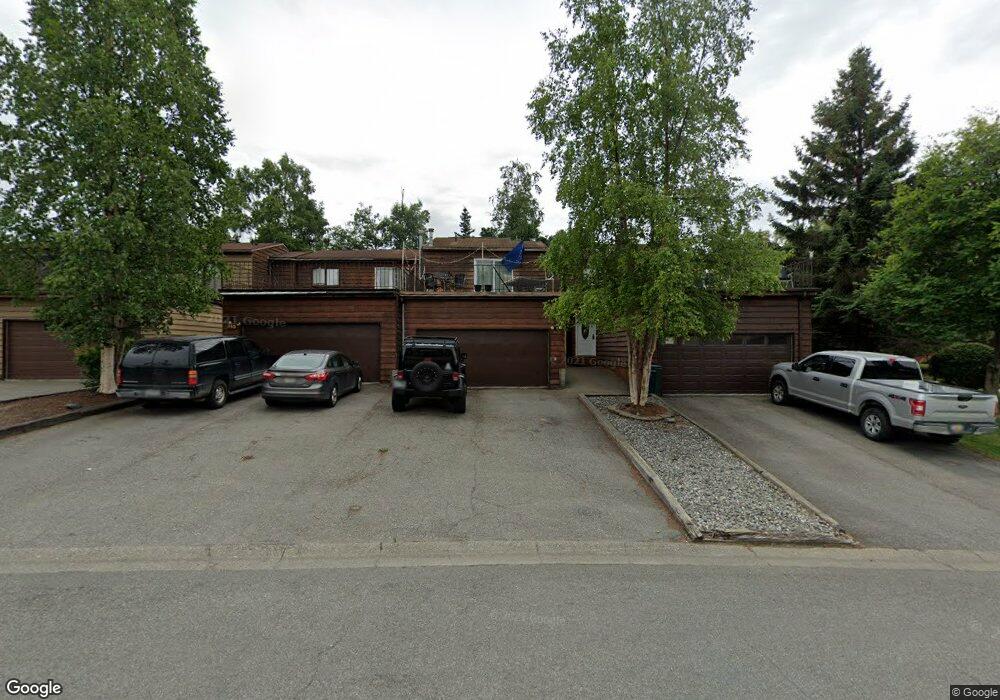
349 Krane Dr Unit 1 Anchorage, AK 99504
Northeast Anchorage NeighborhoodEstimated Value: $135,000 - $329,819
3
Beds
2
Baths
1,500
Sq Ft
$158/Sq Ft
Est. Value
About This Home
This home is located at 349 Krane Dr Unit 1, Anchorage, AK 99504 and is currently estimated at $236,955, approximately $157 per square foot. 349 Krane Dr Unit 1 is a home located in Anchorage Municipality with nearby schools including Ptarmigan Elementary School, Clark Middle School, and Bartlett High School.
Ownership History
Date
Name
Owned For
Owner Type
Purchase Details
Closed on
Aug 27, 2010
Sold by
Gentry Reuben C and Gentry Elizabeth A
Bought by
Sliker Mark Patrick
Current Estimated Value
Home Financials for this Owner
Home Financials are based on the most recent Mortgage that was taken out on this home.
Original Mortgage
$225,189
Outstanding Balance
$149,302
Interest Rate
4.52%
Mortgage Type
VA
Estimated Equity
$87,653
Create a Home Valuation Report for This Property
The Home Valuation Report is an in-depth analysis detailing your home's value as well as a comparison with similar homes in the area
Home Values in the Area
Average Home Value in this Area
Purchase History
| Date | Buyer | Sale Price | Title Company |
|---|---|---|---|
| Sliker Mark Patrick | -- | Stewart |
Source: Public Records
Mortgage History
| Date | Status | Borrower | Loan Amount |
|---|---|---|---|
| Open | Sliker Mark Patrick | $225,189 |
Source: Public Records
Tax History Compared to Growth
Tax History
| Year | Tax Paid | Tax Assessment Tax Assessment Total Assessment is a certain percentage of the fair market value that is determined by local assessors to be the total taxable value of land and additions on the property. | Land | Improvement |
|---|---|---|---|---|
| 2025 | $4,492 | $297,100 | $73,100 | $224,000 |
| 2024 | $4,492 | $278,200 | $73,100 | $205,100 |
| 2023 | $4,395 | $258,100 | $73,100 | $185,000 |
| 2022 | $4,037 | $239,700 | $73,100 | $166,600 |
| 2021 | $4,035 | $223,900 | $73,100 | $150,800 |
| 2020 | $4,048 | $238,100 | $73,100 | $165,000 |
| 2019 | $3,702 | $226,300 | $73,100 | $153,200 |
| 2018 | $4,116 | $251,000 | $75,100 | $175,900 |
| 2017 | $3,873 | $247,300 | $71,300 | $176,000 |
| 2016 | $3,639 | $242,300 | $71,300 | $171,000 |
| 2015 | $3,639 | $241,400 | $65,100 | $176,300 |
| 2014 | $3,639 | $234,500 | $65,100 | $169,400 |
Source: Public Records
Map
Nearby Homes
- 355 Donna Dr Unit 7
- 301 Krane Dr Unit 5
- 305 Donna Dr Unit 38
- 6314 Whispering Loop Unit 30A
- 6507 Kara Sue Loop Unit 83
- 165 Rusty Allen Place Unit 64
- 150 Rusty Allen Place Unit 20
- 184 Matthew Paul Way Unit 8
- 141 Matthew Paul Way Unit 50
- 152 Matthew Paul Way Unit 27
- 133 Matthew Paul Way Unit 47
- Snowflower 1698 Plan at Lauren Glenn
- Rose 1816 Plan at Lauren Glenn
- Northpointe 1459 Plan at Lauren Glenn
- Cottonwood X 1704 Plan at Lauren Glenn
- 324 Shageluk St
- 302 Shageluk St
- 300 Shageluk St
- 286 Shageluk St
- 284 Shageluk St