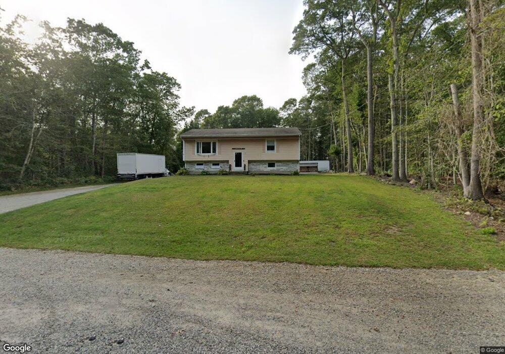
349 Main Rd Westport, MA 02790
Brownell/Giffords Corner NeighborhoodEstimated Value: $422,000 - $545,123
3
Beds
--
Bath
1,144
Sq Ft
$424/Sq Ft
Est. Value
About This Home
This home is located at 349 Main Rd, Westport, MA 02790 and is currently estimated at $485,031, approximately $423 per square foot. 349 Main Rd is a home located in Bristol County with nearby schools including Alice A. Macomber Primary School, Westport Elementary School, and Westport Middle-High School.
Ownership History
Date
Name
Owned For
Owner Type
Purchase Details
Closed on
Oct 5, 2023
Sold by
Leite Lisa M and Cruz Derek
Bought by
Leite Lisa M and Leite Alexa
Current Estimated Value
Purchase Details
Closed on
Mar 3, 2008
Sold by
Fdrl Rt and Cruz
Bought by
Sinclair Madeline
Create a Home Valuation Report for This Property
The Home Valuation Report is an in-depth analysis detailing your home's value as well as a comparison with similar homes in the area
Home Values in the Area
Average Home Value in this Area
Purchase History
| Date | Buyer | Sale Price | Title Company |
|---|---|---|---|
| Leite Lisa M | -- | None Available | |
| Sinclair Madeline | -- | -- |
Source: Public Records
Mortgage History
| Date | Status | Borrower | Loan Amount |
|---|---|---|---|
| Previous Owner | Sinclair Madeline | $10,000 | |
| Previous Owner | Sinclair Madeline | $82,000 |
Source: Public Records
Tax History Compared to Growth
Tax History
| Year | Tax Paid | Tax Assessment Tax Assessment Total Assessment is a certain percentage of the fair market value that is determined by local assessors to be the total taxable value of land and additions on the property. | Land | Improvement |
|---|---|---|---|---|
| 2025 | $3,569 | $479,000 | $176,600 | $302,400 |
| 2024 | $3,193 | $413,100 | $156,500 | $256,600 |
| 2023 | $2,819 | $345,500 | $135,500 | $210,000 |
| 2022 | $2,552 | $300,900 | $135,500 | $165,400 |
| 2021 | $2,465 | $286,000 | $117,000 | $169,000 |
| 2020 | $2,322 | $275,400 | $106,400 | $169,000 |
| 2019 | $2,198 | $265,800 | $106,400 | $159,400 |
| 2018 | $2,189 | $267,900 | $116,800 | $151,100 |
| 2017 | $2,028 | $254,500 | $113,100 | $141,400 |
| 2016 | $1,747 | $220,800 | $109,400 | $111,400 |
| 2015 | $1,802 | $227,300 | $111,800 | $115,500 |
Source: Public Records
Map
Nearby Homes
- 118 Charlotte White Rd
- 118 Charlotte White Rd Extension
- 0 Hidden Glen Ln
- 8 Strawberry Ln
- Lot 0 Marcotte
- 47 Fallon Dr
- 4 Main Rd
- 978 Sodom Rd
- 15 Village Way
- 7 Village Way
- 8 Village Way
- 6 Angel Ct
- 837 Main Rd
- 101 Adamsville Rd
- 218 American Legion Hwy
- 920 Drift Rd
- 27 Dias Ave
- 73 White Oak Run
- 225 Hixbridge Rd
- 308 Robert St
- 341 Main Rd
- 361 Main Rd
- 363 Main Rd
- 366 Main Rd
- 325 Main Rd
- 21 Charlotte White Rd
- 12 Charlotte White Rd
- 323 Main Rd
- 380 Main Rd
- 22 Charlotte White Rd
- 383 Main Rd
- 319 Main Rd
- 20 Charlotte White Rd
- 36 Charlotte White Rd
- 7 Charlotte White Road Extension
- 7 Charlotte White Rd Unit EXT
- 7 Charlotte White Rd
- 38 Charlotte White Rd
- 44 Charlotte White Rd
- 315 Main Rd