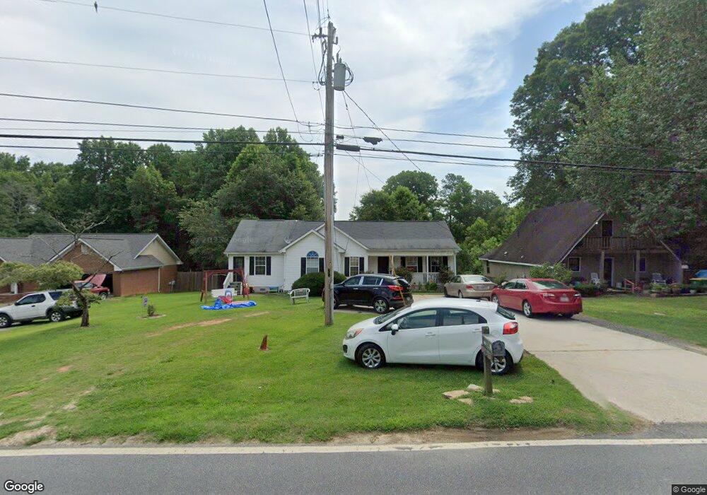
349 Miles Patrick Rd Winder, GA 30680
Estimated Value: $219,000 - $297,000
3
Beds
2
Baths
1,164
Sq Ft
$227/Sq Ft
Est. Value
About This Home
This home is located at 349 Miles Patrick Rd, Winder, GA 30680 and is currently estimated at $263,793, approximately $226 per square foot. 349 Miles Patrick Rd is a home located in Barrow County with nearby schools including County Line Elementary School, Russell Middle School, and Winder-Barrow High School.
Ownership History
Date
Name
Owned For
Owner Type
Purchase Details
Closed on
Sep 12, 2011
Sold by
Secretary Of Housing And U
Bought by
Fuentes Salvador and Fuentes Rigoberta
Current Estimated Value
Purchase Details
Closed on
Jun 7, 2011
Sold by
Everbank
Bought by
Hud-Housing Of Urban Dev
Purchase Details
Closed on
May 5, 2000
Sold by
Tripp Reynolds Construction
Bought by
Wilson Gregory J
Home Financials for this Owner
Home Financials are based on the most recent Mortgage that was taken out on this home.
Original Mortgage
$85,150
Interest Rate
8.23%
Mortgage Type
New Conventional
Create a Home Valuation Report for This Property
The Home Valuation Report is an in-depth analysis detailing your home's value as well as a comparison with similar homes in the area
Home Values in the Area
Average Home Value in this Area
Purchase History
| Date | Buyer | Sale Price | Title Company |
|---|---|---|---|
| Fuentes Salvador | $45,000 | -- | |
| Hud-Housing Of Urban Dev | -- | -- | |
| Everbank | $145,558 | -- | |
| Wilson Gregory J | $85,900 | -- |
Source: Public Records
Mortgage History
| Date | Status | Borrower | Loan Amount |
|---|---|---|---|
| Previous Owner | Wilson Gregory J | $85,150 |
Source: Public Records
Tax History
| Year | Tax Paid | Tax Assessment Tax Assessment Total Assessment is a certain percentage of the fair market value that is determined by local assessors to be the total taxable value of land and additions on the property. | Land | Improvement |
|---|---|---|---|---|
| 2025 | $2,242 | $80,172 | $20,000 | $60,172 |
| 2024 | $2,231 | $78,364 | $20,000 | $58,364 |
| 2023 | $2,224 | $78,364 | $20,000 | $58,364 |
| 2022 | $1,954 | $56,223 | $18,000 | $38,223 |
| 2021 | $1,684 | $45,058 | $14,400 | $30,658 |
| 2020 | $1,530 | $42,537 | $14,400 | $28,137 |
| 2019 | $1,321 | $35,615 | $10,000 | $25,615 |
| 2018 | $1,318 | $35,615 | $10,000 | $25,615 |
| 2017 | $885 | $29,646 | $8,400 | $21,246 |
| 2016 | $1,038 | $29,889 | $8,400 | $21,489 |
| 2015 | $1,047 | $30,131 | $8,400 | $21,731 |
| 2014 | $910 | $25,847 | $4,116 | $21,731 |
| 2013 | -- | $24,804 | $4,116 | $20,688 |
Source: Public Records
Map
Nearby Homes
- 326 Miles Patrick Rd
- 154 Williamsburg Way
- 197 Buena Vista St
- 223 Lacey Ln
- 303 Rocky Point Ct
- 222 Ryan Rd
- 421 N 5th Ave
- 27 Creekside Dr
- 136 Alexander Ct
- 236 6th Ave
- 0 E Northcrest Dr Unit 10648147
- 284 E 5th Ave
- 436 Northcrest Dr
- 326 Fayette Dr
- 469 Plantation Dr
- 206 E 5th Ave
- 352 3rd Ave
- 2050 Whispering Way
- 273 Partridge Trail
- 171 Brookview Terrace
- 345 Miles Patrick Rd
- 351 Miles Patrick Rd
- 341 Miles Patrick Rd
- 355 Miles Patrick Rd
- 337 Miles Patrick Rd Unit 4
- 337 Miles Patrick Rd
- 352 Miles Patrick Rd
- 340 Miles Patrick Rd
- 333 Miles Patrick Rd
- 129 Sims Rd
- 125 Sims Rd
- 133 Sims Rd
- 334 Miles Patrick Rd
- 363 Miles Patrick Rd
- 321 Harrison Ln Unit 15
- 321 Harrison Ln
- 319 Harrison Ln
- 362 Miles Patrick Rd
- 137 Sims Rd
- 179 Sims Rd
Your Personal Tour Guide
Ask me questions while you tour the home.