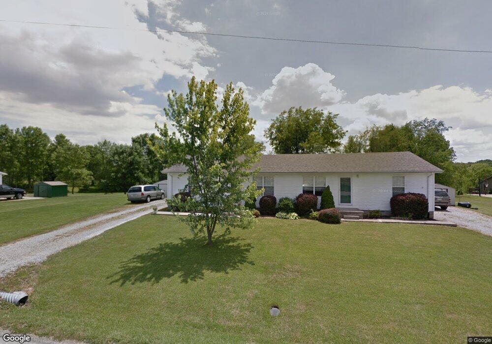
349 Pratt Rd Blanchester, OH 45107
Estimated Value: $184,000 - $328,000
4
Beds
2
Baths
1,890
Sq Ft
$144/Sq Ft
Est. Value
About This Home
This home is located at 349 Pratt Rd, Blanchester, OH 45107 and is currently estimated at $272,784, approximately $144 per square foot. 349 Pratt Rd is a home located in Clinton County with nearby schools including East End Elementary School, Denver Place Elementary School, and Roy E. Holmes Elementary School.
Ownership History
Date
Name
Owned For
Owner Type
Purchase Details
Closed on
Nov 29, 2005
Sold by
York Nancy Mae
Bought by
Timko Jacqueline
Current Estimated Value
Home Financials for this Owner
Home Financials are based on the most recent Mortgage that was taken out on this home.
Original Mortgage
$94,500
Interest Rate
6.13%
Mortgage Type
Fannie Mae Freddie Mac
Purchase Details
Closed on
Nov 10, 2005
Sold by
York Nancy Mae
Bought by
Timko Jacqueline
Home Financials for this Owner
Home Financials are based on the most recent Mortgage that was taken out on this home.
Original Mortgage
$94,500
Interest Rate
6.13%
Mortgage Type
Fannie Mae Freddie Mac
Create a Home Valuation Report for This Property
The Home Valuation Report is an in-depth analysis detailing your home's value as well as a comparison with similar homes in the area
Purchase History
| Date | Buyer | Sale Price | Title Company |
|---|---|---|---|
| Timko Jacqueline | $126,000 | -- | |
| Timko Jacqueline | $126,000 | Landmark Title Agency Inc |
Source: Public Records
Mortgage History
| Date | Status | Borrower | Loan Amount |
|---|---|---|---|
| Previous Owner | Timko Jacqueline | $94,500 |
Source: Public Records
Tax History
| Year | Tax Paid | Tax Assessment Tax Assessment Total Assessment is a certain percentage of the fair market value that is determined by local assessors to be the total taxable value of land and additions on the property. | Land | Improvement |
|---|---|---|---|---|
| 2024 | $2,147 | $69,130 | $18,240 | $50,890 |
| 2023 | $2,218 | $69,130 | $18,240 | $50,890 |
| 2022 | $1,934 | $57,590 | $8,720 | $48,870 |
| 2021 | $1,958 | $57,590 | $8,720 | $48,870 |
| 2020 | $1,890 | $57,590 | $8,720 | $48,870 |
| 2019 | $1,732 | $48,540 | $9,640 | $38,900 |
| 2018 | $1,749 | $48,540 | $9,640 | $38,900 |
| 2017 | $1,660 | $48,540 | $9,640 | $38,900 |
| 2016 | $1,396 | $40,560 | $10,000 | $30,560 |
| 2015 | $1,396 | $40,560 | $10,000 | $30,560 |
| 2013 | $1,336 | $37,790 | $10,000 | $27,790 |
Source: Public Records
Map
Nearby Homes
- 963 Pratt Rd
- 1211 Pratt Rd
- 970 Macedonia Rd
- 597 Haynes Rd
- 2457 Martinsville Rd
- 147 Broadway St S
- 1295 Hales Branch Rd
- 1224 Doak Rd
- 13 S High St
- 1264 Ireland Rd
- 89 E Main St
- 1 Dudley Rd
- 1957 Ohio 730
- 35 Jonesboro Rd
- 807 Linkhart Rd
- 74 Nicely Rd
- 2746 State Route 730
- 2746 Ohio 730
- ac Cuba Rd
- 955 Windsor Ave