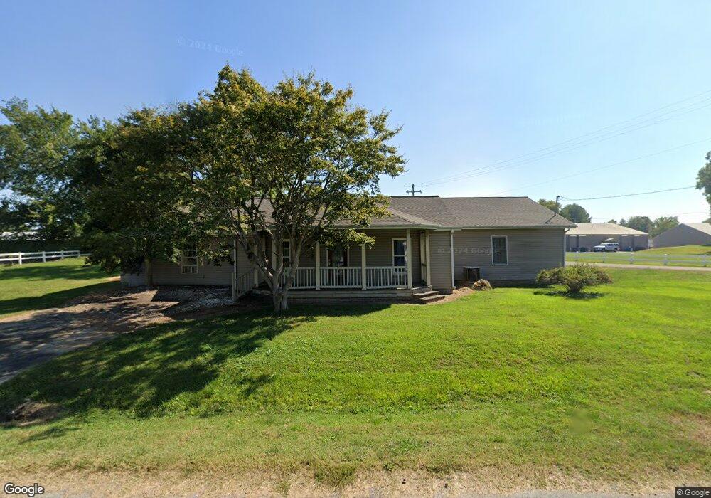
349 W 1st St La Center, KY 42056
Estimated Value: $128,844 - $196,000
2
Beds
2
Baths
1,352
Sq Ft
$113/Sq Ft
Est. Value
About This Home
This home is located at 349 W 1st St, La Center, KY 42056 and is currently estimated at $152,961, approximately $113 per square foot. 349 W 1st St is a home with nearby schools including Ballard County Elementary School, Ballard County Middle School, and Ballard Memorial High School.
Ownership History
Date
Name
Owned For
Owner Type
Purchase Details
Closed on
Aug 11, 2025
Sold by
273 Olive Street Trust and Heartland Enterprises Llc
Bought by
City Of La Center Kentucky
Current Estimated Value
Purchase Details
Closed on
Nov 25, 2015
Sold by
Hicks Mary Helen
Bought by
Morrow Robert L and Morrow Caryn J
Home Financials for this Owner
Home Financials are based on the most recent Mortgage that was taken out on this home.
Original Mortgage
$81,150
Interest Rate
3.83%
Mortgage Type
Future Advance Clause Open End Mortgage
Create a Home Valuation Report for This Property
The Home Valuation Report is an in-depth analysis detailing your home's value as well as a comparison with similar homes in the area
Home Values in the Area
Average Home Value in this Area
Purchase History
| Date | Buyer | Sale Price | Title Company |
|---|---|---|---|
| City Of La Center Kentucky | $9,980 | None Listed On Document | |
| Morrow Robert L | $94,600 | None Available |
Source: Public Records
Mortgage History
| Date | Status | Borrower | Loan Amount |
|---|---|---|---|
| Previous Owner | Morrow Robert L | $81,150 |
Source: Public Records
Tax History Compared to Growth
Tax History
| Year | Tax Paid | Tax Assessment Tax Assessment Total Assessment is a certain percentage of the fair market value that is determined by local assessors to be the total taxable value of land and additions on the property. | Land | Improvement |
|---|---|---|---|---|
| 2025 | $968 | $95,600 | $0 | $0 |
| 2024 | $972 | $95,600 | $0 | $0 |
| 2023 | $973 | $94,600 | $0 | $0 |
| 2022 | $980 | $94,600 | $0 | $0 |
| 2021 | $988 | $94,600 | $0 | $0 |
| 2020 | $983 | $94,600 | $0 | $0 |
| 2019 | $992 | $94,600 | $0 | $0 |
| 2018 | $986 | $94,600 | $0 | $0 |
| 2017 | $992 | $108,600 | $14,000 | $94,600 |
| 2015 | -- | $93,000 | $13,000 | $80,000 |
| 2013 | $344 | $75,000 | $13,000 | $62,000 |
Source: Public Records
Map
Nearby Homes
- 17 Kenwood Dr
- 523 W Third St
- 103 E Kentucky Dr
- 0 Hickory St Unit 120847
- 5127 La Center Rd
- 359 Lap Rollings Rd
- 720 Jim Ireland Rd
- 0 Unit 132618
- 4496 Bandana Rd
- 000 Holloway Landing Rd
- 4844 Bandana Rd
- 1342 Richard Burnley Ave
- 1223 Clyde M Elrod Ave Unit 953 N 1st St.
- 0 Liberty Dr Lot 6a
- 173 New Liberty Church Rd
- 4933 Slater Rd
- 82 Ingleside Rd
- 739 New Liberty Church Rd
- 942 Crews Rd
- 0 County Line Rd