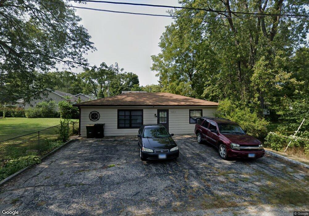
34910 N James Ave Ingleside, IL 60041
Estimated Value: $210,000 - $274,000
2
Beds
2
Baths
1,000
Sq Ft
$237/Sq Ft
Est. Value
About This Home
This home is located at 34910 N James Ave, Ingleside, IL 60041 and is currently estimated at $236,639, approximately $236 per square foot. 34910 N James Ave is a home located in Lake County with nearby schools including Gavin Central Elementary School, Gavin South Middle School, and Grant Community High School.
Ownership History
Date
Name
Owned For
Owner Type
Purchase Details
Closed on
Aug 28, 1998
Sold by
Grand Premier Trust & Investment Inc Na
Bought by
Wood Joanne A
Current Estimated Value
Home Financials for this Owner
Home Financials are based on the most recent Mortgage that was taken out on this home.
Original Mortgage
$93,354
Outstanding Balance
$20,219
Interest Rate
7.06%
Mortgage Type
FHA
Estimated Equity
$216,420
Purchase Details
Closed on
Apr 3, 1995
Sold by
Cederquist Margaret
Bought by
Grand National Bank and Wauconda National Bank & Trust Co
Create a Home Valuation Report for This Property
The Home Valuation Report is an in-depth analysis detailing your home's value as well as a comparison with similar homes in the area
Home Values in the Area
Average Home Value in this Area
Purchase History
| Date | Buyer | Sale Price | Title Company |
|---|---|---|---|
| Wood Joanne A | $94,000 | Plm Title Company | |
| Grand National Bank | -- | -- |
Source: Public Records
Mortgage History
| Date | Status | Borrower | Loan Amount |
|---|---|---|---|
| Open | Wood Joanne A | $93,354 |
Source: Public Records
Tax History Compared to Growth
Tax History
| Year | Tax Paid | Tax Assessment Tax Assessment Total Assessment is a certain percentage of the fair market value that is determined by local assessors to be the total taxable value of land and additions on the property. | Land | Improvement |
|---|---|---|---|---|
| 2024 | $2,543 | $56,499 | $11,581 | $44,918 |
| 2023 | $3,555 | $48,759 | $10,909 | $37,850 |
| 2022 | $3,555 | $50,767 | $8,924 | $41,843 |
| 2021 | $3,421 | $47,853 | $8,412 | $39,441 |
| 2020 | $3,514 | $47,169 | $8,292 | $38,877 |
| 2019 | $3,388 | $45,233 | $7,952 | $37,281 |
| 2018 | $2,569 | $35,866 | $7,218 | $28,648 |
| 2017 | $2,499 | $33,151 | $6,672 | $26,479 |
| 2016 | $2,585 | $30,319 | $6,102 | $24,217 |
| 2015 | $2,661 | $28,293 | $5,694 | $22,599 |
| 2014 | $3,498 | $25,429 | $8,569 | $16,860 |
| 2012 | $3,198 | $37,667 | $8,935 | $28,732 |
Source: Public Records
Map
Nearby Homes
- 34880 N Rock Island St
- 34906 N Augustana Ave
- 34763 Peterson Ave
- 1584 W Crystal Rock Ct Unit 2B
- 1221 N Village Dr
- 1376 W Split Oak Cir
- 25644 W Brooks Farm Rd
- 1688 W Turtle Creek Ln
- 1316 N Red Oak Cir Unit 2
- 25018 W Lake Shore Dr
- 1475 W Sedgewood Ct
- 24576 W Norelius Ave
- 1506 W Turtle Creek Ln
- 1248 N Red Oak Cir Unit 2
- 1561 W Turtle Creek Ln
- 924 N Village Dr Unit 2
- 347 N Red Oak Cir Unit 406
- 35611 N Grove Ave
- 24967 W Clinton Ave
- 1163 N Red Oak Cir Unit 4
- 34913 N Decorah Ave
- 34919 N Decorah Ave
- 34925 N Decorah Ave
- 34895 N James Ave
- 25300 W Anderson St
- 34939 N Decorah Ave
- 34925 N James Ave
- 25275 W Stoughton St
- 34858 N James Ave
- 34880 N Decorah Ave
- 34928 N Decorah Ave
- 25276 W Anderson St
- 34917 N Rock Island St
- 34871 N Decorah Ave
- 34855 N James Ave
- 34925 N Rock Island St
- 25297 W Chicago Ave
- 25307 W Anderson St
- 25321 W Chicago Ave
- 25261 W Stoughton St