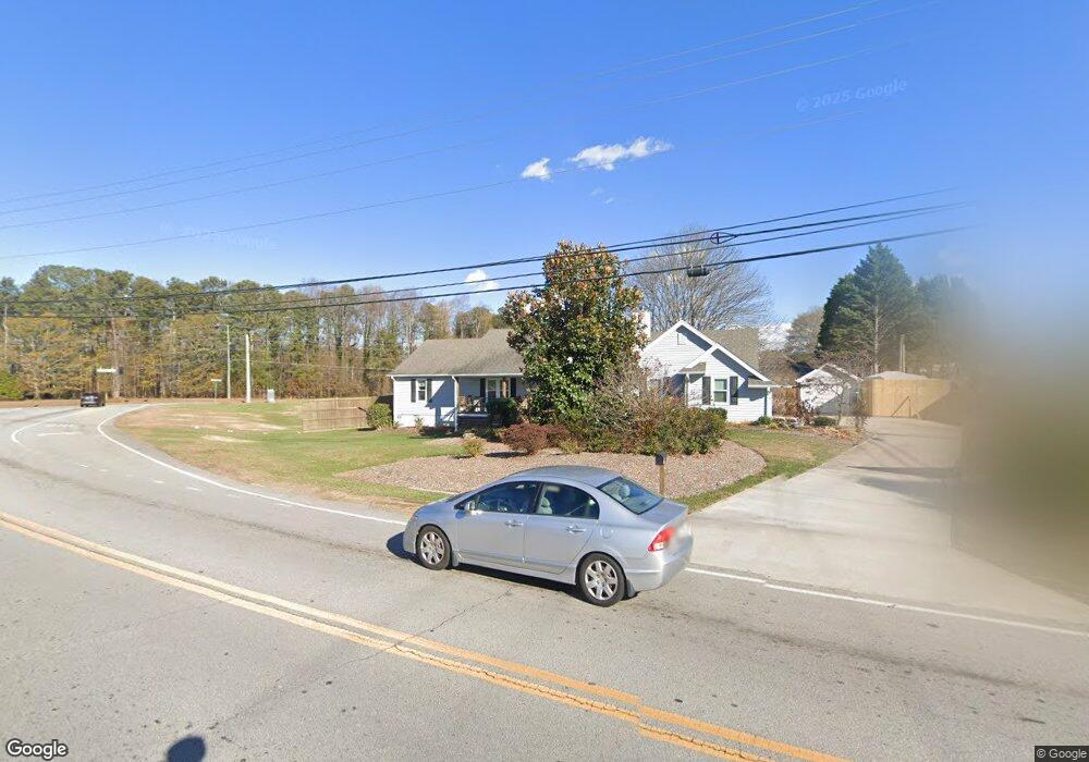
3497 Camp Branch Rd Buford, GA 30519
Estimated Value: $364,000 - $472,000
3
Beds
2
Baths
1,788
Sq Ft
$233/Sq Ft
Est. Value
About This Home
This home is located at 3497 Camp Branch Rd, Buford, GA 30519 and is currently estimated at $416,745, approximately $233 per square foot. 3497 Camp Branch Rd is a home located in Gwinnett County with nearby schools including Patrick Elementary School and Glenn C. Jones Middle School.
Ownership History
Date
Name
Owned For
Owner Type
Purchase Details
Closed on
May 17, 2016
Sold by
Katie
Bought by
Potts Katie and Potts Ryan
Current Estimated Value
Home Financials for this Owner
Home Financials are based on the most recent Mortgage that was taken out on this home.
Original Mortgage
$148,265
Outstanding Balance
$118,830
Interest Rate
3.87%
Mortgage Type
FHA
Estimated Equity
$297,915
Create a Home Valuation Report for This Property
The Home Valuation Report is an in-depth analysis detailing your home's value as well as a comparison with similar homes in the area
Home Values in the Area
Average Home Value in this Area
Purchase History
| Date | Buyer | Sale Price | Title Company |
|---|---|---|---|
| Potts Katie | $151,000 | -- | |
| Potts Katie | $151,000 | -- |
Source: Public Records
Mortgage History
| Date | Status | Borrower | Loan Amount |
|---|---|---|---|
| Open | Potts Katie | $148,265 | |
| Closed | Potts Katie | $148,265 |
Source: Public Records
Tax History Compared to Growth
Tax History
| Year | Tax Paid | Tax Assessment Tax Assessment Total Assessment is a certain percentage of the fair market value that is determined by local assessors to be the total taxable value of land and additions on the property. | Land | Improvement |
|---|---|---|---|---|
| 2024 | $3,159 | $107,160 | $24,000 | $83,160 |
| 2023 | $3,159 | $107,160 | $24,000 | $83,160 |
| 2022 | $2,434 | $73,960 | $14,000 | $59,960 |
| 2021 | $2,468 | $73,960 | $14,000 | $59,960 |
| 2020 | $2,483 | $73,960 | $14,000 | $59,960 |
| 2019 | $1,945 | $51,840 | $10,000 | $41,840 |
| 2018 | $1,941 | $51,840 | $10,000 | $41,840 |
| 2016 | $819 | $51,840 | $10,000 | $41,840 |
| 2015 | $836 | $51,840 | $10,000 | $41,840 |
| 2014 | -- | $48,040 | $8,000 | $40,040 |
Source: Public Records
Map
Nearby Homes
- 2716 Hamilton Mill Rd
- 3525 Hamilton Mill Rd
- 2789 Kilgore Rd
- 3488 Hamilton Mill Rd
- 2718 Kilgore Rd
- 2710 Kilgore Rd
- 3060 Hamilton Mill Rd
- 3379 Camp Branch Rd
- 3470 Hamilton Mill Rd
- 3671 Hamilton Mill Rd
- 2982 Hollow Mill Ln
- 2859 Preserve Walk Ct NE
- 3596 Bendleton Dr
- 3600 Bogan Mill Rd
- 3848 Heirloom Loop Ct
- 3765 Woodlawn Ct
- 2753 Blue Moon Dr Unit 4
- 2859 Presertve at Hamilton Mill
- 2551 Kilgore Rd
- 3487 Camp Branch Rd
- 3516 Hamilton Mill Rd
- 3510 Hamilton Mill Rd
- 2829 Kilgore Rd
- 3483 Camp Branch Rd
- 3481 Camp Branch Rd
- 3481 Camp Branch Rd Unit 3
- 3481 Camp Branch Rd Unit 2
- 3481 Camp Branch Rd Unit 1
- 3500 Hamilton Mill Rd
- 2819 Kilgore Rd
- 3528 Hamilton Mill Rd
- 3528 Camp Branch Rd
- 3506 Hamilton Mill Rd
- 2798 Kilgore Rd
- 2809 Kilgore Rd
- 3485 Camp Branch Rd
- 3469 Camp Branch Rd
- 2799 Kilgore Rd
- 3545 Hamilton Mill Rd