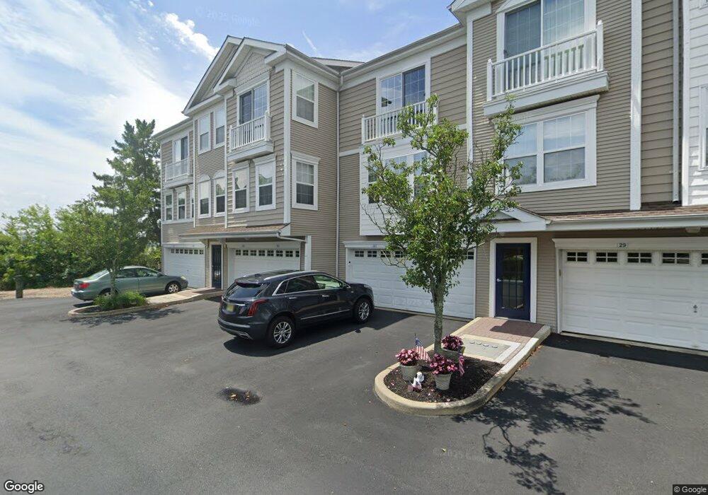
35 Bayside Dr Unit A1 Somers Point, NJ 08244
Estimated Value: $517,533 - $559,000
2
Beds
2
Baths
1,269
Sq Ft
$420/Sq Ft
Est. Value
About This Home
This home is located at 35 Bayside Dr Unit A1, Somers Point, NJ 08244 and is currently estimated at $533,383, approximately $420 per square foot. 35 Bayside Dr Unit A1 is a home located in Atlantic County with nearby schools including Mainland Regional High School, ChARTer TECH High School for the Performing Arts, and Saint Joseph Regional School.
Ownership History
Date
Name
Owned For
Owner Type
Purchase Details
Closed on
Jul 12, 2019
Sold by
Rock Spatola Bernice M
Bought by
James V Spatola Iii Revocable Trust and Bernice M Rock Spatola Revocable Trust
Current Estimated Value
Purchase Details
Closed on
Apr 12, 2019
Sold by
Marks Harold G and Marks Nedra V
Bought by
Rock Spatola Bernice M
Purchase Details
Closed on
Jan 13, 2010
Sold by
Marks Harold G and Marks Nedra V
Bought by
Marks Harold G and Marks Nedra
Purchase Details
Closed on
Jul 28, 2003
Sold by
K Hovnanian At Somers Point In
Bought by
Marks Harold and Marks Nedra
Home Financials for this Owner
Home Financials are based on the most recent Mortgage that was taken out on this home.
Original Mortgage
$250,000
Interest Rate
5.46%
Create a Home Valuation Report for This Property
The Home Valuation Report is an in-depth analysis detailing your home's value as well as a comparison with similar homes in the area
Home Values in the Area
Average Home Value in this Area
Purchase History
| Date | Buyer | Sale Price | Title Company |
|---|---|---|---|
| James V Spatola Iii Revocable Trust | -- | None Available | |
| Rock Spatola Bernice M | $230,000 | None Available | |
| Marks Harold G | -- | None Available | |
| Marks Harold | $333,256 | -- |
Source: Public Records
Mortgage History
| Date | Status | Borrower | Loan Amount |
|---|---|---|---|
| Previous Owner | Marks Harold | $250,000 |
Source: Public Records
Tax History Compared to Growth
Tax History
| Year | Tax Paid | Tax Assessment Tax Assessment Total Assessment is a certain percentage of the fair market value that is determined by local assessors to be the total taxable value of land and additions on the property. | Land | Improvement |
|---|---|---|---|---|
| 2025 | $7,535 | $210,700 | $110,000 | $100,700 |
| 2024 | $7,535 | $210,700 | $110,000 | $100,700 |
| 2023 | $7,039 | $210,700 | $110,000 | $100,700 |
| 2022 | $7,039 | $210,700 | $110,000 | $100,700 |
| 2021 | $6,934 | $210,700 | $110,000 | $100,700 |
| 2020 | $6,793 | $210,700 | $110,000 | $100,700 |
| 2019 | $6,601 | $210,700 | $110,000 | $100,700 |
| 2018 | $6,462 | $210,700 | $110,000 | $100,700 |
| 2017 | $7,206 | $243,700 | $111,000 | $132,700 |
| 2016 | $6,880 | $243,700 | $111,000 | $132,700 |
| 2015 | $6,809 | $243,700 | $111,000 | $132,700 |
| 2014 | $6,958 | $257,700 | $125,000 | $132,700 |
Source: Public Records
Map
Nearby Homes
- 1 Bayside Dr Unit F1
- 78 Windjammer Dr
- 2604 Christina Ln
- 2603 Christina Ln
- 74 Mays Landing Rd
- 7 Shell Lane - Somerset Cove Marina
- Strauss with Rooftop Deck Plan at Greate Bay - The Links at Greate Bay Towns
- Bethany Plan at Greate Bay - The Links at Greate Bay Villas
- 1810 Somers Point Rd Unit 1
- 13 Gulph Mill Rd
- 19 Merion Dr
- 100 Colwick Dr
- 139 Colwick Dr
- 120 Jordan Rd
- 906 New Rd
- 1005 Jesse Dr Unit 1005
- 15 Yale Blvd
- 6 Colgate Rd
- 901 W New York Ave
- 18 Greate Bay Dr
- 28 Bayside Dr Unit E2
- 64 Dockside Dr Unit 64
- 60 Dockside Dr Unit OPEN BAY Views/Swimm
- 64 Dockside Dr Unit Waterfront
- 64 Dockside Dr Unit A2
- 63 Dockside Dr
- 62 Dockside Dr
- 60 Dockside Dr Unit 1003
- 59 Dockside Dr Unit 1003C1
- 58 Dockside Dr
- 57 Dockside Dr Unit D1
- 56 Dockside Dr Unit E2
- 55 Dockside Dr Unit E1
- 54 Dockside Dr Unit F2
- 53 Dockside Dr Unit F1
- 60 Dockside Dr Unit 60
- 60 Dockside Dr Unit Sunset Marina Townho
- 10 Woodlawn Ave
- 8 Woodlawn Ave
- 20 Bayside Dr Unit C2