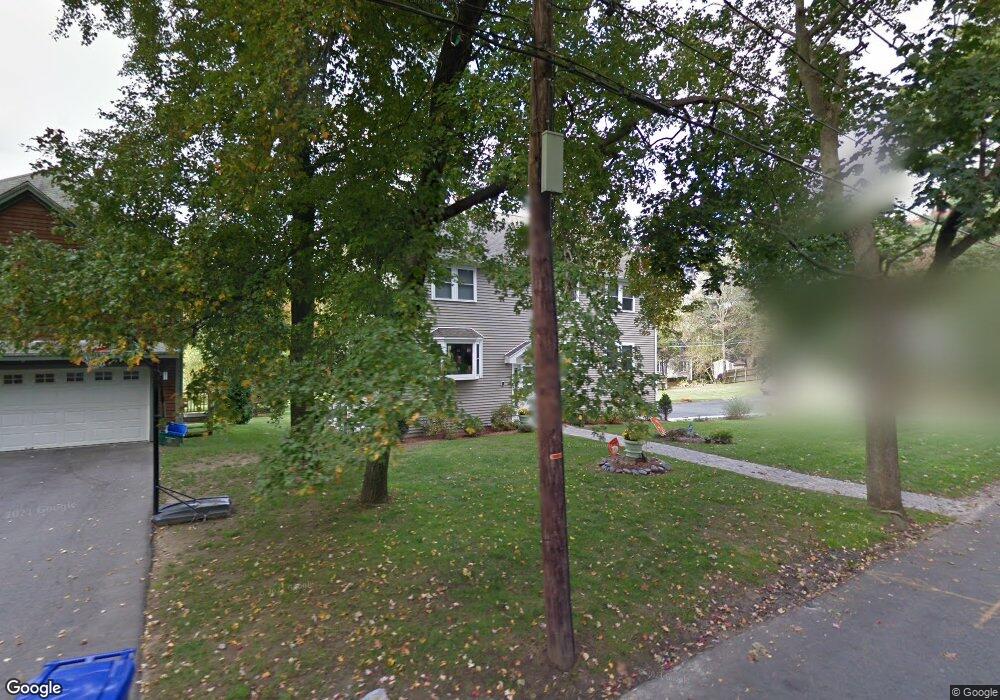
35 Bernard St Newton Highlands, MA 02461
Newton Highlands NeighborhoodEstimated Value: $1,483,694 - $1,855,000
4
Beds
3
Baths
2,376
Sq Ft
$687/Sq Ft
Est. Value
About This Home
This home is located at 35 Bernard St, Newton Highlands, MA 02461 and is currently estimated at $1,632,924, approximately $687 per square foot. 35 Bernard St is a home located in Middlesex County with nearby schools including Countryside Elementary School, Charles E Brown Middle School, and Newton South High School.
Ownership History
Date
Name
Owned For
Owner Type
Purchase Details
Closed on
Sep 14, 2021
Sold by
Penton Pamela J and Penton Duane Mary
Bought by
35 Bernard Street Rt
Current Estimated Value
Purchase Details
Closed on
Mar 31, 2008
Sold by
Penton Pamela J
Bought by
Duane Mary Christine and Penton Pamela J
Home Financials for this Owner
Home Financials are based on the most recent Mortgage that was taken out on this home.
Original Mortgage
$250,000
Interest Rate
5.76%
Mortgage Type
Purchase Money Mortgage
Create a Home Valuation Report for This Property
The Home Valuation Report is an in-depth analysis detailing your home's value as well as a comparison with similar homes in the area
Home Values in the Area
Average Home Value in this Area
Purchase History
| Date | Buyer | Sale Price | Title Company |
|---|---|---|---|
| 35 Bernard Street Rt | -- | None Available | |
| Duane Mary Christine | -- | -- | |
| Penton Pamela J | -- | -- | |
| Penton Charles R | -- | -- |
Source: Public Records
Mortgage History
| Date | Status | Borrower | Loan Amount |
|---|---|---|---|
| Previous Owner | Penton Charles R | $250,000 |
Source: Public Records
Tax History Compared to Growth
Tax History
| Year | Tax Paid | Tax Assessment Tax Assessment Total Assessment is a certain percentage of the fair market value that is determined by local assessors to be the total taxable value of land and additions on the property. | Land | Improvement |
|---|---|---|---|---|
| 2025 | $11,036 | $1,126,100 | $915,500 | $210,600 |
| 2024 | $10,675 | $1,093,800 | $888,800 | $205,000 |
| 2023 | $10,118 | $993,900 | $685,000 | $308,900 |
| 2022 | $9,682 | $920,300 | $634,300 | $286,000 |
| 2021 | $9,342 | $868,200 | $598,400 | $269,800 |
| 2020 | $9,064 | $868,200 | $598,400 | $269,800 |
| 2019 | $8,808 | $842,900 | $581,000 | $261,900 |
| 2018 | $8,212 | $759,000 | $510,800 | $248,200 |
| 2017 | $7,962 | $716,000 | $481,900 | $234,100 |
| 2016 | $7,615 | $669,200 | $450,400 | $218,800 |
| 2015 | $7,261 | $625,400 | $420,900 | $204,500 |
Source: Public Records
Map
Nearby Homes
- 36 Roland St
- 51 Carl St
- 183 Oak St Unit 307
- 183 Oak St Unit 404
- 183 Oak St Unit 205
- 193 Oak St Unit 403
- 1 Williams Ct
- 66 Linden St
- 15 Buff Cir
- 415 Dedham St Unit D
- 27 Indiana Terrace Unit 29
- 18-20 Pennsylvania Ave Unit 18
- 20 Pennsylvania Ave
- 20 Pennsylvania Ave Unit 20
- 396 Dedham St
- 54 Indiana Terrace
- 36 Cannon St
- 207 Nahanton St Unit 207
- 51 Pettee St Unit 11
- 250 Woodcliff Rd
- 41 Bernard St
- 41 Bernard St Unit 41
- Lot A Bernard St
- 25 Bernard St
- 36 Bernard St
- 47 Bernard St
- 15 Banks St
- 44 Bernard St
- 30 Bernard St
- 51 Bernard St
- 48 Bernard St
- 22 Bernard St
- 22 Bernard St Unit o
- 22 Bernard St Unit 1
- 143 Christina St
- 137 Christina St
- 149 Christina St
- 155 Christina St
- 155 Christina St
- 55 Bernard St