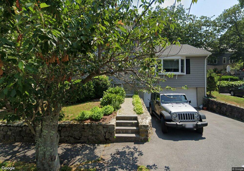
35 Beverly Rd Swampscott, MA 01907
Estimated Value: $1,022,895 - $1,214,000
3
Beds
3
Baths
2,370
Sq Ft
$461/Sq Ft
Est. Value
About This Home
This home is located at 35 Beverly Rd, Swampscott, MA 01907 and is currently estimated at $1,093,724, approximately $461 per square foot. 35 Beverly Rd is a home located in Essex County with nearby schools including Swampscott Middle School, Swampscott High School, and Epstein Hillel School.
Ownership History
Date
Name
Owned For
Owner Type
Purchase Details
Closed on
Aug 19, 2010
Sold by
Roper Coan Geoffrey M and Roper Coan Kristen
Bought by
Siefken Timothy and Siefken Caroline
Current Estimated Value
Purchase Details
Closed on
Apr 12, 2001
Sold by
Subrizi Daniele and Subrizi Linda B
Bought by
Coan Geoffrey M and Roper-Coan Kristen
Purchase Details
Closed on
Feb 28, 1994
Sold by
Mckeough Ellen J
Bought by
Subrizi Linda and Subrizi Aniele
Create a Home Valuation Report for This Property
The Home Valuation Report is an in-depth analysis detailing your home's value as well as a comparison with similar homes in the area
Home Values in the Area
Average Home Value in this Area
Purchase History
| Date | Buyer | Sale Price | Title Company |
|---|---|---|---|
| Siefken Timothy | $464,000 | -- | |
| Siefken Timothy | $464,000 | -- | |
| Coan Geoffrey M | $367,500 | -- | |
| Coan Geoffrey M | $367,500 | -- | |
| Subrizi Linda | $197,000 | -- | |
| Subrizi Linda | $197,000 | -- |
Source: Public Records
Mortgage History
| Date | Status | Borrower | Loan Amount |
|---|---|---|---|
| Open | Subrizi Linda | $448,500 |
Source: Public Records
Tax History
| Year | Tax Paid | Tax Assessment Tax Assessment Total Assessment is a certain percentage of the fair market value that is determined by local assessors to be the total taxable value of land and additions on the property. | Land | Improvement |
|---|---|---|---|---|
| 2025 | $10,003 | $872,100 | $357,400 | $514,700 |
| 2024 | $9,888 | $860,600 | $357,400 | $503,200 |
| 2023 | $9,175 | $781,500 | $322,600 | $458,900 |
| 2022 | $8,708 | $678,700 | $279,000 | $399,700 |
| 2021 | $8,523 | $617,600 | $252,800 | $364,800 |
| 2020 | $8,383 | $586,200 | $226,700 | $359,500 |
| 2019 | $8,644 | $568,700 | $209,200 | $359,500 |
| 2018 | $8,606 | $537,900 | $191,800 | $346,100 |
| 2017 | $8,585 | $492,000 | $167,400 | $324,600 |
| 2016 | $8,485 | $489,600 | $167,400 | $322,200 |
| 2015 | $8,397 | $489,600 | $167,400 | $322,200 |
| 2014 | $8,118 | $434,100 | $156,900 | $277,200 |
Source: Public Records
Map
Nearby Homes
- 35 Alden Rd
- 24 Alden Rd
- 110 Galloupes Point Rd
- 10 Arbutus Rd
- 2 Ocean Ave
- 75 Bay View Dr
- 71 Walnut Rd
- 1 Bond St
- 51 Mountwood Rd
- 50 Mountwood Rd
- 37 Stanley Rd
- 306 Paradise Rd
- 3 Didio Dr
- 48 Bellevue Rd
- 178 Norfolk Ave
- 40 Andrew Rd
- 1002 Paradise Rd Unit PHE
- 28 Claremont Terrace Unit 6
- 445 Essex St Unit 304
- 64 Stetson Ave
Your Personal Tour Guide
Ask me questions while you tour the home.