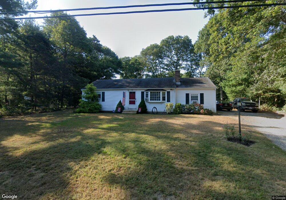
35 Bridgets Path Centerville, MA 02632
Centerville NeighborhoodEstimated Value: $546,000 - $628,000
2
Beds
2
Baths
1,338
Sq Ft
$431/Sq Ft
Est. Value
About This Home
This home is located at 35 Bridgets Path, Centerville, MA 02632 and is currently estimated at $577,205, approximately $431 per square foot. 35 Bridgets Path is a home located in Barnstable County with nearby schools including West Villages Elementary School, Barnstable United Elementary School, and Barnstable Intermediate School.
Ownership History
Date
Name
Owned For
Owner Type
Purchase Details
Closed on
Sep 15, 2020
Sold by
Bridgets Path Irt and Mattson
Bought by
Mattson John J
Current Estimated Value
Home Financials for this Owner
Home Financials are based on the most recent Mortgage that was taken out on this home.
Original Mortgage
$173,500
Outstanding Balance
$152,917
Interest Rate
2.9%
Mortgage Type
New Conventional
Estimated Equity
$424,288
Purchase Details
Closed on
Jul 13, 2012
Sold by
Mattson John J and Sacks Lisa A
Bought by
Bridgets Path Irt and Mattson
Create a Home Valuation Report for This Property
The Home Valuation Report is an in-depth analysis detailing your home's value as well as a comparison with similar homes in the area
Home Values in the Area
Average Home Value in this Area
Purchase History
| Date | Buyer | Sale Price | Title Company |
|---|---|---|---|
| Mattson John J | -- | None Available | |
| Bridgets Path Irt | -- | -- | |
| Bridgets Path Irt | -- | -- |
Source: Public Records
Mortgage History
| Date | Status | Borrower | Loan Amount |
|---|---|---|---|
| Open | Mattson John J | $173,500 |
Source: Public Records
Tax History
| Year | Tax Paid | Tax Assessment Tax Assessment Total Assessment is a certain percentage of the fair market value that is determined by local assessors to be the total taxable value of land and additions on the property. | Land | Improvement |
|---|---|---|---|---|
| 2025 | $3,948 | $488,000 | $151,900 | $336,100 |
| 2024 | $3,753 | $480,500 | $151,900 | $328,600 |
| 2023 | $3,494 | $418,900 | $138,100 | $280,800 |
| 2022 | $3,333 | $345,700 | $102,300 | $243,400 |
| 2021 | $3,144 | $299,700 | $102,300 | $197,400 |
| 2020 | $3,262 | $297,600 | $102,300 | $195,300 |
| 2019 | $3,070 | $272,200 | $102,300 | $169,900 |
| 2018 | $2,789 | $248,600 | $107,700 | $140,900 |
| 2017 | $2,596 | $241,300 | $107,700 | $133,600 |
| 2016 | $2,639 | $242,100 | $108,500 | $133,600 |
| 2015 | $2,510 | $231,300 | $105,100 | $126,200 |
Source: Public Records
Map
Nearby Homes
- 51 Larch Ln
- 200 Lumbert Mill Rd
- 315 Prince Hinckley Rd
- 296 Buckskin Path
- 7 Ebenezer
- 53 Meadow Farm Rd
- 52 Meadow Farm Rd
- 103 Pine Tree Dr
- 87 Foxglove Rd
- 82 Yacht Club Rd
- 900 Old Stage Rd
- 19 Marrick Ct
- 1028 Old Falmouth Rd
- 351 Swift Ave
- 369 Bumps River Rd
- 62 Three Ponds Dr
- 66 Tern Ln
- 40 Sachem Dr
- 156 S Main St
- 12 S Cedar Rd
- 25 Bridgets Path
- 45 Bridgets Path
- 45 Bridget's Path
- 170 Taramac Rd
- 178 Taramac Rd
- 36 Bridgets Path
- 55 Bridgets Path
- 7 Bridgets Path
- 24 Bridgets Path
- 48 Bridgets Path
- 25 Bridget's Path
- 171 Donegal Cir
- 65 Bridgets Path
- 295 Ames Way
- 8 Bridgets Path
- 62 Bridgets Path
- 179 Taramac Rd
- 169 Taramac Rd
- 159 Donegal Cir
- 307 Ames Way
Your Personal Tour Guide
Ask me questions while you tour the home.