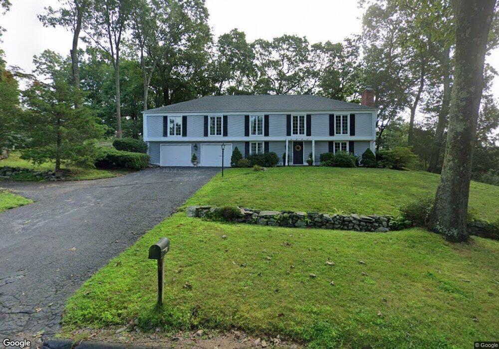
35 Canady Ln Madison, CT 06443
Estimated Value: $700,000 - $765,000
5
Beds
4
Baths
2,015
Sq Ft
$362/Sq Ft
Est. Value
About This Home
This home is located at 35 Canady Ln, Madison, CT 06443 and is currently estimated at $730,222, approximately $362 per square foot. 35 Canady Ln is a home located in New Haven County with nearby schools including Walter C. Polson Upper Middle School, Daniel Hand High School, and Our Lady of Mercy Preparatory Academy.
Ownership History
Date
Name
Owned For
Owner Type
Purchase Details
Closed on
Nov 30, 2020
Sold by
Jasko Paul
Bought by
Jasko Kate and Jasko Paul
Current Estimated Value
Purchase Details
Closed on
Dec 8, 2003
Sold by
Ellenbast Elizabeth
Bought by
Jasko Paul
Home Financials for this Owner
Home Financials are based on the most recent Mortgage that was taken out on this home.
Original Mortgage
$275,000
Interest Rate
6.03%
Create a Home Valuation Report for This Property
The Home Valuation Report is an in-depth analysis detailing your home's value as well as a comparison with similar homes in the area
Home Values in the Area
Average Home Value in this Area
Purchase History
| Date | Buyer | Sale Price | Title Company |
|---|---|---|---|
| Jasko Kate | -- | None Available | |
| Jasko Paul | $350,000 | -- |
Source: Public Records
Mortgage History
| Date | Status | Borrower | Loan Amount |
|---|---|---|---|
| Previous Owner | Jasko Paul | $75,000 | |
| Previous Owner | Jasko Paul | $395,000 | |
| Previous Owner | Jasko Paul | $275,000 |
Source: Public Records
Tax History
| Year | Tax Paid | Tax Assessment Tax Assessment Total Assessment is a certain percentage of the fair market value that is determined by local assessors to be the total taxable value of land and additions on the property. | Land | Improvement |
|---|---|---|---|---|
| 2025 | $8,337 | $371,700 | $135,000 | $236,700 |
| 2024 | $8,177 | $371,700 | $135,000 | $236,700 |
| 2023 | $8,134 | $271,400 | $103,900 | $167,500 |
| 2022 | $7,888 | $268,200 | $103,900 | $164,300 |
| 2021 | $7,738 | $268,200 | $103,900 | $164,300 |
| 2020 | $7,603 | $268,200 | $103,900 | $164,300 |
| 2019 | $5,921 | $268,200 | $103,900 | $164,300 |
| 2018 | $7,091 | $252,900 | $98,800 | $154,100 |
| 2017 | $6,904 | $252,900 | $98,800 | $154,100 |
| 2016 | $6,699 | $252,900 | $98,800 | $154,100 |
| 2015 | $6,515 | $252,900 | $98,800 | $154,100 |
| 2014 | $8,409 | $334,100 | $181,500 | $152,600 |
Source: Public Records
Map
Nearby Homes
- 0 Skytop Dr
- 4 Van Dyke Ln
- 92 Scotland Rd Unit Lot. 3
- 38 Sportsman Hill Rd
- 16 Forest Hills Dr
- 92 Scotland Ave
- 21 Apple Way
- 73 Airline Rd
- 40 Hull Rd
- 42 Wildcat Rd
- 24 Railroad Ave
- 162 Yankee Peddler Path
- 34 Wilshire Rd
- 18 Kelsey Springs Dr
- 1 Wilshire Rd Unit 1D
- 45 Wilshire Rd Unit 45
- 908 Boston Post Rd Unit 908
- 0 Bushnell Ln
- 696 Green Hill Rd
- 461 Green Hill Rd
Your Personal Tour Guide
Ask me questions while you tour the home.