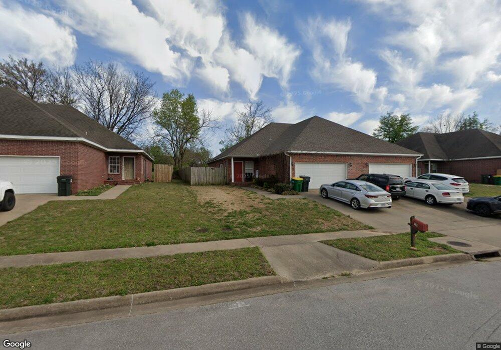
35 Dakota Trail Farmington, AR 72730
Estimated Value: $403,000 - $426,000
--
Bed
4
Baths
3,056
Sq Ft
$135/Sq Ft
Est. Value
About This Home
This home is located at 35 Dakota Trail, Farmington, AR 72730 and is currently estimated at $413,853, approximately $135 per square foot. 35 Dakota Trail is a home located in Washington County with nearby schools including Randall G. Lynch Middle School, Bob Folsom Elementary School, and Farmington Jr. High.
Ownership History
Date
Name
Owned For
Owner Type
Purchase Details
Closed on
Jul 1, 2015
Bought by
Bagepalli Venkata and Bagepalli Vaidehi
Current Estimated Value
Purchase Details
Closed on
May 12, 2004
Sold by
Deweese L John
Bought by
Stevens James L and Stevens Brenda S
Home Financials for this Owner
Home Financials are based on the most recent Mortgage that was taken out on this home.
Original Mortgage
$161,910
Interest Rate
5.53%
Mortgage Type
Purchase Money Mortgage
Purchase Details
Closed on
Aug 26, 2003
Sold by
Commercial Properties Inc
Bought by
Deweese L John
Home Financials for this Owner
Home Financials are based on the most recent Mortgage that was taken out on this home.
Original Mortgage
$125,500
Interest Rate
5.71%
Mortgage Type
Construction
Purchase Details
Closed on
Feb 11, 1993
Bought by
Commercial Properties, Inc
Create a Home Valuation Report for This Property
The Home Valuation Report is an in-depth analysis detailing your home's value as well as a comparison with similar homes in the area
Home Values in the Area
Average Home Value in this Area
Purchase History
| Date | Buyer | Sale Price | Title Company |
|---|---|---|---|
| Bagepalli Venkata | $189,000 | -- | |
| Stevens James L | $180,000 | Heritage Land Title Of Ar | |
| Deweese L John | $35,000 | Landtrust Title & Closing | |
| Commercial Properties, Inc | $453,000 | -- |
Source: Public Records
Mortgage History
| Date | Status | Borrower | Loan Amount |
|---|---|---|---|
| Previous Owner | Stevens James L | $161,910 | |
| Previous Owner | Deweese L John | $125,500 |
Source: Public Records
Tax History Compared to Growth
Tax History
| Year | Tax Paid | Tax Assessment Tax Assessment Total Assessment is a certain percentage of the fair market value that is determined by local assessors to be the total taxable value of land and additions on the property. | Land | Improvement |
|---|---|---|---|---|
| 2025 | $3,236 | $73,510 | $9,000 | $64,510 |
| 2024 | $3,016 | $73,510 | $9,000 | $64,510 |
| 2023 | $2,883 | $73,510 | $9,000 | $64,510 |
| 2022 | $2,621 | $48,900 | $6,000 | $42,900 |
| 2021 | $2,477 | $48,900 | $6,000 | $42,900 |
| 2020 | $2,271 | $48,900 | $6,000 | $42,900 |
| 2019 | $2,072 | $38,300 | $6,000 | $32,300 |
| 2018 | $2,072 | $38,300 | $6,000 | $32,300 |
| 2017 | $2,053 | $38,300 | $6,000 | $32,300 |
| 2016 | $2,053 | $38,300 | $6,000 | $32,300 |
| 2015 | $2,053 | $38,300 | $6,000 | $32,300 |
| 2014 | $2,149 | $40,100 | $6,000 | $34,100 |
Source: Public Records
Map
Nearby Homes
- 93 Old Depot Rd
- 271 Greenfield Ave
- 48 Cedar St
- 201 Countryside Dr
- 216 Idaho Ave
- 142 N Sheep Dog Ave
- 485 W Branta St
- 237 Briarhill Dr
- TBD White St
- 311 S Sundown Dr
- 285 Briarhill Dr
- 9 Bois d Arc St
- 179 Birchfield Ln
- 114 W Main St
- 275 S Nightfall Ave
- Rye 1903 Plan at The Grove at Engles Mill
- Ouachita 1669 Plan at The Grove at Engles Mill
- Cache 1788 Plan at The Grove at Engles Mill
- Degray 1757 Plan at The Grove at Engles Mill
- Stella 1848 Plan at The Grove at Engles Mill
- 35 & 37 W Dakota Trail
- 39 Dakota Trail
- 31 & 33 Dakota Trail
- 31 Dakota Trail
- 43 Dakota Trail
- 325 S Hunter St
- 27 Dakota Trail
- 44 Dakota Trail
- 51 Sweetwater St
- 48 Dakota Trail
- 47 Dakota Trail
- 24 Dakota Trail
- 42 Sweetwater Way
- 52 Dakota Trail
- 19 Dakota Trail
- 48 W Sweetwater Way
- 48 - 50 W Sweetwater Way
- 48/50 W Sweetwater Way
- 48/50 W Sweetwater Way Unit 48 / 50
- 48 / 50 W Sweetwater Way