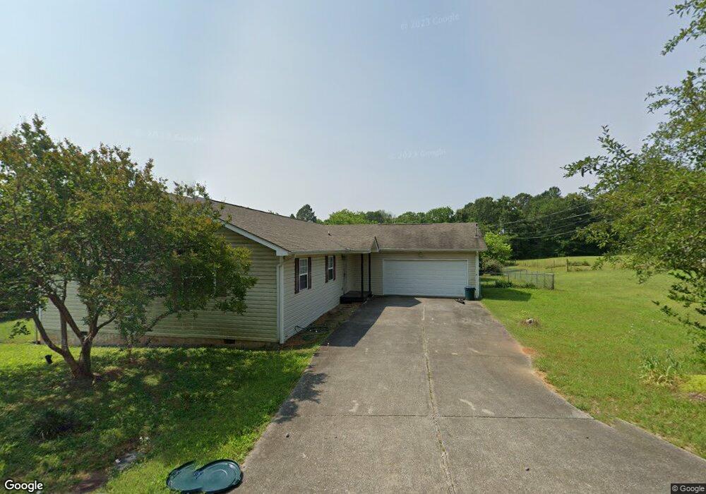
35 Davis Rd Chickamauga, GA 30707
Estimated Value: $248,000 - $302,000
3
Beds
2
Baths
1,800
Sq Ft
$150/Sq Ft
Est. Value
About This Home
This home is located at 35 Davis Rd, Chickamauga, GA 30707 and is currently estimated at $270,585, approximately $150 per square foot. 35 Davis Rd is a home located in Walker County with nearby schools including Cherokee Ridge Elementary School, Rossville Middle School, and Ridgeland High School.
Ownership History
Date
Name
Owned For
Owner Type
Purchase Details
Closed on
Oct 29, 2003
Sold by
Green Carol L
Bought by
Derry James M
Current Estimated Value
Purchase Details
Closed on
Aug 31, 1999
Sold by
Green Hugh S and Green Carol
Bought by
Green Carol L
Purchase Details
Closed on
Jun 21, 1999
Sold by
Temo Enterprises Of Tem Lp
Bought by
Green Hugh S and Green Carol
Purchase Details
Closed on
Sep 18, 1998
Sold by
Hall William A
Bought by
Temo Enterprises Of Tem Lp
Purchase Details
Closed on
Nov 14, 1997
Sold by
Baker Rental & Leasing Inc
Bought by
Hall William A
Purchase Details
Closed on
Sep 12, 1997
Bought by
Baker Rental & Leasing Inc
Create a Home Valuation Report for This Property
The Home Valuation Report is an in-depth analysis detailing your home's value as well as a comparison with similar homes in the area
Purchase History
| Date | Buyer | Sale Price | Title Company |
|---|---|---|---|
| Derry James M | $102,500 | -- | |
| Green Carol L | -- | -- | |
| Green Hugh S | $91,000 | -- | |
| Temo Enterprises Of Tem Lp | $94,800 | -- | |
| Hall William A | -- | -- | |
| Baker Rental & Leasing Inc | -- | -- |
Source: Public Records
Tax History
| Year | Tax Paid | Tax Assessment Tax Assessment Total Assessment is a certain percentage of the fair market value that is determined by local assessors to be the total taxable value of land and additions on the property. | Land | Improvement |
|---|---|---|---|---|
| 2025 | $1,839 | $86,782 | $10,182 | $76,600 |
| 2024 | $1,899 | $83,084 | $10,427 | $72,657 |
| 2023 | $1,831 | $78,210 | $9,310 | $68,900 |
| 2022 | $1,613 | $63,671 | $4,227 | $59,444 |
| 2021 | $1,464 | $51,936 | $4,227 | $47,709 |
| 2020 | $1,250 | $42,075 | $4,227 | $37,848 |
| 2019 | $1,271 | $42,075 | $4,227 | $37,848 |
| 2018 | $1,113 | $42,075 | $4,227 | $37,848 |
| 2017 | $1,387 | $42,075 | $4,227 | $37,848 |
| 2016 | $1,111 | $42,075 | $4,227 | $37,848 |
| 2015 | $1,213 | $43,590 | $3,120 | $40,470 |
| 2014 | $1,114 | $43,590 | $3,120 | $40,470 |
| 2013 | -- | $43,589 | $3,119 | $40,470 |
Source: Public Records
Map
Nearby Homes
- 550 Osborn Rd
- 115 Wilder St
- 55 Rutledge St
- 140 Arlington Dr
- 146 Arlington Dr
- 84 Arlington Dr
- 94 Arlington Dr
- 100 Arlington Dr
- 108 Arlington Dr
- 116 Arlington Dr
- 124 Arlington Dr
- 130 Arlington Dr
- 117 S Forest Rd
- 134 Heritage Dr
- 191 Haleys Cove Dr
- 5.28 ACRES Johnson Rd
- 30 Boseman Ln
- 115 Wilder Rd
- 633 E Garden Farm Rd
- 1208 Johnson Rd
Your Personal Tour Guide
Ask me questions while you tour the home.