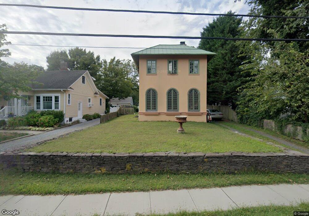
35 E River Rd Rumson, NJ 07760
Estimated Value: $988,000 - $1,133,242
3
Beds
1
Bath
1,696
Sq Ft
$629/Sq Ft
Est. Value
About This Home
This home is located at 35 E River Rd, Rumson, NJ 07760 and is currently estimated at $1,067,561, approximately $629 per square foot. 35 E River Rd is a home located in Monmouth County with nearby schools including Deane Porter School, Forrestdale School, and Rumson Fair Haven Regional High School.
Ownership History
Date
Name
Owned For
Owner Type
Purchase Details
Closed on
Sep 21, 2010
Sold by
Groves Richard
Bought by
Groves Richard and Groves Jamie
Current Estimated Value
Purchase Details
Closed on
Oct 25, 1995
Sold by
Lriaud Thersa
Bought by
Groves Richard
Home Financials for this Owner
Home Financials are based on the most recent Mortgage that was taken out on this home.
Original Mortgage
$105,000
Outstanding Balance
$738
Interest Rate
7.62%
Estimated Equity
$1,066,823
Create a Home Valuation Report for This Property
The Home Valuation Report is an in-depth analysis detailing your home's value as well as a comparison with similar homes in the area
Home Values in the Area
Average Home Value in this Area
Purchase History
| Date | Buyer | Sale Price | Title Company |
|---|---|---|---|
| Groves Richard | -- | None Available | |
| Groves Richard | $125,000 | -- |
Source: Public Records
Mortgage History
| Date | Status | Borrower | Loan Amount |
|---|---|---|---|
| Open | Groves Richard | $105,000 |
Source: Public Records
Tax History
| Year | Tax Paid | Tax Assessment Tax Assessment Total Assessment is a certain percentage of the fair market value that is determined by local assessors to be the total taxable value of land and additions on the property. | Land | Improvement |
|---|---|---|---|---|
| 2025 | $9,620 | $916,700 | $764,600 | $152,100 |
| 2024 | $9,406 | $874,500 | $736,100 | $138,400 |
Source: Public Records
Map
Nearby Homes
Your Personal Tour Guide
Ask me questions while you tour the home.