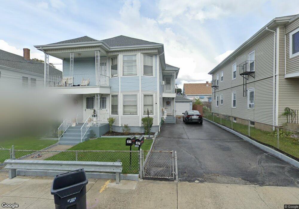
35 Foss Ave Pawtucket, RI 02860
Estimated Value: $455,629 - $601,000
6
Beds
2
Baths
2,132
Sq Ft
$246/Sq Ft
Est. Value
About This Home
This home is located at 35 Foss Ave, Pawtucket, RI 02860 and is currently estimated at $524,657, approximately $246 per square foot. 35 Foss Ave is a home located in Providence County with nearby schools including International Charter School and Blackstone Valley Prep Junior High School.
Ownership History
Date
Name
Owned For
Owner Type
Purchase Details
Closed on
Mar 26, 2021
Sold by
Lopes-Mello Dilia
Bought by
Mello Alex L
Current Estimated Value
Purchase Details
Closed on
Jun 23, 2015
Sold by
Mello Dilia L and Araujo Regina L
Bought by
Lopes Dilia M and Mello Eduardo
Create a Home Valuation Report for This Property
The Home Valuation Report is an in-depth analysis detailing your home's value as well as a comparison with similar homes in the area
Home Values in the Area
Average Home Value in this Area
Purchase History
| Date | Buyer | Sale Price | Title Company |
|---|---|---|---|
| Mello Alex L | -- | None Available | |
| Lopes-Mello Dilia | -- | None Available | |
| Lopes Dilia M | $82,000 | -- | |
| Lopes Dilia M | -- | -- |
Source: Public Records
Tax History Compared to Growth
Tax History
| Year | Tax Paid | Tax Assessment Tax Assessment Total Assessment is a certain percentage of the fair market value that is determined by local assessors to be the total taxable value of land and additions on the property. | Land | Improvement |
|---|---|---|---|---|
| 2024 | $4,818 | $390,400 | $117,700 | $272,700 |
| 2023 | $4,184 | $247,000 | $53,000 | $194,000 |
| 2022 | $4,095 | $247,000 | $53,000 | $194,000 |
| 2021 | $4,095 | $247,000 | $53,000 | $194,000 |
| 2020 | $3,835 | $183,600 | $53,700 | $129,900 |
| 2019 | $3,835 | $183,600 | $53,700 | $129,900 |
| 2018 | $3,696 | $183,600 | $53,700 | $129,900 |
| 2017 | $3,251 | $143,100 | $40,600 | $102,500 |
| 2016 | $3,132 | $143,100 | $40,600 | $102,500 |
| 2015 | $3,132 | $143,100 | $40,600 | $102,500 |
| 2014 | -- | $146,100 | $52,200 | $93,900 |
Source: Public Records
Map
Nearby Homes
- 381 Weeden St
- 390 Weeden St
- 580 Lonsdale Ave
- 584 Lonsdale Ave Unit 586
- 10 Barber Ave
- 264 Weeden St
- 126 Conant St
- 61 Orchard St Unit 61
- 71 Brook St
- 75 Baldwin St
- 533 Weeden St
- 20 Hope St
- 14 Martin Ct
- 0 Hazel St
- 193 Harrison St
- 58 Lawn Ave
- 75 Elder St
- 76 Slater St
- 167 Lonsdale Ave
- 722 Dexter St Unit 726