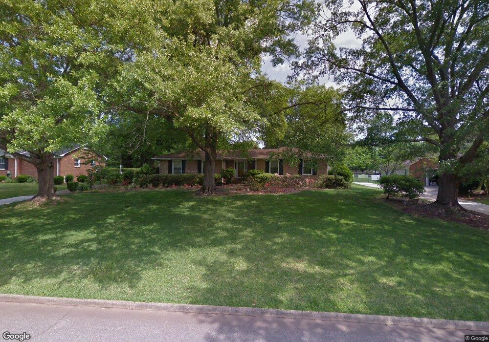
35 Hillsborough Dr Greenville, SC 29615
Eastside NeighborhoodEstimated Value: $472,000 - $561,000
3
Beds
2
Baths
2,521
Sq Ft
$203/Sq Ft
Est. Value
About This Home
This home is located at 35 Hillsborough Dr, Greenville, SC 29615 and is currently estimated at $512,932, approximately $203 per square foot. 35 Hillsborough Dr is a home located in Greenville County with nearby schools including Pelham Road Elementary School, Greenville Middle Academy, and Eastside High School.
Ownership History
Date
Name
Owned For
Owner Type
Purchase Details
Closed on
Feb 24, 2020
Sold by
Smith Anne T
Bought by
Smith Anne T and Smith Carl A
Current Estimated Value
Purchase Details
Closed on
Feb 27, 2007
Sold by
Wilson Esther H
Bought by
Smith Anne T and Smith William J
Home Financials for this Owner
Home Financials are based on the most recent Mortgage that was taken out on this home.
Original Mortgage
$100,000
Outstanding Balance
$60,197
Interest Rate
6.16%
Mortgage Type
Purchase Money Mortgage
Estimated Equity
$452,735
Create a Home Valuation Report for This Property
The Home Valuation Report is an in-depth analysis detailing your home's value as well as a comparison with similar homes in the area
Home Values in the Area
Average Home Value in this Area
Purchase History
| Date | Buyer | Sale Price | Title Company |
|---|---|---|---|
| Smith Anne T | -- | None Available | |
| Smith Anne T | $207,000 | None Available |
Source: Public Records
Mortgage History
| Date | Status | Borrower | Loan Amount |
|---|---|---|---|
| Open | Smith Anne T | $100,000 |
Source: Public Records
Tax History Compared to Growth
Tax History
| Year | Tax Paid | Tax Assessment Tax Assessment Total Assessment is a certain percentage of the fair market value that is determined by local assessors to be the total taxable value of land and additions on the property. | Land | Improvement |
|---|---|---|---|---|
| 2024 | $1,567 | $9,940 | $1,420 | $8,520 |
| 2023 | $1,567 | $9,940 | $1,420 | $8,520 |
| 2022 | $1,526 | $9,940 | $1,420 | $8,520 |
| 2021 | $1,500 | $9,940 | $1,420 | $8,520 |
| 2020 | $1,338 | $8,800 | $1,380 | $7,420 |
| 2019 | $1,692 | $8,800 | $1,380 | $7,420 |
| 2018 | $1,667 | $8,800 | $1,380 | $7,420 |
| 2017 | $1,648 | $8,800 | $1,380 | $7,420 |
| 2016 | $1,547 | $220,100 | $34,500 | $185,600 |
| 2015 | $1,537 | $220,100 | $34,500 | $185,600 |
| 2014 | $1,369 | $199,360 | $34,500 | $164,860 |
Source: Public Records
Map
Nearby Homes
- 17 Seabury Dr
- 119 Twin Creek Cove
- 724 Hudson Rd
- 604 Hudson Rd
- 2 Pilgrims Point Rd
- 310 Devenger Rd
- 217 Devenger Rd
- 1207 Pelham Rd
- 307 Devenger Rd
- 516 Foxcroft Rd
- 1254 Shadow Way
- 1205 Shadow Way
- 1251 Shadow Way Unit 51
- 11 Caliston Ct
- 3 Hearthstone Ct
- 1212 Shadow Way
- 12 Ashwicke Ln
- 5016 Bridle Path Ln
- 1269 Shadow Way Unit 3C
- 217 Redland Way Unit Homesite 09
- 31 Hillsborough Dr
- 39 Hillsborough Dr
- 216 Merrifield Dr
- 212 Merrifield Dr
- 43 Hillsborough Dr
- 36 Hillsborough Dr
- 32 Hillsborough Dr
- 220 Merrifield Dr
- 208 Merrifield Dr
- 40 Hillsborough Dr
- 28 Hillsborough Dr
- 23 Hillsborough Dr
- 47 Hillsborough Dr
- 224 Merrifield Dr
- 204 Merrifield Dr
- 44 Hillsborough Dr
- 24 Hillsborough Dr
- 109 Seabury Dr
- 105 Seabury Dr
- 213 Merrifield Dr