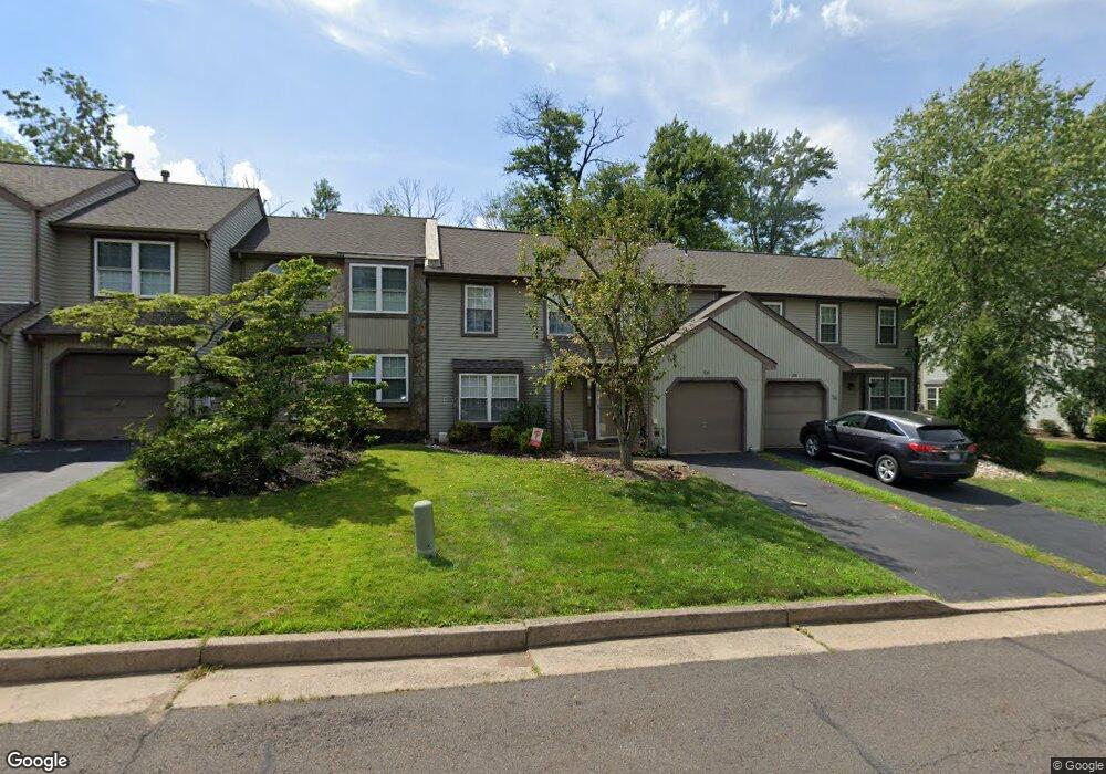
35 Laurel Cir Newtown, PA 18940
Estimated Value: $549,000 - $609,000
3
Beds
3
Baths
2,033
Sq Ft
$282/Sq Ft
Est. Value
About This Home
This home is located at 35 Laurel Cir, Newtown, PA 18940 and is currently estimated at $573,909, approximately $282 per square foot. 35 Laurel Cir is a home located in Bucks County with nearby schools including Newtown Elementary School, Newtown Middle School, and Council Rock High School North.
Ownership History
Date
Name
Owned For
Owner Type
Purchase Details
Closed on
Aug 7, 2014
Sold by
Blacker Scott F and Blacker Amy
Bought by
Blacker Scott F
Current Estimated Value
Home Financials for this Owner
Home Financials are based on the most recent Mortgage that was taken out on this home.
Original Mortgage
$243,500
Outstanding Balance
$185,529
Interest Rate
4.09%
Mortgage Type
New Conventional
Estimated Equity
$388,380
Purchase Details
Closed on
Sep 9, 2011
Sold by
Estrin Jason T and Estrin Joanne N
Bought by
Blacker Scott F and Blacker Amy
Home Financials for this Owner
Home Financials are based on the most recent Mortgage that was taken out on this home.
Original Mortgage
$250,000
Interest Rate
4.15%
Mortgage Type
New Conventional
Purchase Details
Closed on
Nov 15, 2006
Sold by
Reid Barbara A
Bought by
Estrin Jason T and Estrin Joanne N
Home Financials for this Owner
Home Financials are based on the most recent Mortgage that was taken out on this home.
Original Mortgage
$315,366
Interest Rate
6.4%
Mortgage Type
Purchase Money Mortgage
Create a Home Valuation Report for This Property
The Home Valuation Report is an in-depth analysis detailing your home's value as well as a comparison with similar homes in the area
Home Values in the Area
Average Home Value in this Area
Purchase History
| Date | Buyer | Sale Price | Title Company |
|---|---|---|---|
| Blacker Scott F | -- | None Available | |
| Blacker Scott F | $312,500 | None Available | |
| Estrin Jason T | $332,000 | None Available |
Source: Public Records
Mortgage History
| Date | Status | Borrower | Loan Amount |
|---|---|---|---|
| Open | Blacker Scott F | $243,500 | |
| Closed | Blacker Scott F | $250,000 | |
| Previous Owner | Estrin Jason T | $315,366 |
Source: Public Records
Tax History Compared to Growth
Tax History
| Year | Tax Paid | Tax Assessment Tax Assessment Total Assessment is a certain percentage of the fair market value that is determined by local assessors to be the total taxable value of land and additions on the property. | Land | Improvement |
|---|---|---|---|---|
| 2025 | $5,389 | $30,320 | $3,200 | $27,120 |
| 2024 | $5,389 | $30,320 | $3,200 | $27,120 |
| 2023 | $5,155 | $30,320 | $3,200 | $27,120 |
| 2022 | $5,056 | $30,320 | $3,200 | $27,120 |
| 2021 | $4,977 | $30,320 | $3,200 | $27,120 |
| 2020 | $4,738 | $30,320 | $3,200 | $27,120 |
| 2019 | $4,626 | $30,320 | $3,200 | $27,120 |
| 2018 | $4,538 | $30,320 | $3,200 | $27,120 |
| 2017 | $4,380 | $30,320 | $3,200 | $27,120 |
| 2016 | $4,350 | $30,320 | $3,200 | $27,120 |
| 2015 | -- | $30,320 | $3,200 | $27,120 |
| 2014 | -- | $30,320 | $3,200 | $27,120 |
Source: Public Records
Map
Nearby Homes
- 401 Society Place Unit A1
- 101 Laurel Cir
- 2204 Society Place Unit B2
- 95 Rittenhouse Cir Unit 92
- 288 Jane Chapman Dr E Unit E
- 291 Sequoia Dr
- 35 Elfreths Ct
- 316 Monterey Place
- 10 Providence Ct
- 4 Gladiola Cir
- 97 Quaker Dr
- 220 Stoopville Rd
- Lot 4 Ava Ct
- 7 Grace Cir
- 313 Matthews Ln
- 309 Matthews Ln
- 5 Pansy Ct
- 632 Durham Rd
- 19 Goldney Dr
- 2034 Woodland Rd