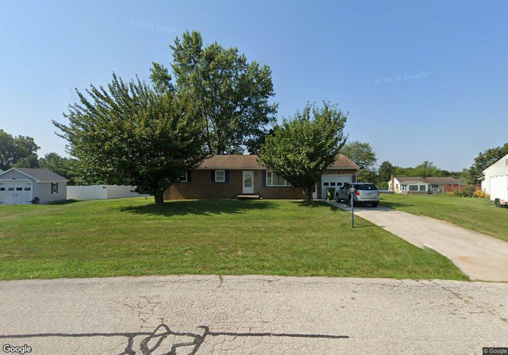
35 Lee Ann Ct Hanover, PA 17331
Estimated Value: $262,000 - $302,000
3
Beds
1
Bath
1,232
Sq Ft
$228/Sq Ft
Est. Value
About This Home
This home is located at 35 Lee Ann Ct, Hanover, PA 17331 and is currently estimated at $280,668, approximately $227 per square foot. 35 Lee Ann Ct is a home located in York County with nearby schools including South Western Senior High School.
Ownership History
Date
Name
Owned For
Owner Type
Purchase Details
Closed on
Jun 8, 2022
Sold by
Boothroyd David A
Bought by
Boothroyd David A
Current Estimated Value
Purchase Details
Closed on
Sep 27, 1989
Sold by
Hanson Helen W
Bought by
Boothroyd David A and Boothroyd Alice E
Purchase Details
Closed on
Sep 1, 1980
Bought by
Hanson Helen W
Create a Home Valuation Report for This Property
The Home Valuation Report is an in-depth analysis detailing your home's value as well as a comparison with similar homes in the area
Home Values in the Area
Average Home Value in this Area
Purchase History
| Date | Buyer | Sale Price | Title Company |
|---|---|---|---|
| Boothroyd David A | $25,000 | Worley Donald E | |
| Boothroyd David A | $25,000 | None Listed On Document | |
| Boothroyd David A | $91,500 | -- | |
| Hanson Helen W | $51,000 | -- |
Source: Public Records
Tax History Compared to Growth
Tax History
| Year | Tax Paid | Tax Assessment Tax Assessment Total Assessment is a certain percentage of the fair market value that is determined by local assessors to be the total taxable value of land and additions on the property. | Land | Improvement |
|---|---|---|---|---|
| 2025 | $4,343 | $130,020 | $35,160 | $94,860 |
| 2024 | $4,343 | $130,020 | $35,160 | $94,860 |
| 2023 | $4,265 | $130,020 | $35,160 | $94,860 |
| 2022 | $4,198 | $130,020 | $35,160 | $94,860 |
| 2021 | $4,007 | $130,020 | $35,160 | $94,860 |
| 2020 | $4,007 | $130,020 | $35,160 | $94,860 |
| 2019 | $3,931 | $130,020 | $35,160 | $94,860 |
| 2018 | $3,866 | $130,020 | $35,160 | $94,860 |
| 2017 | $3,790 | $130,020 | $35,160 | $94,860 |
| 2016 | $0 | $130,020 | $35,160 | $94,860 |
| 2015 | -- | $130,020 | $35,160 | $94,860 |
| 2014 | -- | $130,020 | $35,160 | $94,860 |
Source: Public Records
Map
Nearby Homes
- 2861 Baltimore Pike
- 626 Ledger Dr
- 41 Michelle Way
- TBB Heritage Dr Unit WHITEHALL II
- TBB Michelle Way Unit GLENSHAW
- 90 Michelle Way
- Carnegie II Plan at Prinland Heights - Single Family Homes
- Edgewood II Plan at Prinland Heights - Single Family Homes
- Newbury II Plan at Prinland Heights - Single Family Homes
- Cranberry II Plan at Prinland Heights - Single Family Homes
- Bridgeport II Plan at Prinland Heights - Single Family Homes
- Glenshaw Plan at Prinland Heights - Single Family Homes
- New Haven II Plan at Prinland Heights - Single Family Homes
- Regent II Plan at Prinland Heights - Single Family Homes
- Whitehall II Plan at Prinland Heights - Single Family Homes
- 205 Pheasant Ridge Rd
- 2401 Baltimore Pike
- 59 Pheasant Ridge Rd
- Homesite 96 Pheasant Ridge Rd
- TBB Pheasant Ridge Rd Unit CRANBERRY
- 45 Lee Ann Ct
- 23 Lee Ann Ct
- 2708 Baltimore Pike
- 2722 Baltimore Pike
- 2692 Baltimore Pike
- 55 Lee Ann Ct
- 26 Lee Ann Ct
- 42 Lee Ann Ct
- 25 Utz Dr
- 2736 Baltimore Pike
- 15 Utz Dr
- 35 Utz Dr
- 56 Lee Ann Ct
- 67 Lee Ann Ct
- 5 Utz Dr
- 45 Utz Dr
- 2731 Baltimore Pike
- 2709 Baltimore Pike
- 2731 Baltimore Pike
- 2719 Baltimore Pike