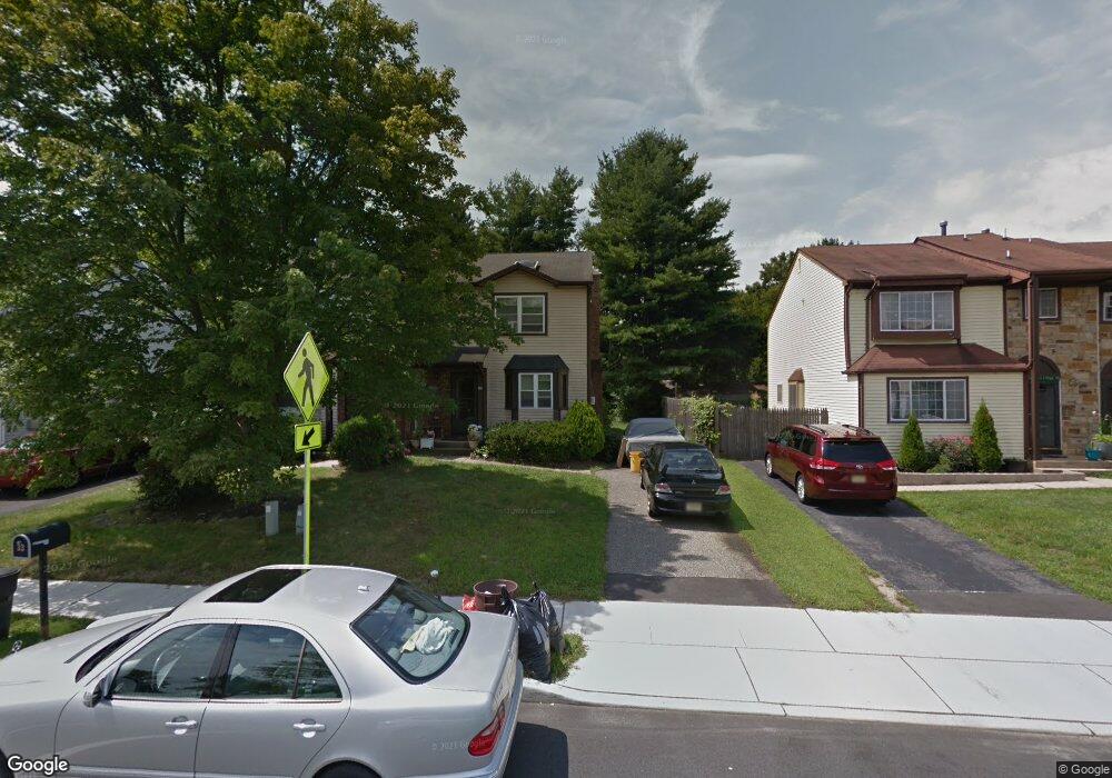
35 Marc Dr Dayton, NJ 08810
Estimated Value: $450,946 - $485,000
2
Beds
2
Baths
1,360
Sq Ft
$345/Sq Ft
Est. Value
About This Home
This home is located at 35 Marc Dr, Dayton, NJ 08810 and is currently estimated at $469,737, approximately $345 per square foot. 35 Marc Dr is a home located in Middlesex County with nearby schools including Brooks Crossing Elementary School, Crossroads North Middle School, and South Brunswick High School.
Ownership History
Date
Name
Owned For
Owner Type
Purchase Details
Closed on
Jun 30, 2021
Sold by
Gogineni Yuva A
Bought by
Arroyo Martha and Soto Diego
Current Estimated Value
Home Financials for this Owner
Home Financials are based on the most recent Mortgage that was taken out on this home.
Original Mortgage
$274,725
Outstanding Balance
$249,650
Interest Rate
3%
Mortgage Type
FHA
Estimated Equity
$220,087
Purchase Details
Closed on
Apr 30, 2019
Sold by
Secretary Of Housing & Urban Development
Bought by
Gogineni Yuva A
Home Financials for this Owner
Home Financials are based on the most recent Mortgage that was taken out on this home.
Original Mortgage
$208,952
Interest Rate
4.25%
Mortgage Type
FHA
Purchase Details
Closed on
Dec 19, 2018
Sold by
Weisberg And Conway Llc
Bought by
Secretary Of Housing & Urban Development
Purchase Details
Closed on
Apr 9, 1985
Bought by
Johnston Constantia
Create a Home Valuation Report for This Property
The Home Valuation Report is an in-depth analysis detailing your home's value as well as a comparison with similar homes in the area
Home Values in the Area
Average Home Value in this Area
Purchase History
| Date | Buyer | Sale Price | Title Company |
|---|---|---|---|
| Arroyo Martha | $300,000 | Elite Title Group Llc | |
| Arroyo Martha | $300,000 | Elite Title Group | |
| Gogineni Yuva A | $205,459 | Shepherd Title Agency | |
| Secretary Of Housing & Urban Development | -- | None Available | |
| Johnston Constantia | $84,900 | -- |
Source: Public Records
Mortgage History
| Date | Status | Borrower | Loan Amount |
|---|---|---|---|
| Open | Arroyo Martha | $274,725 | |
| Closed | Arroyo Martha | $274,725 | |
| Previous Owner | Gogineni Yuva A | $208,952 |
Source: Public Records
Tax History Compared to Growth
Tax History
| Year | Tax Paid | Tax Assessment Tax Assessment Total Assessment is a certain percentage of the fair market value that is determined by local assessors to be the total taxable value of land and additions on the property. | Land | Improvement |
|---|---|---|---|---|
| 2025 | $5,705 | $105,600 | $45,000 | $60,600 |
| 2024 | $5,500 | $105,600 | $45,000 | $60,600 |
| 2023 | $5,500 | $105,600 | $45,000 | $60,600 |
| 2022 | $5,331 | $105,500 | $45,000 | $60,500 |
| 2021 | $4,103 | $105,500 | $45,000 | $60,500 |
| 2020 | $5,364 | $105,500 | $45,000 | $60,500 |
| 2019 | $5,412 | $105,500 | $45,000 | $60,500 |
| 2018 | $5,235 | $105,500 | $45,000 | $60,500 |
| 2017 | $4,978 | $105,500 | $45,000 | $60,500 |
| 2016 | $5,173 | $105,500 | $45,000 | $60,500 |
| 2015 | $5,321 | $117,200 | $45,000 | $72,200 |
| 2014 | $5,230 | $117,200 | $45,000 | $72,200 |
Source: Public Records
Map
Nearby Homes
- 45 Hannah Dr
- 3 Hannah Dr
- 10 Quincy Cir
- 10-Q Dayton Cir
- Q10 Quincy Cir Unit Q-10
- G8 Quincy Cir Unit G
- 8 Quincy Cir Unit G
- 4 Lincoln Ln Unit F4
- 48 Woodland Way
- 21 Regal Dr
- 29 Jeffrey Cir
- 1106 Dahlia Cir
- 586 Ridge Rd
- 24 Pullman Loop
- 605 Dahlia Cir
- 45 Old New Rd
- 408 Blossom Cir
- 385 Ridge Rd
- 1401 Yarrow Cir
- 22 Witch Hazel Ct Unit 2