J
Seller's Agent in 2018
Julianna Flanders
Flanders Real Estate
Estimated Value: $1,371,000 - $1,554,000
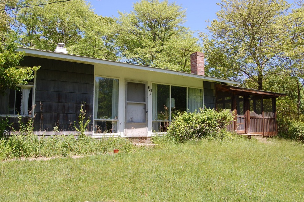
Located just off of Menemsha Crossroad, this 2+ acre parcel is great spot to build a new home. Currently situated on this lot is a 3 bedroom, 1 bathroom home. A lovely front yard with mature plantings offering coverage from the road. Menemsha village is only a short distance as is Chilmark center.
Last Agent to Sell the Property
Julianna Flanders
Flanders Real Estate Listed on: 07/02/2018
Last Buyer's Agent
Julianna Flanders
Flanders Real Estate Listed on: 07/02/2018
| Date | Buyer | Sale Price | Title Company |
|---|---|---|---|
| Hickey Rachel G | $430,000 | -- | |
| Thorpe Robert B | $480,000 | -- |
| Date | Status | Borrower | Loan Amount |
|---|---|---|---|
| Open | Hickey Rachel G | $430,000 |
| Date | Event | Price | List to Sale | Price per Sq Ft |
|---|---|---|---|---|
| 09/12/2018 09/12/18 | Sold | $480,000 | -6.8% | $480 / Sq Ft |
| 07/05/2018 07/05/18 | Pending | -- | -- | -- |
| 07/02/2018 07/02/18 | For Sale | $515,000 | -- | $515 / Sq Ft |
| Year | Tax Paid | Tax Assessment Tax Assessment Total Assessment is a certain percentage of the fair market value that is determined by local assessors to be the total taxable value of land and additions on the property. | Land | Improvement |
|---|---|---|---|---|
| 2025 | $2,013 | $894,800 | $655,600 | $239,200 |
| 2024 | $1,697 | $800,400 | $570,100 | $230,300 |
| 2023 | $1,625 | $618,000 | $438,500 | $179,500 |
| 2022 | $1,671 | $592,400 | $438,500 | $153,900 |
| 2021 | $1,658 | $569,900 | $438,500 | $131,400 |
| 2020 | $1,342 | $469,300 | $429,900 | $39,400 |
| 2019 | $1,688 | $586,000 | $505,800 | $80,200 |
| 2018 | $1,612 | $586,000 | $505,800 | $80,200 |
| 2017 | $1,566 | $584,400 | $505,800 | $78,600 |
| 2016 | $1,474 | $543,900 | $505,800 | $38,100 |
| 2015 | $1,533 | $582,900 | $505,800 | $77,100 |
| 2014 | $1,419 | $572,200 | $534,000 | $38,200 |
J
Seller's Agent in 2018
Julianna Flanders
Flanders Real Estate
Source: LINK (Vineyard)
MLS Number: 22072
APN: CHIL-000026-000000-000137