Estimated Value: $846,000 - $980,000
4
Beds
2
Baths
1,703
Sq Ft
$532/Sq Ft
Est. Value
About This Home
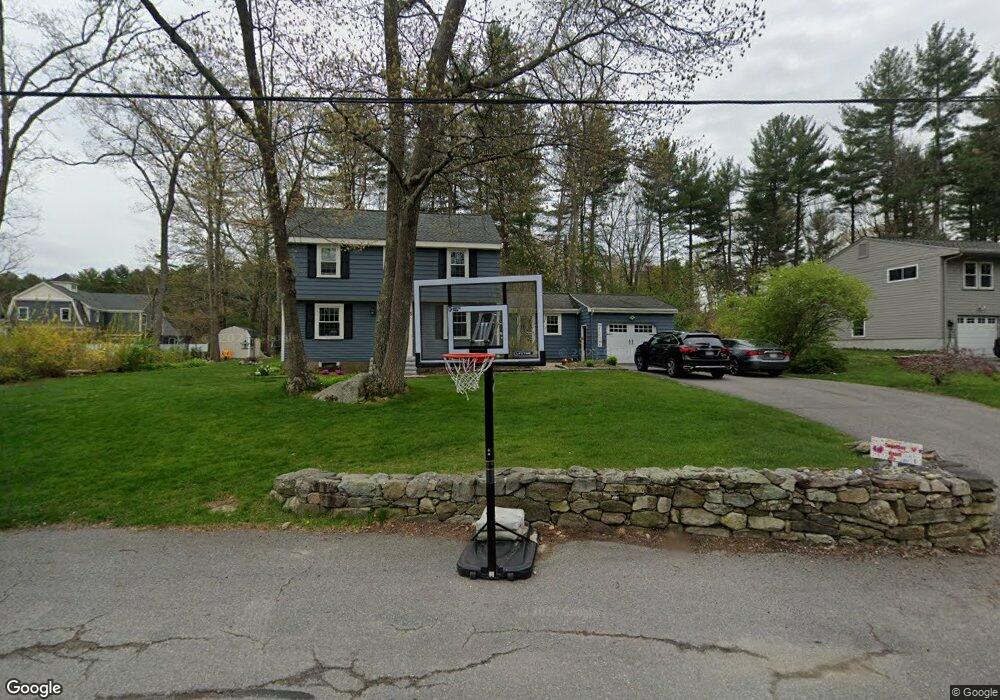
This home is located at 35 Mohegan Rd, Acton, MA 01720 and is currently estimated at $906,671, approximately $532 per square foot. 35 Mohegan Rd is a home located in Middlesex County with nearby schools including Acton-Boxborough Regional High School.
Ownership History
Date
Name
Owned For
Owner Type
Purchase Details
Closed on
Oct 29, 2020
Sold by
Wellinghoff David P and Wellinghoff Sandra L
Bought by
David & S Wellinghoff Lt
Current Estimated Value
Purchase Details
Closed on
May 8, 2009
Sold by
Appel Kenneth M and Appel Susan L
Bought by
Wellinghoff David P and Wellinghoff Sandra L
Home Financials for this Owner
Home Financials are based on the most recent Mortgage that was taken out on this home.
Original Mortgage
$364,444
Interest Rate
4.9%
Mortgage Type
Purchase Money Mortgage
Create a Home Valuation Report for This Property
The Home Valuation Report is an in-depth analysis detailing your home's value as well as a comparison with similar homes in the area
Home Values in the Area
Average Home Value in this Area
Purchase History
| Date | Buyer | Sale Price | Title Company |
|---|---|---|---|
| David & S Wellinghoff Lt | -- | None Available | |
| Wellinghoff David P | $455,555 | -- |
Source: Public Records
Mortgage History
| Date | Status | Borrower | Loan Amount |
|---|---|---|---|
| Previous Owner | Wellinghoff David P | $364,444 |
Source: Public Records
Tax History
| Year | Tax Paid | Tax Assessment Tax Assessment Total Assessment is a certain percentage of the fair market value that is determined by local assessors to be the total taxable value of land and additions on the property. | Land | Improvement |
|---|---|---|---|---|
| 2025 | $13,624 | $794,400 | $310,900 | $483,500 |
| 2024 | $12,734 | $763,900 | $310,900 | $453,000 |
| 2023 | $10,403 | $592,400 | $282,500 | $309,900 |
| 2022 | $9,859 | $506,900 | $245,600 | $261,300 |
| 2021 | $9,605 | $474,800 | $227,400 | $247,400 |
| 2020 | $9,068 | $471,300 | $227,400 | $243,900 |
| 2019 | $8,565 | $442,200 | $227,400 | $214,800 |
| 2018 | $8,438 | $435,400 | $227,400 | $208,000 |
| 2017 | $8,234 | $432,000 | $227,400 | $204,600 |
| 2016 | $8,223 | $427,600 | $227,400 | $200,200 |
| 2015 | $8,083 | $424,300 | $227,400 | $196,900 |
| 2014 | $7,879 | $405,100 | $227,400 | $177,700 |
Source: Public Records
Map
Nearby Homes
- 60 Nashoba Rd
- 5 Perkins Ln
- 79 Charter Rd
- 4 Littlefield Rd
- 20 Joseph Reed Ln
- 235 Arlington St
- 18 Hayward Rd
- 11 Braebrook
- 4 Omega Way
- 246 Main St Unit 2
- 33 Meadowbrook Rd
- 7 Kelley Rd
- 46 Taylor Rd
- 92 Willow St Unit 3
- 92 Willow St Unit 2
- 90 Willow St Unit 1
- 491 Main St
- 524 Main St
- 184 Main St Unit 3
- 709 Main St
- 33 Mohegan Rd
- 31 Mohegan Rd
- 36 Mohegan Rd
- 34 Mohegan Rd
- 37 Mohegan Rd
- 32 Mohegan Rd
- 29 Mohegan Rd
- 30 Mohegan Rd
- 30 Mohegan Rd Unit 1
- 21 Freedom Farme Rd
- 19 Freedom Farme Rd
- 27 Mohegan Rd
- 88 Seminole Rd
- 86 Seminole Rd
- 17 Freedom Farme Rd
- 84 Seminole Rd
- 25 Mohegan Rd
- 11 Freedom Farme Rd
- 2 Olde Barn Way
- 82 Seminole Rd
Your Personal Tour Guide
Ask me questions while you tour the home.