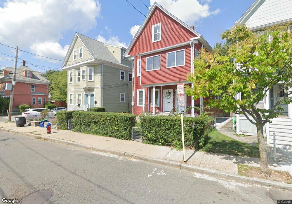
35 Morrison Ave Unit 1 Somerville, MA 02144
Ball Square NeighborhoodEstimated Value: $1,350,000 - $1,543,000
2
Beds
1
Bath
1,100
Sq Ft
$1,318/Sq Ft
Est. Value
About This Home
This home is located at 35 Morrison Ave Unit 1, Somerville, MA 02144 and is currently estimated at $1,449,629, approximately $1,317 per square foot. 35 Morrison Ave Unit 1 is a home located in Middlesex County with nearby schools including Somerville High School, St. Clement Elementary School, and Wild Rose Montessori School.
Ownership History
Date
Name
Owned For
Owner Type
Purchase Details
Closed on
Oct 17, 2011
Sold by
Lytle Loretta A
Bought by
Lacourt Foundation Llc
Current Estimated Value
Home Financials for this Owner
Home Financials are based on the most recent Mortgage that was taken out on this home.
Original Mortgage
$420,000
Outstanding Balance
$298,583
Interest Rate
5%
Mortgage Type
Purchase Money Mortgage
Estimated Equity
$1,151,046
Create a Home Valuation Report for This Property
The Home Valuation Report is an in-depth analysis detailing your home's value as well as a comparison with similar homes in the area
Home Values in the Area
Average Home Value in this Area
Purchase History
| Date | Buyer | Sale Price | Title Company |
|---|---|---|---|
| Lacourt Foundation Llc | $560,000 | -- |
Source: Public Records
Mortgage History
| Date | Status | Borrower | Loan Amount |
|---|---|---|---|
| Open | Lacourt Foundation Llc | $420,000 |
Source: Public Records
Tax History Compared to Growth
Tax History
| Year | Tax Paid | Tax Assessment Tax Assessment Total Assessment is a certain percentage of the fair market value that is determined by local assessors to be the total taxable value of land and additions on the property. | Land | Improvement |
|---|---|---|---|---|
| 2025 | $13,226 | $1,212,300 | $659,300 | $553,000 |
| 2024 | $12,649 | $1,202,400 | $659,300 | $543,100 |
| 2023 | $12,045 | $1,164,900 | $659,300 | $505,600 |
| 2022 | $11,338 | $1,113,800 | $627,900 | $485,900 |
| 2021 | $11,026 | $1,082,000 | $623,300 | $458,700 |
| 2020 | $10,648 | $1,055,300 | $623,700 | $431,600 |
| 2019 | $10,091 | $937,800 | $567,800 | $370,000 |
| 2018 | $9,283 | $820,800 | $516,200 | $304,600 |
| 2017 | $9,099 | $779,700 | $487,000 | $292,700 |
| 2016 | $8,789 | $701,400 | $434,900 | $266,500 |
| 2015 | $8,394 | $665,700 | $401,600 | $264,100 |
Source: Public Records
Map
Nearby Homes
- 9 Morrison Ave
- 13 Warwick St
- 27 Boston Ave
- 23 Highland Rd
- 114 Cedar St
- 60 Pearson Ave Unit 60
- 156 Albion St Unit A
- 156 Albion St Unit B
- 31 Rogers Ave
- 69 Boston Ave
- 39 Rogers Ave
- 3 Fairlee St
- 12 Windsor Rd Unit 1
- 79 Willow Ave
- 10 Roberts St Unit 14
- 8 Albion Terrace
- 32 Richardson St
- 371 Highland Ave
- 303 Lowell St Unit 1
- 301 Lowell Street Condo Unit 31
- 35 Morrison Ave
- 31 Morrison Ave
- 29 Morrison Ave Unit 1
- 29 Morrison Ave
- 31 Morrison Ave Unit 3
- 31 Morrison Ave Unit 2
- 39 Morrison Ave
- 39 Morrison Ave Unit 1
- 37 Morrison Ave
- 27 Morrison Ave Unit 3
- 27 Morrison Ave Unit 2
- 27 Morrison Ave
- 7 Pearson Ave Unit 7
- 7 Pearson Ave
- 7 Pearson Ave Unit 2
- 5 Pearson Ave
- 25 Morrison Ave Unit 1
- 6 Prichard Ave
- 45 Morrison Ave
- 9 Pearson Ave