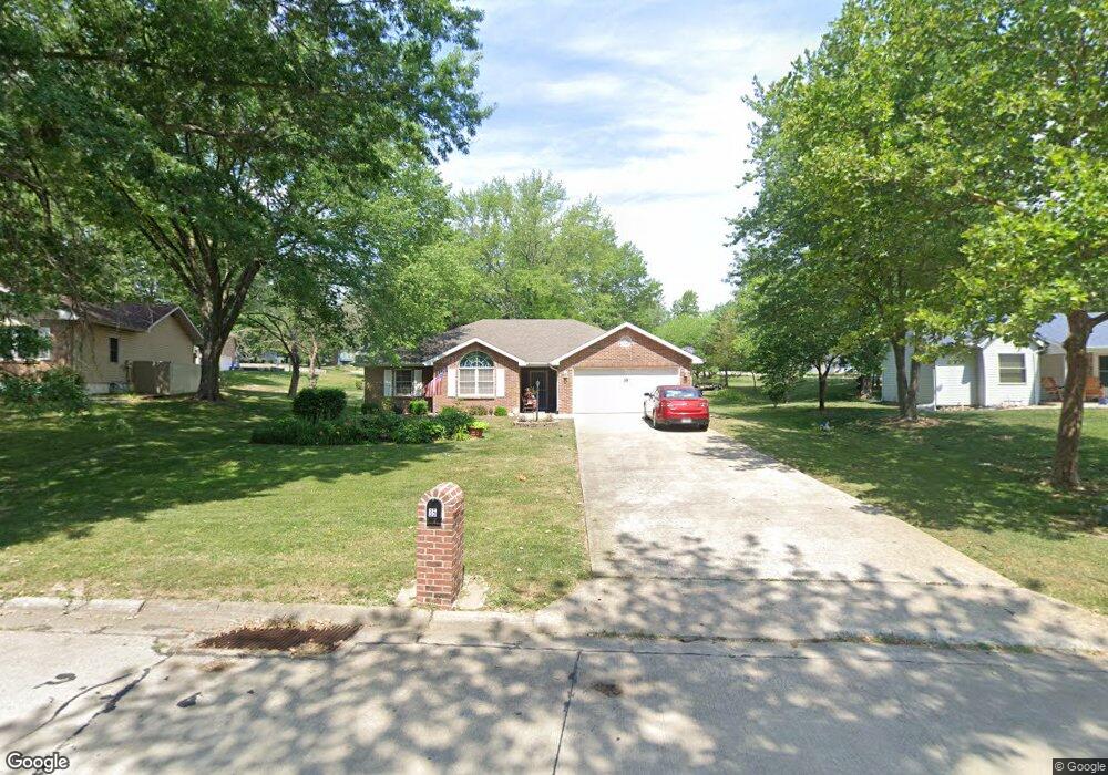
35 N Larand Dr Holts Summit, MO 65043
Estimated Value: $241,207 - $291,000
Studio
--
Bath
1,439
Sq Ft
$186/Sq Ft
Est. Value
About This Home
This home is located at 35 N Larand Dr, Holts Summit, MO 65043 and is currently estimated at $268,052, approximately $186 per square foot. 35 N Larand Dr is a home located in Callaway County with nearby schools including New Bloomfield Elementary School and New Bloomfield High School.
Ownership History
Date
Name
Owned For
Owner Type
Purchase Details
Closed on
Mar 14, 2018
Sold by
Edwards Velma
Bought by
Watson William J
Current Estimated Value
Purchase Details
Closed on
Jan 18, 2017
Sold by
Distler Stephen L and Wold Nancy A
Bought by
Watson William J and Edwards Velma
Home Financials for this Owner
Home Financials are based on the most recent Mortgage that was taken out on this home.
Original Mortgage
$120,828
Interest Rate
3.87%
Mortgage Type
FHA
Purchase Details
Closed on
Jul 21, 2006
Sold by
Garwood Joyce Ellen and Garwood John E
Bought by
Davis Henrietta D
Create a Home Valuation Report for This Property
The Home Valuation Report is an in-depth analysis detailing your home's value as well as a comparison with similar homes in the area
Home Values in the Area
Average Home Value in this Area
Purchase History
| Date | Buyer | Sale Price | Title Company |
|---|---|---|---|
| Watson William J | -- | -- | |
| Watson William J | -- | -- | |
| Davis Henrietta D | -- | None Available |
Source: Public Records
Mortgage History
| Date | Status | Borrower | Loan Amount |
|---|---|---|---|
| Previous Owner | Watson William J | $120,828 |
Source: Public Records
Tax History
| Year | Tax Paid | Tax Assessment Tax Assessment Total Assessment is a certain percentage of the fair market value that is determined by local assessors to be the total taxable value of land and additions on the property. | Land | Improvement |
|---|---|---|---|---|
| 2025 | $1,449 | $25,568 | $0 | $0 |
| 2024 | $1,449 | $24,324 | $0 | $0 |
| 2023 | $1,437 | $23,849 | $0 | $0 |
| 2022 | $1,406 | $23,849 | $3,420 | $20,429 |
| 2021 | $1,386 | $23,849 | $3,420 | $20,429 |
| 2020 | $1,388 | $23,849 | $3,420 | $20,429 |
| 2019 | $1,357 | $23,849 | $3,420 | $20,429 |
| 2018 | $1,362 | $23,849 | $3,420 | $20,429 |
| 2017 | $1,374 | $23,849 | $3,420 | $20,429 |
| 2016 | $1,332 | $21,210 | $0 | $0 |
| 2015 | $1,326 | $21,210 | $0 | $0 |
| 2014 | $1,363 | $21,210 | $0 | $0 |
Source: Public Records
Map
Nearby Homes
Your Personal Tour Guide
Ask me questions while you tour the home.