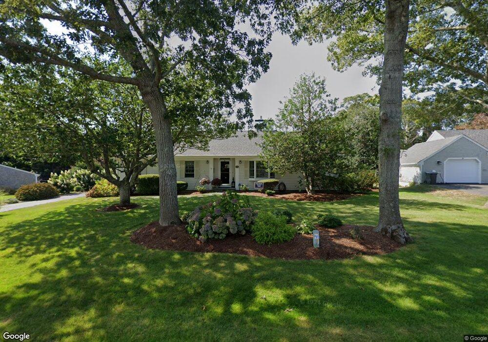
35 Pheasant Cove Cir Yarmouth Port, MA 02675
Yarmouth Port NeighborhoodEstimated Value: $889,809 - $1,044,000
3
Beds
2
Baths
1,720
Sq Ft
$571/Sq Ft
Est. Value
About This Home
This home is located at 35 Pheasant Cove Cir, Yarmouth Port, MA 02675 and is currently estimated at $982,702, approximately $571 per square foot. 35 Pheasant Cove Cir is a home located in Barnstable County with nearby schools including Dennis-Yarmouth Regional High School.
Ownership History
Date
Name
Owned For
Owner Type
Purchase Details
Closed on
Jan 29, 2015
Sold by
Mcdonough Paul V and Mcdonough Katherine M
Bought by
Mcdonough Irt
Current Estimated Value
Purchase Details
Closed on
Feb 29, 2008
Sold by
Cobb Ft and Cobb Steven Lee
Bought by
Mcdonough Katherine M and Mcdonough Paul
Home Financials for this Owner
Home Financials are based on the most recent Mortgage that was taken out on this home.
Original Mortgage
$410,000
Interest Rate
5.8%
Mortgage Type
Purchase Money Mortgage
Purchase Details
Closed on
Feb 22, 2005
Sold by
Cobb Joseph S
Bought by
Cobb Ft and Cobb Joseph S
Purchase Details
Closed on
Jun 21, 1991
Sold by
Zink Julius and Zink Veronica M
Bought by
Cobb Joseph S and Cobb Katherine L
Home Financials for this Owner
Home Financials are based on the most recent Mortgage that was taken out on this home.
Original Mortgage
$55,000
Interest Rate
9.37%
Mortgage Type
Purchase Money Mortgage
Create a Home Valuation Report for This Property
The Home Valuation Report is an in-depth analysis detailing your home's value as well as a comparison with similar homes in the area
Home Values in the Area
Average Home Value in this Area
Purchase History
| Date | Buyer | Sale Price | Title Company |
|---|---|---|---|
| Mcdonough Irt | -- | -- | |
| Mcdonough Katherine M | $540,000 | -- | |
| Cobb Ft | -- | -- | |
| Cobb Joseph S | $145,000 | -- |
Source: Public Records
Mortgage History
| Date | Status | Borrower | Loan Amount |
|---|---|---|---|
| Previous Owner | Cobb Joseph S | $395,500 | |
| Previous Owner | Mcdonough Katherine M | $410,000 | |
| Previous Owner | Cobb Joseph S | $52,500 | |
| Previous Owner | Cobb Joseph S | $55,000 | |
| Previous Owner | Cobb Joseph S | $85,000 |
Source: Public Records
Tax History Compared to Growth
Tax History
| Year | Tax Paid | Tax Assessment Tax Assessment Total Assessment is a certain percentage of the fair market value that is determined by local assessors to be the total taxable value of land and additions on the property. | Land | Improvement |
|---|---|---|---|---|
| 2025 | $5,720 | $807,900 | $225,900 | $582,000 |
| 2024 | $5,397 | $731,300 | $196,500 | $534,800 |
| 2023 | $5,359 | $660,800 | $185,200 | $475,600 |
| 2022 | $5,842 | $636,400 | $210,300 | $426,100 |
| 2021 | $5,373 | $562,000 | $200,700 | $361,300 |
| 2020 | $5,179 | $517,900 | $200,200 | $317,700 |
| 2019 | $4,608 | $456,200 | $200,200 | $256,000 |
| 2018 | $4,603 | $447,300 | $191,300 | $256,000 |
| 2017 | $4,482 | $447,300 | $191,300 | $256,000 |
| 2016 | $4,464 | $447,300 | $191,300 | $256,000 |
| 2015 | $4,291 | $427,400 | $191,300 | $236,100 |
Source: Public Records
Map
Nearby Homes
- 30 W Woods
- 30 W Woods Cir Unit 30
- 2 Pine Grove
- 7 Forest Gate Unit 7
- 23 Dauphine Dr
- 25 Oak Glen Village Unit 25
- 25 Oak Glen
- 50 John Hall Cartway
- 50 John Hall Cartway Unit 50
- 42 John Hall Cartway Unit 42
- 228 Kates Path
- 17 Kates Path Unit A
- 34 Kates Path
- 34 Kates Path Unit 34
- 64 Kates Path
- 43 Canterbury Rd
- 24 Minnetuxet Way
- 49 Rodoalph's Way
- 44 Stratford Ln
- 4 Spadoni Way
- 41 Pheasant Cove Cir
- 29 Pheasant Cove Cir
- 19 Loch Rannoch Way
- 25 Loch Rannoch Way
- 44 Pheasant Cove Cir
- 13 Loch Rannoch Way
- 47 Pheasant Cove Cir
- 47 & 49 Pheasant Cove Cir
- 30 Pheasant Cove Cir
- 68 Pheasant Cove Cir
- 16 Marsh Point
- 47 Loch Rannoch Way
- 40 Loch Rannoch Way
- 74 Pheasant Cove Cir
- 58 Pheasant Cove Cir
- 9 Loch Rannoch Way
- 19 Pheasant Cove Cir
- 20 Loch Rannoch Way
- 120 Homers Dock Rd
- 10 Marsh Point