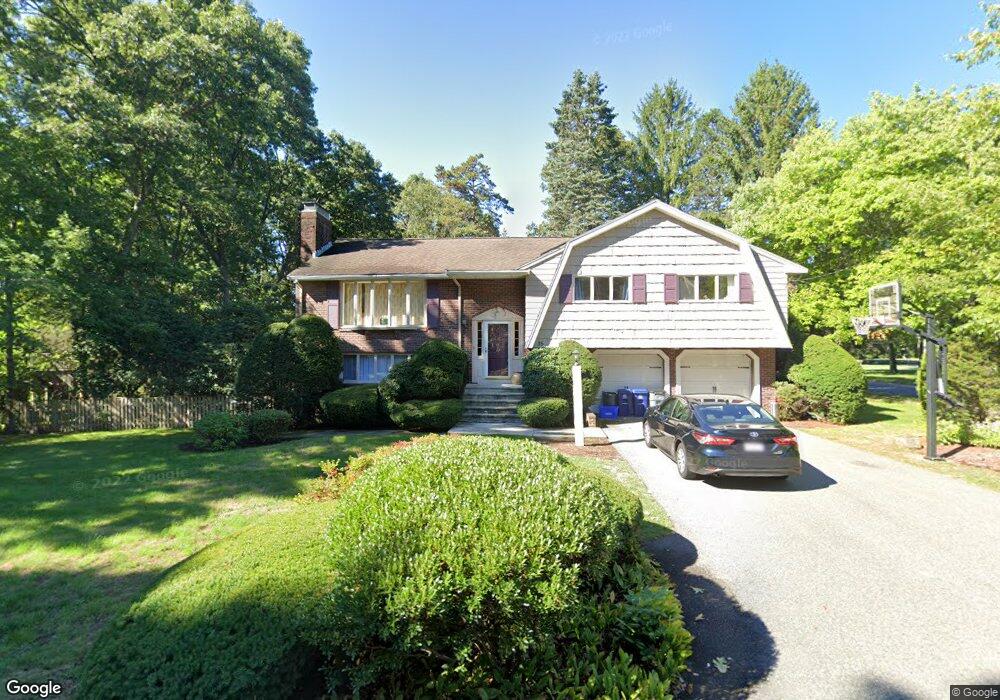
35 Philip Rd Lexington, MA 02421
Follen Heights NeighborhoodEstimated Value: $1,596,882 - $1,823,000
4
Beds
3
Baths
2,194
Sq Ft
$762/Sq Ft
Est. Value
About This Home
This home is located at 35 Philip Rd, Lexington, MA 02421 and is currently estimated at $1,671,221, approximately $761 per square foot. 35 Philip Rd is a home located in Middlesex County with nearby schools including Bowman Elementary School, Jonas Clarke Middle School, and Lexington High School.
Ownership History
Date
Name
Owned For
Owner Type
Purchase Details
Closed on
Jan 25, 2006
Sold by
Fitzgerald Barry C and Fitzgerald Margaret E
Bought by
Johnson Alexis W and Johnson Kyle J
Current Estimated Value
Home Financials for this Owner
Home Financials are based on the most recent Mortgage that was taken out on this home.
Original Mortgage
$592,000
Outstanding Balance
$336,030
Interest Rate
6.34%
Mortgage Type
Purchase Money Mortgage
Estimated Equity
$1,335,191
Create a Home Valuation Report for This Property
The Home Valuation Report is an in-depth analysis detailing your home's value as well as a comparison with similar homes in the area
Home Values in the Area
Average Home Value in this Area
Purchase History
| Date | Buyer | Sale Price | Title Company |
|---|---|---|---|
| Johnson Alexis W | $740,000 | -- |
Source: Public Records
Mortgage History
| Date | Status | Borrower | Loan Amount |
|---|---|---|---|
| Open | Johnson Alexis W | $592,000 |
Source: Public Records
Tax History Compared to Growth
Tax History
| Year | Tax Paid | Tax Assessment Tax Assessment Total Assessment is a certain percentage of the fair market value that is determined by local assessors to be the total taxable value of land and additions on the property. | Land | Improvement |
|---|---|---|---|---|
| 2025 | $16,975 | $1,388,000 | $748,000 | $640,000 |
| 2024 | $15,766 | $1,287,000 | $713,000 | $574,000 |
| 2023 | $14,716 | $1,132,000 | $648,000 | $484,000 |
| 2022 | $13,828 | $1,002,000 | $589,000 | $413,000 |
| 2021 | $20,945 | $984,000 | $561,000 | $423,000 |
| 2020 | $4,447 | $972,000 | $561,000 | $411,000 |
| 2019 | $12,877 | $912,000 | $534,000 | $378,000 |
| 2018 | $7,405 | $867,000 | $509,000 | $358,000 |
| 2017 | $20,566 | $839,000 | $485,000 | $354,000 |
| 2016 | $11,709 | $802,000 | $461,000 | $341,000 |
| 2015 | $10,863 | $731,000 | $420,000 | $311,000 |
| 2014 | $10,035 | $647,000 | $381,000 | $266,000 |
Source: Public Records
Map
Nearby Homes
- 6 Linc Cole Ln
- 5 April Ln Unit 12
- 35 Tower Rd
- 475 Massachusetts Ave Unit B
- 65 Woburn St
- 170 Clocktower Dr Unit 5103
- 1 Tricorne Rd
- 1105 Lexington St Unit 9-2
- 4 Aerial St
- 20 Marrett Rd
- 64 Browning Rd
- 107 Hibbert St
- 25 Maple St
- 55 Circle Dr
- 10 Eliot Rd
- 5 Carnegie Place
- 56 Valentine Rd
- 70 Birch Hill Rd
- 69 Bridge St
- 24 Grapevine Ave