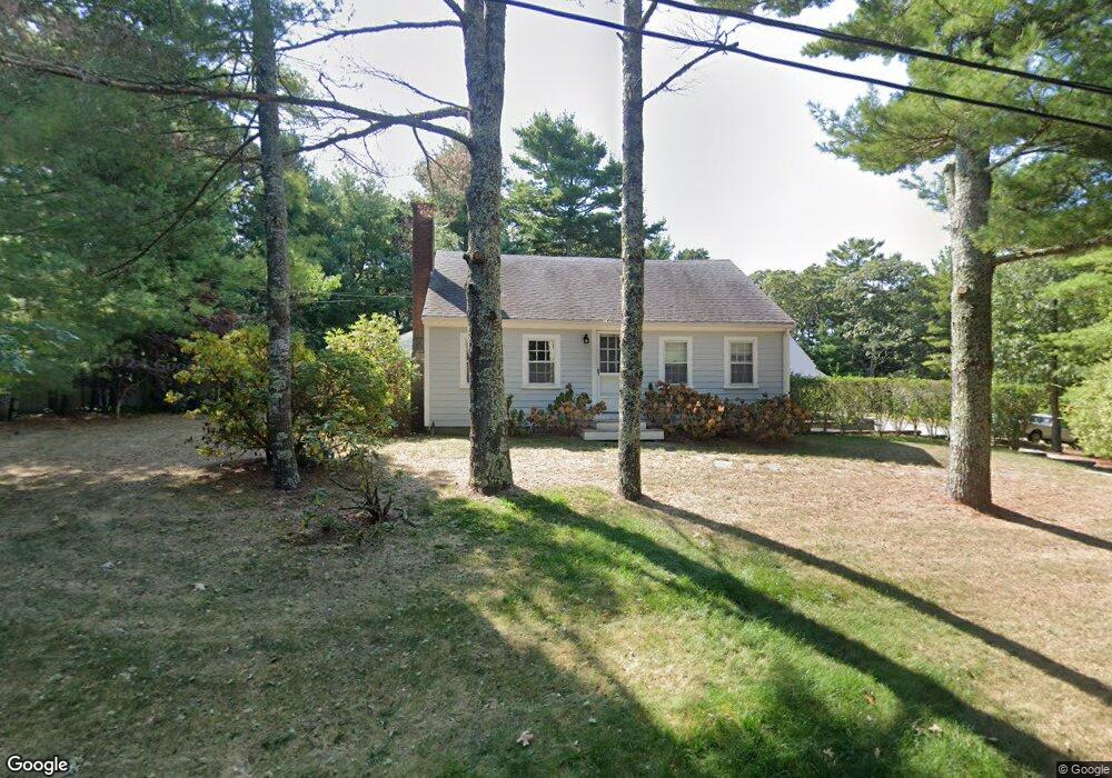
35 Pine Ridge Rd Cotuit, MA 02635
Cotuit NeighborhoodEstimated Value: $711,238 - $853,000
4
Beds
2
Baths
1,392
Sq Ft
$570/Sq Ft
Est. Value
About This Home
This home is located at 35 Pine Ridge Rd, Cotuit, MA 02635 and is currently estimated at $792,810, approximately $569 per square foot. 35 Pine Ridge Rd is a home located in Barnstable County with nearby schools including West Villages Elementary School, Barnstable United Elementary School, and Barnstable Intermediate School.
Ownership History
Date
Name
Owned For
Owner Type
Purchase Details
Closed on
Nov 30, 2012
Sold by
Spence Justin R and Spence Natalie B
Bought by
Pt Cotuit
Current Estimated Value
Purchase Details
Closed on
May 27, 2011
Sold by
Kleinschmidt Trude L
Bought by
Spence Justin R and Spence Natalie B
Purchase Details
Closed on
Mar 9, 2010
Sold by
Raviola Elio
Bought by
Kleinschmidt Trude L
Create a Home Valuation Report for This Property
The Home Valuation Report is an in-depth analysis detailing your home's value as well as a comparison with similar homes in the area
Home Values in the Area
Average Home Value in this Area
Purchase History
| Date | Buyer | Sale Price | Title Company |
|---|---|---|---|
| Pt Cotuit | -- | -- | |
| Spence Justin R | $318,000 | -- | |
| Kleinschmidt Trude L | -- | -- |
Source: Public Records
Tax History
| Year | Tax Paid | Tax Assessment Tax Assessment Total Assessment is a certain percentage of the fair market value that is determined by local assessors to be the total taxable value of land and additions on the property. | Land | Improvement |
|---|---|---|---|---|
| 2025 | $4,898 | $586,600 | $203,300 | $383,300 |
| 2024 | $4,470 | $567,200 | $203,300 | $363,900 |
| 2023 | $4,419 | $528,000 | $200,900 | $327,100 |
| 2022 | $4,411 | $426,600 | $143,000 | $283,600 |
| 2021 | $0 | $392,800 | $143,000 | $249,800 |
| 2020 | $4,629 | $395,300 | $152,400 | $242,900 |
| 2019 | $4,436 | $373,400 | $152,400 | $221,000 |
| 2018 | $4,341 | $365,400 | $167,100 | $198,300 |
| 2017 | $0 | $338,200 | $167,100 | $171,100 |
| 2016 | $3,942 | $342,500 | $171,400 | $171,100 |
| 2015 | $3,812 | $330,900 | $159,700 | $171,200 |
Source: Public Records
Map
Nearby Homes
- 6 Cedar St
- 6 Cedar St
- 188 Ocean View Ave
- 30 Wings Ln
- 1081 Main St
- 311 Waquoit Rd
- 925 Main St Unit 3
- 916 Main St
- 33 Oyster Place Rd
- 640 Poponessett Rd
- 640 Poponessett Rd
- 804 Main St
- 16 Cedar St
- 239 Oxford Dr
- 85 Clamshell Cove Rd
- 61 Shoestring Bay Rd
- 11 Teal Cir
- 135 Putnam Avenue (Land)
- 12 Tracey Rd
- 239 Clamshell Cove Rd
- 25 Pine Ridge Rd
- 28 Pine Ridge Rd
- 111 Oakwood St
- 46 Pine Ridge Rd
- 63 Pine Ridge Rd
- 117 Oakwood St
- 140 Oakwood St
- 62 Pine Ridge Rd
- 121 Oakwood St
- 125 Oakwood St
- 42 Nickerson Rd
- 89 Oakwood St
- 83 Cherry Tree Rd
- 127 Shell Ln
- 70 Pine Ridge Rd
- 56 Nickerson Rd
- 15 Cherry Tree Rd
- 30 Cedar St
- 125 Shell Ln
- 81 Pine Ridge Rd
Your Personal Tour Guide
Ask me questions while you tour the home.